The Sunningdale Story
pg.4
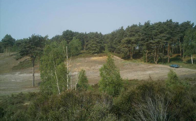
Figure 24
Figure 24 top centre shows a 2011 view of site of Colt sixth green, across the valley following the 2011 tree clearance. The site of the green was cleared in February and March 2011.
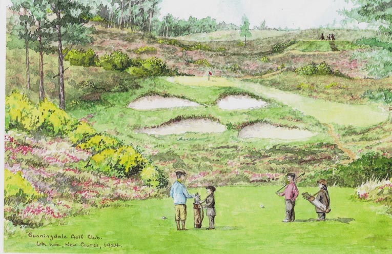
Figure 24 A
Figure 24A is Sunningdale member and landscape painter Chris Lane’s impression of the same sixth green as it might have appeared in 1923, based on recent ground examinations and contemporary descriptions by Darwin and Sillem, shown on the next page. No photo of the hole has been found. The seventh tee is on higher ground top right.
In Bernard Darwin’s 1924 booklet on Sunningdale, referring to the Colt sixth hole shown on the previous page, Darwin describes “the full horror of the situation, to use the language of the penny novelette, bursts upon us. There is the green across the valley and in front of it a sheer precipice of sand. If we get home everything is lovely: if we can’t we may sneak round by the right, get our five and perhaps beat the arrogant person who attempted the carry and failed”. In the watercolour on the previous page, of which prints are available, Chris Lane beautifully captures the dilemma.
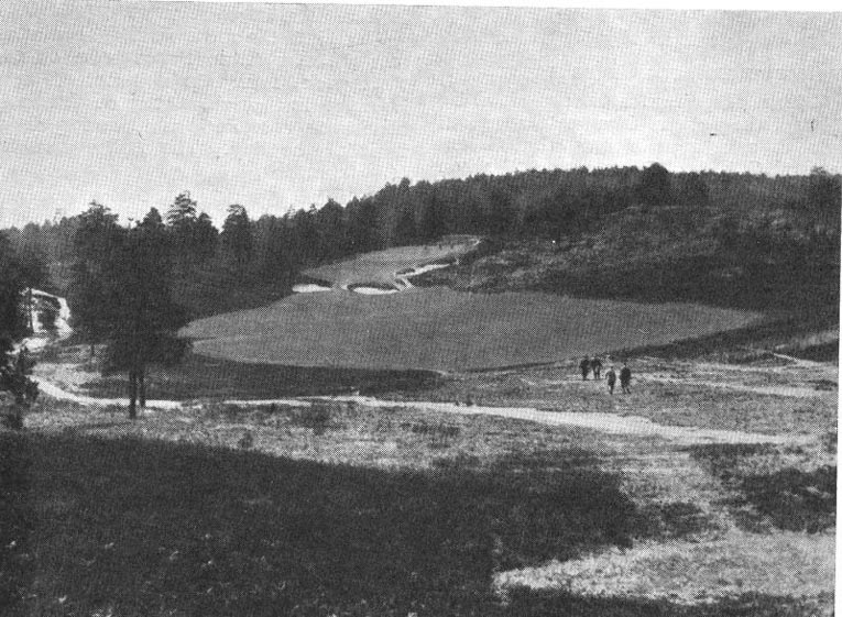
Figure 25
Figure 25 is a March 1934 Golf Illustrated view down and across the original Colt seventh fairway of the New Course, showing the seventh green in the distance. The eighth tees are in two locations; beyond the green and for vigorous climbers a second tee up the hill on right of green.
According to 1930s member Stephen Sillem (p67 History of Sunningdale Golf Club; John Whitfield 2000) the seventh tee was at the top of the hill to the right, and hence 100 yards right of the camera site, and well above it. The hole was a more severe dog-leg than the view from the camera.
By courtesy of Suttons Seeds Ltd
Figure 26 is another view of the lost seventh hole of the New Course as it was soon after the opening of the course.

Figure 26A
Figure 26A shows the same view of the lost seventh hole as Figures 25 and 26 but after the major tree clearance of March 2011: the old bunkers can just be recognised at the end of the valley.
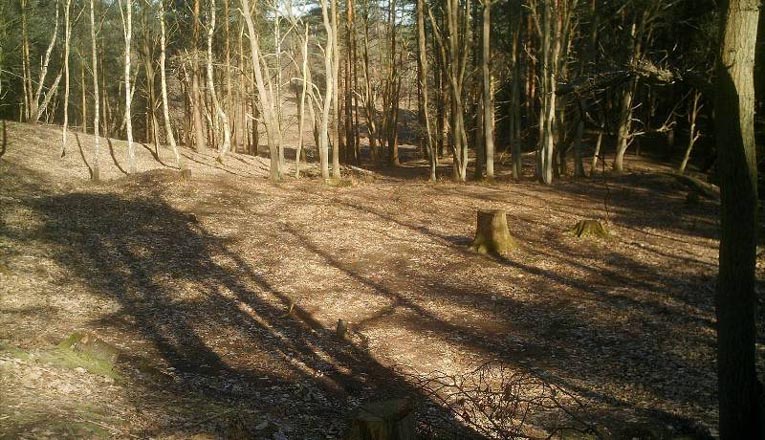
Figure 27
Figure 27 shows the 2010 view of the original Colt seventh green on the New Course, looking back through the trees towards the fairway and fairway area shown in Figures 25-26A. The stump in the centre of the green is that of a 70 year old chestnut, and was removed in March 2011, along with the surrounding trees.
The photo is taken from the eighth tee just beyond the green and there is a second and more exhausting tee at the top of the steep hill just to the left of this photograph.
When the hole was in play full time in the period 1924-1934 and sporadically until 1938, whilst alternative holes were available, there was a cottage thirty yards over the green. That cottage is there in 2012 and is seen on the Google Earth photo in Figure 22 at the centre bottom of the photo, and also at the bottom of the map on the same page.
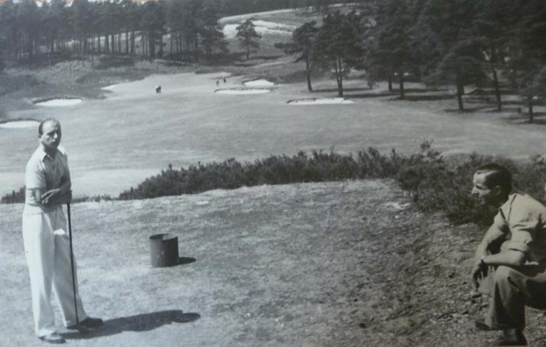
Figure 28
Figure 28 is a member’s album photo of the 1930s view of the now “lost” 310 yard eighth hole of New Course. The fairway in the top distance is actually the horizontal ninth fairway of the Old Course. The photographer was Drogo Montagu, the father of Sunningdale Member Dru Montagu, a winner of a number of European national amateur championships in the 1960s.
On the right is Count Paul Munster, who was still golfing at Sunningdale as late as 1957. The paths down the tenth hill from the tee, and still in use today, are clearly visible. This photo provides the background to the portrait of Harry Colt by war artist Arabella Dorman commissioned and donated to the Club in 2011.
All the bunkers shown in the photo are readily found on the ground in today’s woodland that has replaced this fairway. The path faintly visible obliquely across the fairway is still easily to be found as it is part of a “right of way” that is signposted at the right of today’s tenth fairway of the Old Course, and leads ultimately to the Brickmaker’s Arms public house in Windlesham.
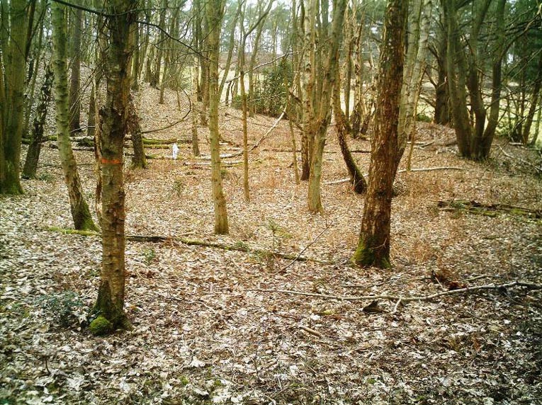
Figure 29
Figure 29 shows the lost eighth green and was taken from 130 yards inside the wood from a similar spot as the 1924 photo in Figure 29A, looking back at the Old Course tenth descent to the fairway. In the centre left of Figure 29 is a white marker where the pin is in the lower picture. The green was surrounded by bunkers, but the deep one has been filled in. A visit here is a “must” for Colt admirers.
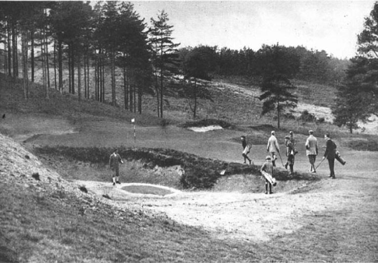
Figure 29A (Courtesy of Press Association)
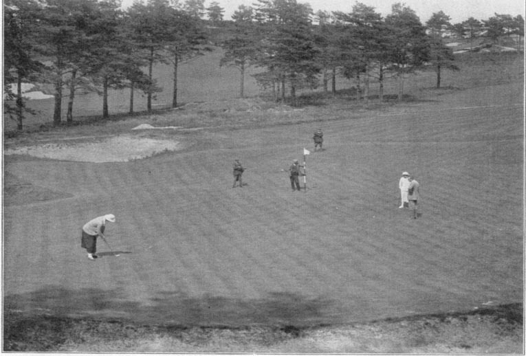
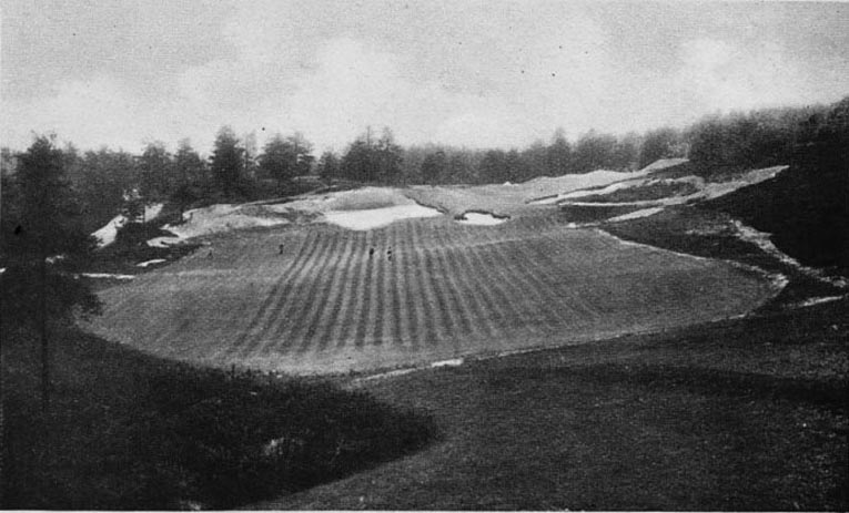
Figure 30
The Figure 30 photo of the lost eighth green is from the Suttons Seeds catalogue for 1924. At that time Suttons was based in Reading but are now in Paignton, S Devon. The photographer was standing above the green on the hill which can be seen on the near left of the photo of the eighth green on the previous page. The photographer is looking in a North Westerly direction, more to the right than in the photograph of the same green in Figure 29A.
The eighth fairway runs down to the green from the near right, and the view of the hole from the tee can be seen in the photo in Figure 28. The bunker in the foreground above is at the back of the green and well to the left of the bunker in the foreground in Figure 29. The fairway through the trees is the ninth fairway, which goes back up the hill, and the path running across the eighth fairway at the top right of the photo is seen running across the ninth fairway in Figure 32.
The path is a public “right of way” and eventually reaches the Chobham to Windlesham road at a point near to the Brickmaker’s Arms public house, which in the 1930s was near to a brick factory that provided casual employment for a number of Sunningdale’s caddies.
The actual Suttons catalogue featured the Secretary Mr. F Le Marchand’s congratulations to Suttons on sewing the seed for the New Course in Aug 1922 and having the course open for play by June 1923. It however was officially opened in November.

Figure 31
Figure 31 shows today’s view of the back tee of the Colt lost ninth hole, marked by a piece of white cloth. The raised contours of the tee are visible to the right, towards the lower end of the asphalt track down from the Old Course tenth tee, from where the photograph was taken.
There is a forward men’s tee about 20 yards to the left and the original Colt eighth green is 120 yards into the wood, at right angles to this tee. It should be approached with care as it is often occupied by deer. (Photos are in Figs 29 and 29A). The ninth hole view from the forward tee is shown in the 1924 photo in Figure 32.
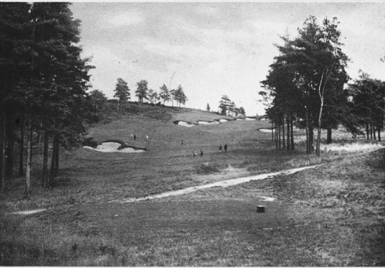
Figure 32
Figure 32 (Courtesy of Press Association) shows the view up the “lost ninth hole” from the tee in the previous photo. The photo came from the Sunningdale Club booklet written by Bernard Darwin in 1924. The path is today signposted as a public footpath. The tee is a ladies tee, fifty yards ahead of the back tee.
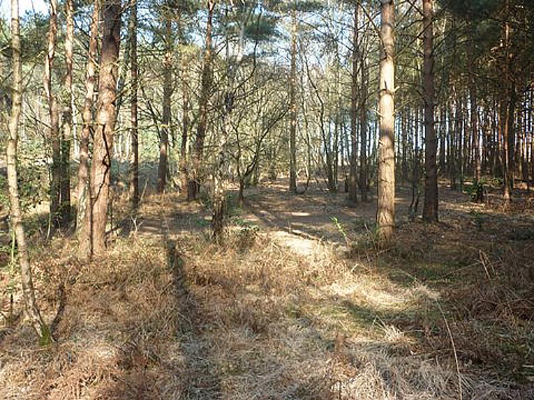
Figure 32A
Figure 32A shows today’s view from same spot. In Figure 32 the green was out of sight beyond the last bunker on the top right, and can be located on a col in the valley by reference to the easily visible bunkers which are still quite obvious today.
The bunker to the left of the fairway is readily visible today, enclosing a tree and is at the corner of a large greenkeeper’s rubbish tip that stretches over a quarter of an acre to its left. A few of the trees shown in the photo can still be identified in 2011.
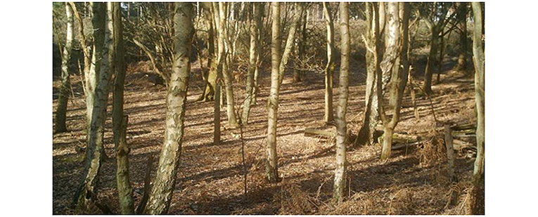
Figure 33
Figure 33 shows the 2010 view of the lost Colt ninth green: the area was completely cleared of trees in March 2011. It can be viewed from a completely different angle in the 2011 view in Figure 26A, where it is located at the col at the top of the hill to the centre right of the photo.
To find the site of this green from the area of the Half Way House, the seeker can stand on the front of the current tenth green of New Course facing the tee, turn 45 degrees right, climb up the hill on that line to locate the old Colt tenth tees. Turn another 30 degrees right, cross the hilltop, where on the col of the valley the other side the site of old ninth green will be seen.
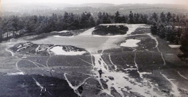
Figure 34
Figure 34 shows the view of the lost tenth hole of the New is from its original Colt tee to the same green as to-day, but today it is played from the right side of the photo, over the right bunker. The Half Way House is just out of sight at the top left corner. An article in the April 2012 “Golf Course Architecture” journal on the lost holes (Ref 13) comments that fescue grass can still be found on the disused tenth tee after seventy years.
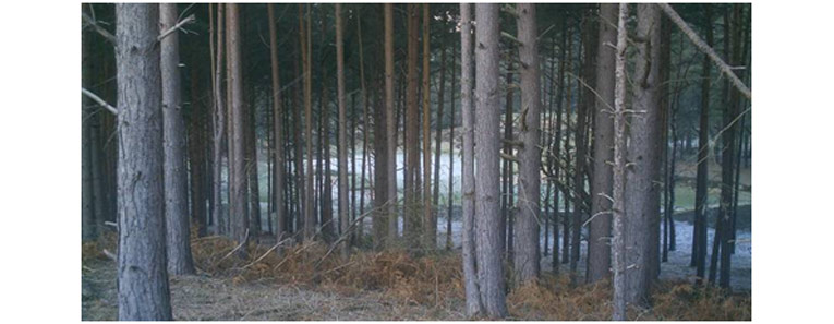
Figure 34A
Figure 34A shows the 2011 view to Fig. 34
The Simpson Redesign
To replace the abandoned (Colt) seventh, eighth, ninth, and tenth, Tom Simpson, who was employed on the original reconstruction, made four new holes on a so far unused part of the Common. The first of these became the sixth and was played from a tee below the fifth green, (near the front of today’s eighth green) a drive and a pitch on to the side of the hill at the point of the dog leg on the present sixth fairway. (An article in The Field dated July14 1934 includes Simpson’s actual and “not to scale” sketch-maps of these holes (see Figures 36,37 and 40). We can now say with some certainty where they were located.
The drive for Simpson’s sixth hole (see Figure 35 be-low) was played from a tee which was near the bottom of the track down from today’s New Course fifth green to today’s eighth green, and directed at a point roughly in the middle of today’s eighth fairway. The drive was aimed left of a pot bunker which is now the arrowed circular gorse bush which catches a long hooked drive off today’s eighth tee; also see diagram Figure 37.
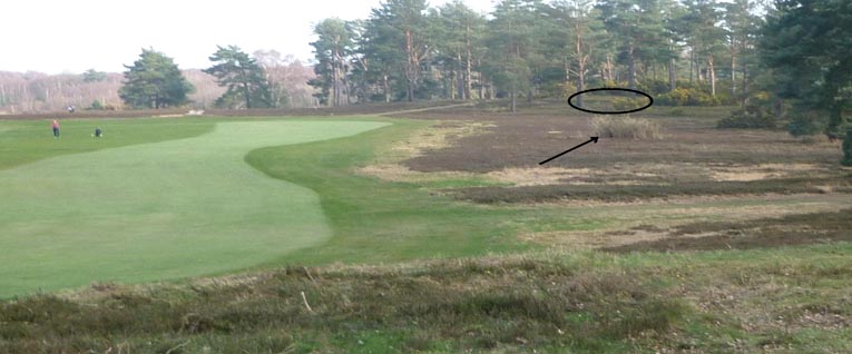
Figure 35
Figure 35 shows the view of the drive from Simpson’s sixth tee in the foreground. The green (marked) area is in the wood well beyond and above the arrowed gorse bush. Today’s eighth fairway is on the left, looking back towards its tee.
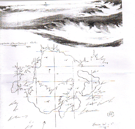
Figure 36
Figure 36 shows Simpson’s sketch of his sixth green. There were no trees or bushes in the area at the time: just heather on a gentle saucer shaped hill. His bunkers are now covered over with gorse bushes but the position of the green can be deduced on the site. His seventh tee was 30 yards left of his sixth green giving a 175 yard shot at what is also today’s seventh green.
The Simpson seventh was a one-shotter of 170 yards to today’s seventh green, at 90 degrees to the present line.
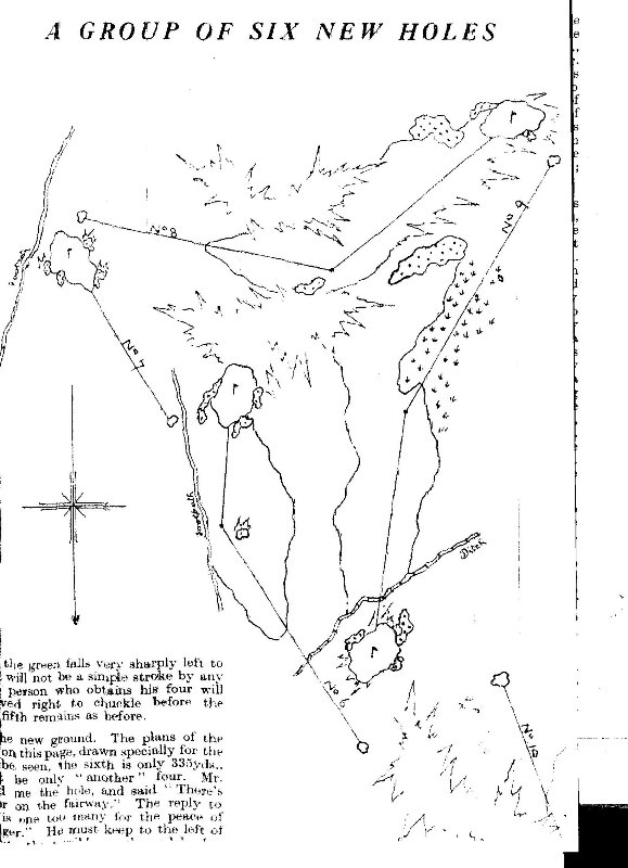
Figure 37
Figure 37 is the page from the Field 1934 that shows Simpson’s own plan, not to scale, of his freshly conceived “loop”. His seventh green is today’s seventh green and his eighth green is today’s sixth green. Colt and Morrison, in changing the loop from clockwise to anticlockwise, were clearly determined to “de-Simpsonise” the New Course, a phrase coined by John Morrison to also describe changes at Rye (Colt & Co, Hawtree 1991).
Because the actual site of the Simpson ninth green was about forty yards beyond the location depicted in this drawing, and the Suttons photo refers to the “final” location, it is likely that Simpson altered the exact position of his ninth green at the bottom of the sketch during the construction phase, and took the green thirty to forty yards further back.
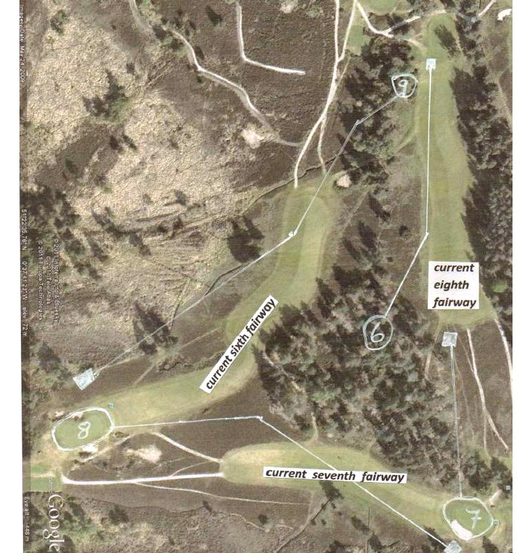
Figure 38
Figure 38 is a Google Earth photograph which has superimposed on it the location of the Simpson sixth to ninth holes, played clockwise, the opposite of today’s anticlockwise play.
A few steps brought one to the tee for the eighth hole. This was designed as a long two-shotter, dog leg left, played to the current sixth green. A heath fire had left the common bare and black, so that some of the longer hitters were able to aim across the corner, and if unable to reach the fairway, were sure of not too bad a lie on the bare hill top. The ninth hole was a two shotter from a tee West of the present sixth green, the second shot across the hand made ditch to a green short of the bridle way and South West of the present fifth green. (Actually it was nearer to South EAST.)
The location of the Simpson ninth green is at the top centre right of Figure 39 in the trees. When approaching today’s eighth green on the New Course, it is the area ten yards short of that green and fifteen yards left. This ninth green later became the location of Colt’s and Morrison’s eighth green in their 1939 alteration, and was in use until 1961 when it was moved 20 yards to its current site. This earlier site of the eighth green is described in Browning’s 1952/55 booklets on Sunningdale, and altered in subse-quent editions (ref 11).
A 1934 photo taken from a similar position, and look-ing in a similar direction, though slightly more to the left, is also shown in Figure 40. It comes from a Suttons Seeds catalogue of that year. Sutton’s catalogues can be seen in the Museum of English Rural life in Reading.