News:

Welcome to the Golf Club Atlas Discussion Group!

Each user is approved by the Golf Club Atlas editorial staff. For any new inquiries, please contact us.


Sven Nilsen

  • Karma: +0/-0
Three Mystery Courses from the Dallin Aerial Surveys
« on: December 28, 2018, 12:16:00 PM »
These photos may have been posted before, but I couldn't find them in a search of the back pages.

1.  An unidentified Seaside Course (1925) -


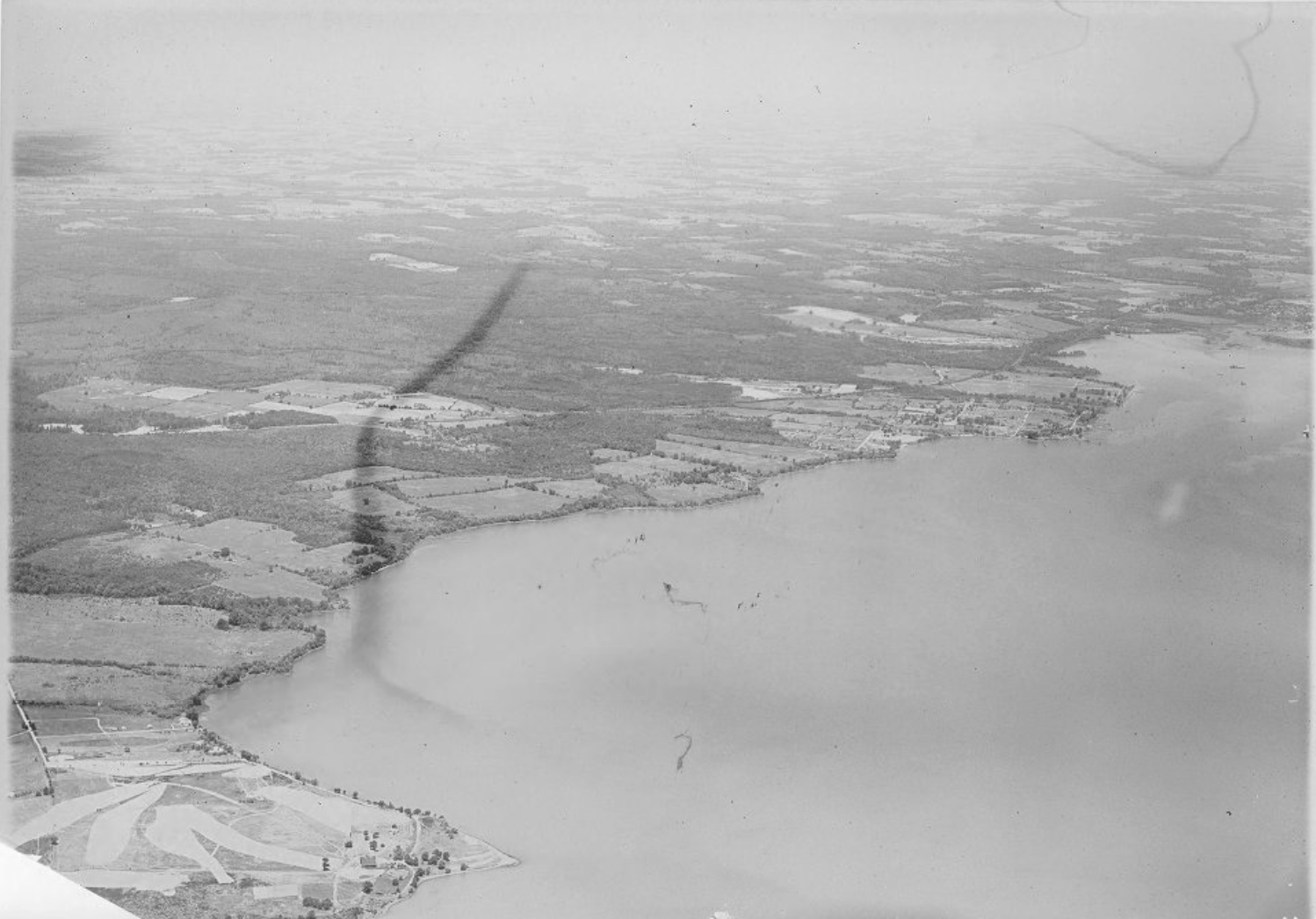
2.  A course near Elk Neck, MD (1927) -


3.  Country Club near Pitman, NJ (1928) -

"As much as we have learned about the history of golf architecture in the last ten plus years, I'm convinced we have only scratched the surface."  A GCA Poster

"There's the golf hole; play it any way you please." Donald Ross

Tom_Doak

  • Karma: +3/-1
Re: Three Mystery Courses from the Dallin Aerial Surveys
« Reply #1 on: December 28, 2018, 03:04:18 PM »


2.  A course near Elk Neck, MD (1927) -


Twenty years ago I looked at a potential golf site on Elk Neck that went right down to the water like this.  This looks like it's possibly the same location, but, nobody involved with the project made any mention of it having been a golf course previously.  It never got built this time around.


Kyle Harris

  • Karma: +0/-0
Re: Three Mystery Courses from the Dallin Aerial Surveys
« Reply #2 on: December 28, 2018, 03:06:12 PM »
Sven,


Reasonably certain that #3 is the Pitman Golf Course, still in existance. Can make out the two Par 3s on the back side in the middle (both around that pond) as well as the elbowing 5th on the far end of the property.


Alex Findlay with minimal modifications due to the construction of a bypass highway - which is just off frame right.
« Last Edit: December 28, 2018, 03:17:32 PM by Kyle Harris »
http://kylewharris.com

Constantly blamed by 8-handicaps for their 7 missed 12-footers each round.

Thank you for changing the font of your posts. It makes them easier to scroll past.

Joe Bausch

  • Karma: +0/-0
Re: Three Mystery Courses from the Dallin Aerial Surveys
« Reply #3 on: December 28, 2018, 03:18:54 PM »
Sven,


Reasonably certain that #3 is the Pitman Golf Course, still in existance.


Alex Findlay design. Only modifications were due to the construction of a bypass highway.


I'm confident in Kyle's identification.

Pitman is a solid public golf course and good value.  Photos:

http://www.myphillygolf.com/uploads/bausch/Pitman/index.html
@jwbausch (for new photo albums)
The site for the Cobb's Creek project:  https://cobbscreek.org/
Nearly all Delaware Valley golf courses in photo albums: Bausch Collection

Mark McKeever

  • Karma: +0/-0
Re: Three Mystery Courses from the Dallin Aerial Surveys
« Reply #4 on: January 02, 2019, 11:16:27 AM »
Hard to tell, but are those palm trees on that first seaside course?
Best MGA showers - Bayonne

"Dude, he's a total d***"

Ronald Montesano

  • Karma: +0/-0
Re: Three Mystery Courses from the Dallin Aerial Surveys
« Reply #5 on: January 02, 2019, 11:34:22 AM »
Hard to tell, but are those palm trees on that first seaside course?


Good call...some of them are super tall, a la tropical trees.


RM
Coming in 2024
~Elmira Country Club
~Soaring Eagles
~Bonavista
~Indian Hills
~Maybe some more!!

Mike Sweeney

  • Karma: +0/-0
Re: Three Mystery Courses from the Dallin Aerial Surveys
« Reply #6 on: January 02, 2019, 01:01:16 PM »


2.  A course near Elk Neck, MD (1927) -


Sven,


This is a guess, but a pretty good guess since you said "near Elk Neck".


I worked for the Muller-Thym family for 6 summers on their boat at the Jersey Shore, and they had an industrial farm, over in Carpenter's Point, Maryland which is just across from Elk Neck, MD. We used to deliver the boat from the Jersey Shore to MD via the Chesapeake and Delaware Canal every September. This was in the early 1980's, and I was told that they used to have a 9 hole course on the farm property which was hundreds of acres on the Chesapeake/NE River. Here is the farm location today on "Muller-Thym Lane:


https://www.google.com/maps/place/Muller-Thyme+Farm+Ln,+5,+North+East,+MD+21903/@39.4809325,-76.0549554,22934m/data=!3m1!1e3!4m8!1m2!2m1!1stoy+thyme+farm+carpenters+point+md!3m4!1s0x89c7b94bc6477c57:0xea115013c91052f6!8m2!3d39.5454522!4d-76.0132027

The course was built by Chap Muller-Thyme's father, who I never met, and Chap is long gone now. Chap let the course go to seed as it was too expensive to maintain and he was a hunter and fisherman first. I don't remember seeing any holes or outline of holes in 1980ish time frame when I was on the property during those trips.


Chap and his father belonged to Merion and Atlantic City, and the family was originally from Philly Main Line. [size=78%]I think I mentioned this to Wayne Morrison and Tom Paul back in the day, because my guess is Grandfather Muller-Thyme would have used Wilson or someone from Merion to build the course. [/size]


This is the first time that I have ever seen any even potential reference to that golf course, if in fact that is Carpenter's Point and not Elk Neck. I am pretty sure they did sell off some land where those houses are on the map on Carpenter's Point. I lost touch with the family when Chap died, so that is about all that I know and can offer.
« Last Edit: January 02, 2019, 01:40:43 PM by Mike Sweeney »
"One of the saddest lessons of history is this: If we’ve been bamboozled long enough, we tend to reject any evidence of the bamboozle. We’re no longer interested in finding out the truth. The bamboozle has captured us."

Dr. Carl Sagan, The Demon-Haunted World: Science as a Candle in the Dark

R_Paulis

  • Karma: +0/-0
Re: Three Mystery Courses from the Dallin Aerial Surveys
« Reply #7 on: January 02, 2019, 02:29:03 PM »
These photos may have been posted before, but I couldn't find them in a search of the back pages.

1.  An unidentified Seaside Course (1925) -


Near Point Mugu Naval Base in Oxnard CA there's a section of land along the coast that "could" be a fit for the seaside course course.

There were two courses on the nearby military bases. One still operational at Pt. Hueneme and the other was located at Point Mugu base but closed some time ago. This closed Pt Mugu course does not appear to fit the location of the the one in the photo.


It's a total guess on my part but the photo could be an area near where PCH hits the coast in Oxnard which might have been undeveloped in the 1920's.

The land is currently a marsh/wetlands and there is river/slough connecting to the ocean but current satellite maps shows there was something there before it was returned to marshland.