David,
Mike clearly chooses to ignore the chronological order of events in order to suit his agenda,
What I find distasteful is his deliberate distortion of the truth.
Yet, that seems to be a common theme in his presentations.
I agree that these guys let their desired outcomes shape their understanding of the evidence, and not visa versa. As we have seen multiple times before, Mike would rather completely reverse himself on "the facts" than face the real fact that his conclusions are wrong. No doubt he will pull this same crap again here. He went from responding to my posts in a matter of minutes to radio silence after my last post spelling it out for him. This means he knows I am correct, or at least he has a good idea that I am. Yet rather than admit it and let the conversation progress, he is trying to regroup and come up with something - anything - to keep alive his bogus theory. Meanwhile, his tail is between his legs and, like any good lap dog, he is probably awaiting his master's next command.
As to PV and contours, neither TEPaul or myself ever stated that PV was the first to employ them, only that PV appears to be amongst the first to employ them.
I guess that depends upon what you mean by "amongst the first." If Willie Dunn was using contour maps in the mid-1890's, then their use dates back to some of the earliest courses in this country. I guess if we look at the entire history of GCA in America, then PV was amongst the first, but I doubt the use was all that groundbreaking if we look close up.
That said, I agree that contour maps were probably pretty important at PV, especially given that the person usually credited with designing the course (for the first few decades at least) was overseas during most of its construction.
Off the top of my head, I can't recall seeing an early course routing superimposed on a topo
That may be because we don't have too many examples where we would be able to tell one way or another whether the contour map came before the plan.
There are actually other course routings on contour maps, but normally we have copies of them and/or they are all drawn in the same ink, so it is impossible to tell for sure whether the contour was used in the planning and/or construction. TEPaul's position on this has been predictable --he assumes that if there is no absolute proof of an example that the contour came before the plan, then we must assume it never happened that way. That of course is flawed and self-serving logic at best.
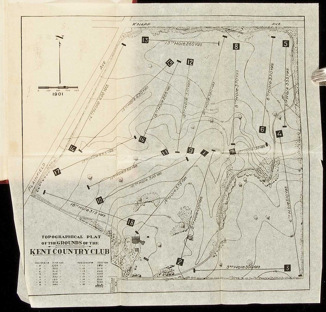
There are enough examples of courses with contour maps that I suspect that the practice was not all that uncommon from the beginning of golf architecture in America. In other words, rather than being first, Pine Valley may just be the rare example where we have enough information to make the determination with anything resembling certainty. Normally we don't have information (such as different color pens) allowing us to make that determination. For example, here is an example of a Kent, Michigan course from 1901, posted earlier this year by Neil Regan:

As you can see, it is a contour map with holes shown, but it is impossible to say from this alone whether the contour map was created after the course, or whether the course was drawn on the contour map at some point in the planning. We don't always have the advantage of a different color inks or of apparent changes made right on the map, suggesting some sort of design progression. But there are enough of such maps that we at least need to consider it a very good possibility that contour maps were being used.
Likewise, in the past I have posted a couple of very early plans by Dunn (or at least I think they are by Dunn) which similarly show contour lines. We cannot say for certain that he used the contour maps as part of the planning and/or construction on these courses, but given the article Joe found stating that this was his procedure at Princeton, and given the engineering demands of some of his early projects, it seems a pretty fair assumption that he used contour maps as part of his planning and construction process.