...Shall we?
The recent thread on routing left me wondering a number of things. Is routing some sort of mystical hoodoo that only the shamans of golf course design can fully comprehend? Is it pointless for we philogolsofers to even attempt to understand it?
My own answers led me to start this thread. I don't think it's impossible to understand, nor is it pointless. But in order to get a better idea of it, we who would like to understand it better will need to be able to read and understand a topographic map. I don't claim any degree of expertise in this area, I simply thought it better to light a candle than to curse the darkness. Therefore anyone who would like to correct me or expand on any of the information contained herein is most welcome and I thank you in advance.
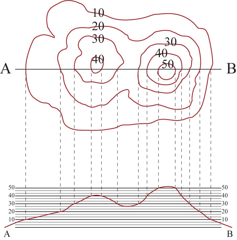
Periodically over the next several weeks I'll provide ever more complex and complicated topographic maps for us to discuss. To start with, however, we'll look at a map whose concept I "appropriated" from the USGS and USC. It is one that was contained in some educational materials meant to teach the understanding of topographic maps. I'll attach the PDF of this document to the end of my post.
I encourage those who are interested to download the document and map and study it if they wish, perhaps even opening the jpeg image below and drawing or shading it in MS Paint or some such program with ideas as to the shape of the land.

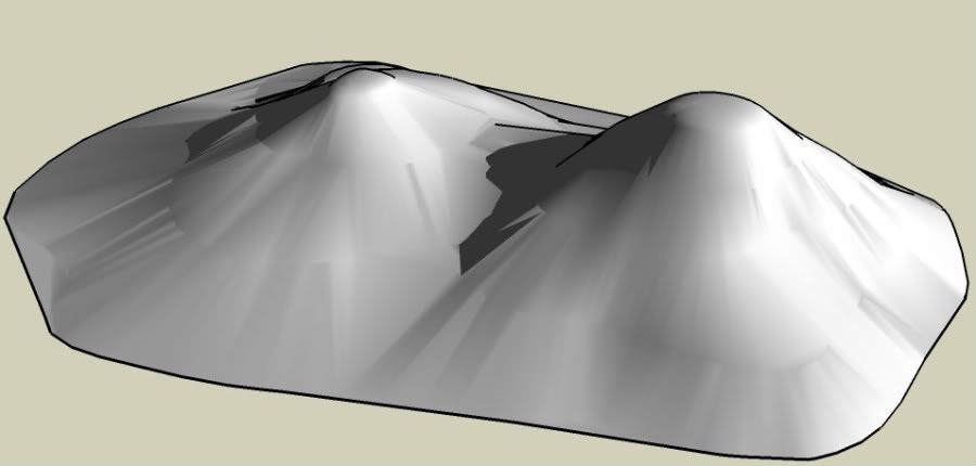
Just below I've depicted the contour lines shown above in the 3D program google sketchup. It is meant to give something of an idea of what the above would look like.

Again, feel free to comment, ask questions, or correct any assertions that I've made. Happy learning!