Jim,
I understand what you’re saying and I truly don’t think we’re too far off, but I think we still differ slightly about what problem we see the Francis Swap/Acquisition solving and when. At least now we both seem to think it was to solve the problem of not enough width!

I do agree with you conceptually that these guys were out there prior to January, and anyone who has ever walked a property being considered for golf would either have to be brain-dead or a complete creative dullard to not envision particular golf holes, whether or not they are feasible, or even would be any good, or whether they'd fit together in an 18 piece jigsaw puzzle. And that natural early envisioning of golf holes is a big part of the problem I have with the idea that these guys decapitated the northern end of the Johnson Farm during initial negotiations, because then it becomes harder to imagine how they might have still ended up with a reasonable 117 acres for golf, or even how they may have imagined using 120 back in July when all they/HDC owned was the Johnson Farm.
What’s more, the idea of walking the property and envisioning golf holes leads me to believe that of any spot they might have considered, the view from up on the hill by today’s 15th green/16th tee down across the quarry would have been inescapable to almost anyone. It is wonderfully dramatic, and I can’t believe they would march down to within 130 yards of the quarry at the south end of the Haverford College boundary, draw an artificial line and say, and say, “let’s start here”. As inconceivable as it is to you that they wouldn’t have been out there fiddling around with where they could put golf holes prior to January 1911, I have the same incredulity to think they would have created an artificial boundary just where it was obvious that greatness could be achieved.
I used to wonder the same thing about the lower part of today’s 11 and 12. How could these guys have been out there and leave themselves only about 250-300 yards to work with between Ardmore Avenue and the bottom of the hill, especially with that beautiful creek flowing through the area; another pretty obvious place to put golf holes, and another dramatic, almost natural amphitheatre setting. Why of course the Johnson Farm ended too abruptly down there, but surely they could have negotiated for another few acres, right? After all, it seems the alternative was to have to cross Ardmore Ave. with three holes.
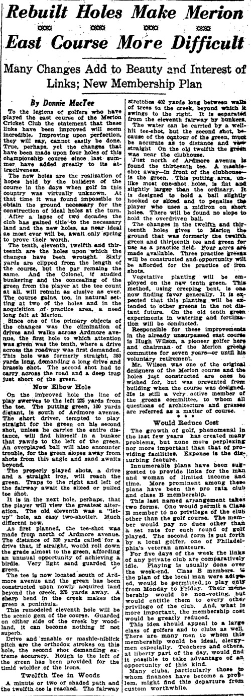
I saw this as a missed opportunity that I scratched my head about until very recently when Joe Bausch found the following article from 1922 by the writer Donald McTee, who also wrote under the name J.E. Ford, and who did a series of historic origin articles later concerning most of the prominent clubs in the Philadelphia area. The article is a beauty, and makes a number of things very clear.
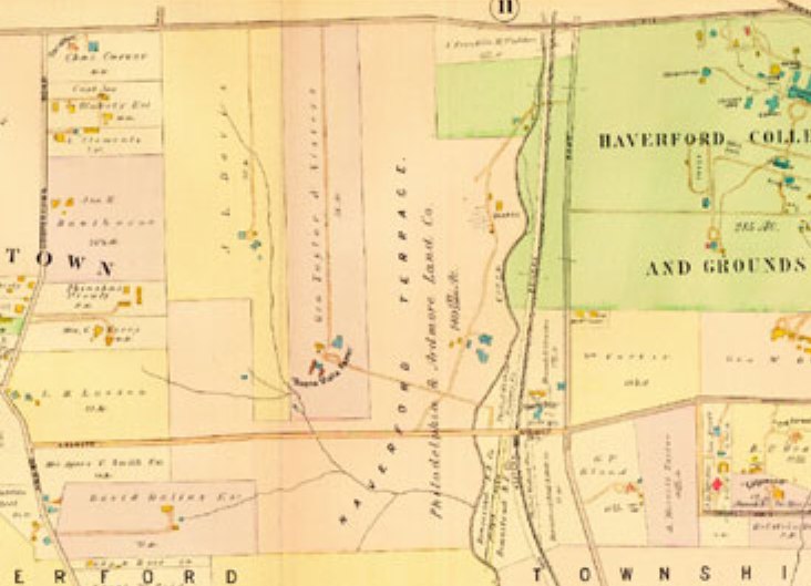
In looking at this map from 1908, prior to the purchase, one can not only see the wonderful hilltop peninsula promontory of the Johnson Farm to the north, which I can’t believe they would summarily decapitate, but also see the land mass in light orange below, which was the 126 acre estate of one John Marshall Gest. Apparently, the club did try to negotiate for some of this land, to no avail. This, and the negotiations for the Dallas Estate, may have been some of the reasons that not much activity took place between July and November of 1910.


Finally, given your interpretation of the Francis Swap/Acquisition, I’m curious why you think they’d need to “give back” any land at all? If they weren’t working with some reasonably firm or “working” boundary, and an additional 3 acres wasn’t much matter to them, why would they need to trade back land “already purchased”, as per the MCC Meeting minutes, and as per Francis’ account where he refers to the give back of the land across from the clubhouse to facilitate the beautiful homes along Golf House Road?
I do agree with you that the area on whatever map they were using ended up being too narrow for their needs, which to me meant they needed to grab an additional net three acres, as well as give back the parts they weren’t using to facilitate the adjustment to the original deal. I just think most of the evidence points to that particular swap of land happening in the March/April timeframe of 1911, and not prior. I think they had part of that upper part of the Johnson Farm in their plans all along, even if they made it too narrow at 100 yards at the base originally.
Hope that helps.