News:

Welcome to the Golf Club Atlas Discussion Group!

Each user is approved by the Golf Club Atlas editorial staff. For any new inquiries, please contact us.


Chris Buie

  • Karma: +0/-0
Re: Overhills History w/ New Photos
« Reply #50 on: October 23, 2010, 09:44:37 AM »
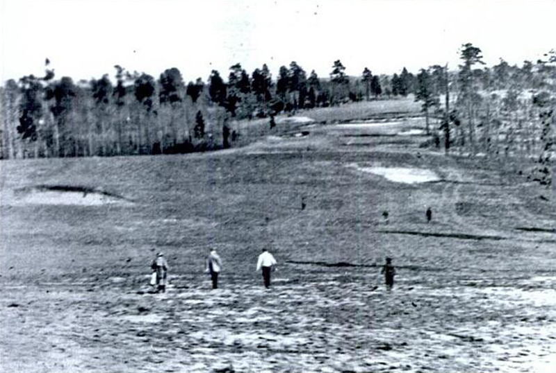
Well, here is some more imagery for your consideration.  The first graphic is two looks (from slightly different angles) of the tee shot on the 360.5 yard 8th hole.  As you can see, the land cants significantly left to right.  There is a good amount of roll in the very sandy land of this course.  
In the new photo below you can just make out the Croatan building which is where the Rockefeller family stayed.
On the left side of the old photo is the first fairway.


Below is the 1st tee shot - aim straight ahead.  The Clubhouse and the Harriman Cottage would be behind you - the 9th green would be to your left.  As you can see the shot is mildly uphill.  The land of 1 and 8 is like the top of a sphere.  


The following is either the tee shot of the 10th or looking from the green of the 18th toward the fairway.  The former I think.  Again you can see the land has some nice movement going on.  The old graphic has an arrow showing the camera direction of the new photo.


The weeds out there now are chest high in places.  I'm sure it could be sorted out if they do the right thing and restore the place.  But it was the thickets and sandspurs which prevented us from touring the rest of the course.  I will definitely look at the rest of the front 9 soon.  The view from the 5th tee is supposed to be panoramic.  It is where they took tea most afternoons - in a gazebo built there.

Beyond that, we took some photos of what was left of the clubhouse area.  The clubhouse itself was razed in 1947.  The Harriman Cottage and the very wonderful Croatan Lodge still stand.
Harriman Cottage:


Croatan Lodge:


Ethel Peterson did little whimsical paintings in the childrens area of Croatan.  They are still there.


Tom MacWood, it's my impression that he worked up until he passed away in the middle of the North and South Open that Harvie won in 1948.  They considered postponing the tournament but knew that he would have wanted them to play.  I don't think anybody doubts that was the right decision.
A man that prolific is a man who rarely finds retirement an appealing configuration - or even a viable one.  I doubt he would be able to walk among those pine hills and hollows without seeing what sort of design could be placed there.  Or perhaps he was more in accord with the Michelangelo view where he said the statue was already in the uncut stone - it was just a matter of removing what was around it.  You've seen the Russell Crowe film "A Beautiful Mind".  Remember when the character looks at ordinary items and sees mathematical equations superimposed over them?  Genius has the person much more than the person has genius.  It's not really a matter of choice.  I doubt he could give up design any more than a fish could give up swimming.  
Well, that's my impression anyway. I could be wrong.  I'd have to do some research to give you a more definitive answer.  Perhaps we can get Mr. Klein or some other Ross expert to give us their take.
Oh and by the way, he remodeled the recent GCA course Charlotte C.C. in 1942 and 1947.
« Last Edit: October 24, 2010, 09:42:17 AM by Chris Buie »

PCCraig

  • Karma: +0/-0
Re: Overhills History w/ New Photos
« Reply #51 on: October 23, 2010, 11:27:20 AM »
Chris:

This is just amazingly interesting. Thank you for the flow of information.

I suppose the good news is that with the natural sandy soil it looks like they could "rebuild" a course fairly easy on the land with minimal clearing. However, would the Army be willing to do so?

Does anyone at the base or within the army understand what they have there?
H.P.S.

Mike Sweeney

Re: Overhills History w/ New Photos
« Reply #52 on: October 23, 2010, 08:40:51 PM »
Chris,

Obviously many of us are history geeks. This is a great thread. Thanks.

Paul Stephenson

  • Karma: +0/-0
Re: Overhills History w/ New Photos
« Reply #53 on: October 23, 2010, 09:41:46 PM »
What a great thread.  Thanks Chris.

I do have one question.  In the 1941 aerial there looks to be lines right down the centre-line of the abandoned holes that are not on the holes still in play.  Any ideas as to why?  I can't imagine the course was irrigated.

Here's the picture I'm referring to:


TEPaul

Re: Overhills History w/ New Photos
« Reply #54 on: October 24, 2010, 08:13:20 AM »
"I can't imagine the course was irrigated."

Paul:

Why not?


Tom MacWood

  • Karma: +0/-0
Re: Overhills
« Reply #55 on: October 24, 2010, 10:17:35 AM »
It looks like the nine holes that were in play in 1941 had sand within standard grass greens sand greens, very tiny sand greens that is.

Chris
If you have access to the Tufts archives I think could pretty easily determine what Ross was doing in the 1940s with those golf courses.

Allan Long

  • Karma: +0/-0
Re: Overhills
« Reply #56 on: October 24, 2010, 11:44:43 AM »
This is a really great find, thanks for sharing. Before I moved from NC, I went down to see Stryker, but could not get close to where I thought the Overhills site was located. Seeing what has become of the course and seeing club's buildings is their current state is quite fascinating. The playing corridors just scream "restore me". 

In regard to Ross and Raleigh C.C., for what it's worth, Brad Klein in Discovering Donald Ross confirms Ross on-site at RCC.
I don't know how I would ever have been able to look into the past with any degree of pleasure or enjoy the present with any degree of contentment if it had not been for the extraordinary influence the game of golf has had upon my welfare.
--C.B. Macdonald

Chris Buie

  • Karma: +0/-0
Re: Overhills
« Reply #57 on: October 24, 2010, 06:37:31 PM »
Quote
However, would the Army be willing to do so?
Does anyone at the base or within the army understand what they have there?
- Pat Craig

Pat, these are very good questions.  
Do they understand what they have there?
Yes.  
But only a small group within that mammoth organization realizes it. The group assigned to document the historic aspect have done an outstanding job. The rest of the Army is obviously focused on other things. I can't really be too critical of them with this complicated war going on.  That doesn't mean a restoration shouldn't happen.  I've looked at some information and haven't found a convincing case that the relatively minuscule parcel is uniquely necessary for training.  That doesn't mean a convincing case doesn't exist - just that I haven't seen it yet.  I'll ask some people I know about it and see what they say.

I'll give you some facts to consider:
Fort Bragg has 251 square miles of land.
The Overhills tract is 10,580.
I'm told the golf course and immediate area around it is about 150 acres.
Also, you can read a pertinent official document here:
http://www.thefederalregister.com/d.p/2006-01-06-06-100
The main statement I found in the document is this:
"Presently, the maneuver/training areas at Fort Bragg are so heavily utilized that the land to support training needs to be used to its fullest extent."

If the land is as heavily utilized as they say then they must need a huge amount of natural forest for their purposes because there is a lot of that on Ft. Bragg.
Like I said, I don't find their case persuasive.  Maybe they are correct, but it appears to me that the tract could be put to better use.  

Moving on, here is a bit more ephemera for you.
They used the style of hole marker in the photo until the late Twenties.  They switched to using red cloth flags after that.
« Last Edit: October 24, 2010, 08:16:47 PM by Chris Buie »

Paul Stephenson

  • Karma: +0/-0
Re: Overhills History w/ New Photos
« Reply #58 on: October 25, 2010, 11:40:08 AM »
"I can't imagine the course was irrigated."

Paul:

Why not?


I just figured that with sand greens still being there in 1941 and reading about the "natural aesthetic" on the first page that they most likely would not have irrigated the fairways. 

I wasn't implying that it couldn't be done, I just don't think it was done.

Do you think those are irrigation lines down the middle of the fairways of the abandoned holes?

TEPaul

Re: The Story of Overhills
« Reply #59 on: October 25, 2010, 03:12:32 PM »
"Do you think those are irrigation lines down the middle of the fairways of the abandoned holes?"


That would be my first guess, but there is probably a very good way to find out.  ;)

Paul Stephenson

  • Karma: +0/-0
Re: The Story of Overhills
« Reply #60 on: October 26, 2010, 09:50:50 AM »
"Do you think those are irrigation lines down the middle of the fairways of the abandoned holes?"


That would be my first guess, but there is probably a very good way to find out.  ;)

I'd love to find out first hand, but unfortunately I'm just too far away.  However, there are "boots on the ground."

Chris Buie

  • Karma: +0/-0
Re: The Story of Overhills
« Reply #61 on: October 27, 2010, 07:44:24 PM »
As you probably saw, the first journey out there was in the area of the 1st, 8th and 9th holes - as well as the buildings.  So the next trip will focus on the rest of the outward 9 - holes 2 through 7.  To make sure we don't wander around lost I've been looking at the maps and holes pretty closely.  I thought you might like to have a look as well.
Here is the area without any guiding points:


Based on old maps I was able to make sense of the vague green area in the first image:


In looking at these holes closely the 4th and the 6th seem to have the most character.  
The 4th was/is a winding 510 yard hole with a bunker to drive over and water to contend with.

  
The antiquarian photo is from near the 3rd green looking back over the 4th hole and the sharp ridge that takes you to the 5th green/6th tee.  You can make out the dip in the 4th fairway where the natural stream is.  The bunker short right is on the 2nd hole.


Google Earth is a remarkable program because not only can you get good aerials - you can flip back and forth between different times from the exact same vantage point.  The most amazingly aspect to me is that you can zoom down to ground level and look at the topography - which was done by NASA.  People seemed to be blasé about the imagery I've put up from the program before but I still find it stunning.  Oh well.
Here is an approximate look at the tee shot on the 4th.  It is (according to the Google program) exactly 135 to the front edge of the bunker and 168 to carry it.  That is a pretty good hit for 1915, isn't it?  


From the far edge of the bunker to the front of the angled water is 170 yards - about 200 yards to carry it.  The dark area that just out from the left in front of the hazard is trees - so you would have to bend your shot around that if you were trying to get it over the hazard.  Note the hill to the right of the green.  It is higher than it appears here.  That where the 5th green/6th tee/gazebo was.


It is about 110 from the water to the green.  Probably you would lay up back then.  Your 3rd shot would look something like this:


That is a curious line vertical line bunker elevated a bit and to the right of the green.  


So that's the 4th hole.  I may post a similar examination of the 6th hole later but this will have to suffice for now.
I think I've got a pretty good idea what is going on out there.  I'll be out there very soon and will post the photos so you can have a look.
« Last Edit: October 27, 2010, 07:55:47 PM by Chris Buie »

TEPaul

Re: The Story of Overhills
« Reply #62 on: October 28, 2010, 10:56:13 AM »
Chris:

I missed your mention sometime ago of William Kent. It really is interesting when one begins to consider what some of the connections may be in some of these names.

Kent was obviously very closely connected to John Muir who probably can be considered to be the patron saint of the initial American environmental movement in the vehicle of state and national parks (see the Ken Burns documentary on American National Parks and its concentration on the likes of John Muir).

It probably isn't just a coincidence that the Rockefellers and particularly Laurence Rockefeller was one of America's most active and large-scale latter day environmentalists.

As "Deep Throat" said to the team of Woodward and Bernstein in their Watergate chronical, "Follow the money," it seems with this subject the most productive policy would be to "Follow the names and their connections."
« Last Edit: October 28, 2010, 11:17:49 AM by TEPaul »

Chris Buie

  • Karma: +0/-0
Re: The Story of Overhills
« Reply #63 on: October 28, 2010, 01:00:37 PM »
Yes, Mr. Paul, I think we may have inadvertently stumbled upon a larger story with Overhills.  There are many cross-currents and dimensions that I wasn't aware of before looking into the history of the course.
To give it even more of an X-Files twist, Kent was associated with The Bohemian Club in Northern California.  As I said before, conspiracy theories don't interest me except for unintentional amusement.  But it is pretty clear that this was was an element of the Overhills story. 
Back to GCA, later today if I get the chance, I'll post a look at the hole that interests me the most out there: the 6th.

Lester George

  • Karma: +0/-0
Re: The Story of Overhills
« Reply #64 on: October 28, 2010, 02:39:25 PM »
Might the lines down the center of the abandoned holes be tracks where the caretaker travelled down the holes to maintain the property?  I have seen it before.

Lester

TEPaul

Re: The Story of Overhills
« Reply #65 on: October 28, 2010, 03:12:25 PM »
"As I said before, conspiracy theories don't interest me except for unintentional amusement.  But it is pretty clear that this was was an element of the Overhills story."


Chris:

I'm not sure I know what you're referring to when you mention conspiracy theories unless you're referring to the references I made to that 1991 book I mentioned entitled "The Unauthorized Biography of George Bush" by Webster Tarpley. When I read it the idea that it was some kind of a conspiracy theory book sure did cross my mind and that idea has not exactly crossed out of my mind either, despite the fact I sure was intriqued by some of it bibliography which apparently contains declassified material. My first thought, of course, was why would some of it have been classified in the first place?  ;)

Eric Pevoto

  • Karma: +0/-0
Re: The Story of Overhills
« Reply #66 on: October 28, 2010, 03:16:23 PM »
Strange that the property appears less treed in the later aerial than when it was a functioning golf course.
There's no home cooking these days.  It's all microwave.Bill Kittleman

Golf doesn't work for those that don't know what golf can be...Mike Nuzzo

Chris Buie

  • Karma: +0/-0
Re: The Story of Overhills
« Reply #67 on: October 28, 2010, 07:52:10 PM »
The most intriguing hole on the course is the 6th. It is a 417.9 yard down and over hills gem. 
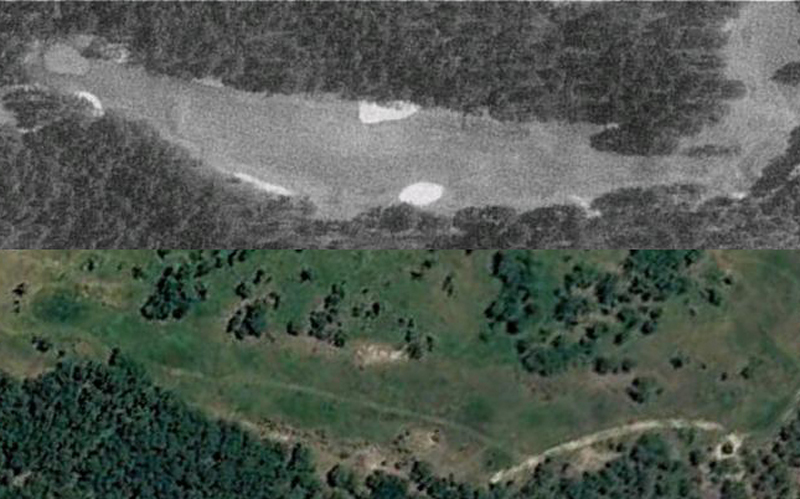

The tee is located on the high point of the course next to the 5th green.  As was covered earlier, they loved this perch overlooking the property so much that they built a gazebo there.  We don't take afternoon tea or watch sunsets like they did there anymore and we are the lesser for it.  Obviously.
To give you an idea of the height, consider this photo of a gentleman who is apparently practicing his fox trot on that tee box.
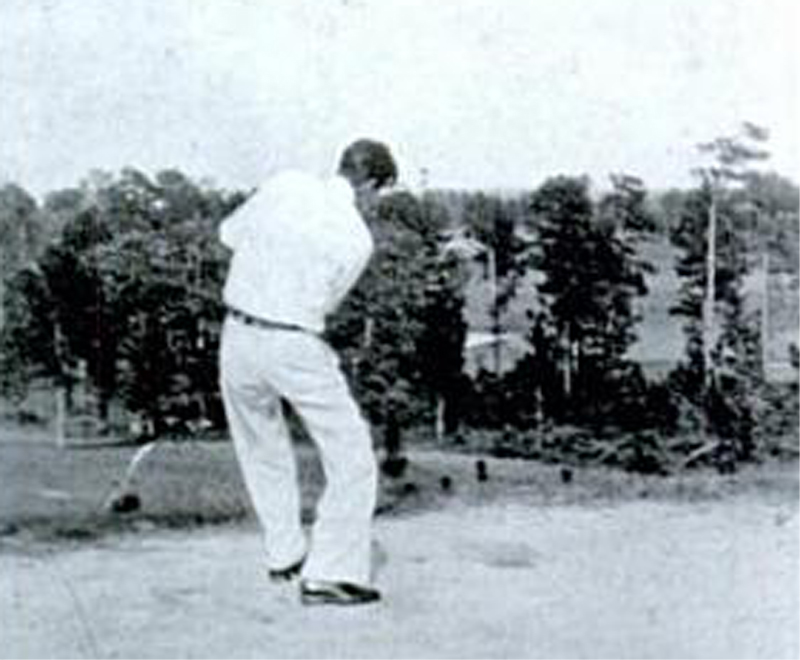

I'll be taking photos of the place very soon and very sotto voce but in the meantime I'm getting my bearings and having fun with the digital wizardry of Google Earth.  As you can see, the tee shot is considerably downhill.  Even more so than it appears in the old photo.  Photography sometimes doesn't quite seem to convey terrain with some drama to it.
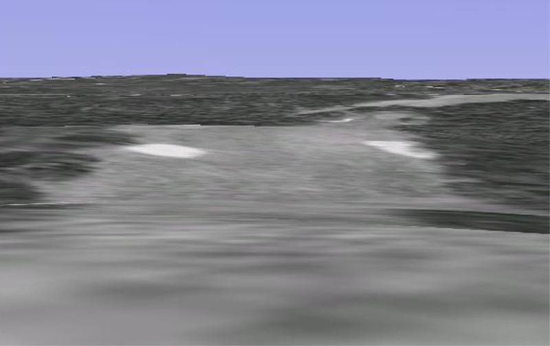


Looking back toward the tee from between the bunkers gives you something of an idea of the variation in height.  Do you suppose Ross walked the property found the hill and essentially arranged the front 9 according to that hill?
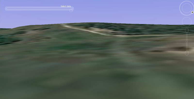

Then the land rises again before going down once again to the green.  From this side angle view you can see how the land falls before cresting just past the bunkers.  The green is marked so you can see how the hole bends a bit to the right.
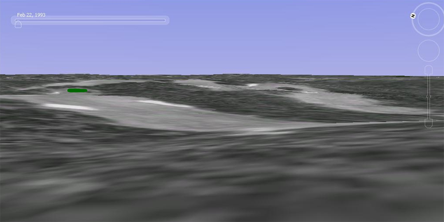

This would be the approximate approach shot after a good drive.  The book (Overhills Oral History) said:
"A wiregrass mound on the left side of the fairway about 350 yards from the tee preceded two small bunkers flanking the green."
I can't make them out myself but I'm glad to know the description.


This side view shows how the land moves down from the fairway crest - then moves back up yet again.
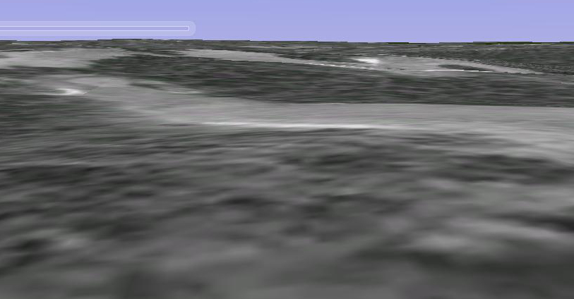

Finally, looking back from the green.
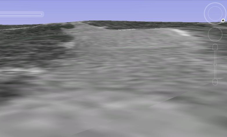

Quote
I'm not sure I know what you're referring to when you mention conspiracy theories
TEPaul

Mr. Paul there is a whole industry of conspiracy theories by delusional people regarding the JFK assassination, aliens, SPECTRE, fake moon landings, etc.  Buzz Aldrin actually punched out one guy that kept bugging him.  Many people actually believe all that.  It makes it a little difficult to look at anything close to their dubious realm.  This isn't to say that there aren't matters along those lines which aren't true.   
It could be very interesting if somebody that had credibility put together a nice exposition regarding the historic influence of secretive cabals.  Perhaps that is what happened with the Bush book you were referring to.   I wasn't denigrating you or the Bush book.  I'd have to look at it before I could render an opinion.  I'll take you at your word that it contains things that are true and provocative.  Again, I wasn't taking you to task in my commentary. 

Eric, I noticed that as well.  I'm not sure what could account for that.  Something or somebody did do a lot of tree removal though. 

Paul and Lester, I'll have a look at that in the future if I get the chance.  Nice observation on that Paul. 

PCCraig

  • Karma: +0/-0
Re: The Story of Overhills
« Reply #68 on: October 29, 2010, 09:19:19 AM »
Chris:

I'm loving the detailed hole descriptions and antique photos. When you first showed the overhead routing of the course I could tell #4 especially, and to an extent #6, would be somewhat interesting holes.

Seeing number six though in your detailed description shows that Ross made excellent use of the natural land contours and the two bunkers off the tee (excuse my blatent use of a modern GCA term) "frame" the tee shot perfectly.

The more you decribe the holes I keep thinking to myself "if this course was still around today, how would it play?" I keep thinking it wouldn't be the hardest or even the most interesting course in the area, but the idea that it would make for the perfect pleasant afternoon round....short and fun. Maybe almost like a Mid-Pines?
H.P.S.

Chris Buie

  • Karma: +0/-0
Re: The Story of Overhills
« Reply #69 on: October 29, 2010, 03:05:39 PM »
Just got back from the second trip out there.  I'll post more photos and comment later this evening.

The 6th tee is significantly more elevated than the photo shows.  There is a huge drop in height from tee to fairway.


Looking back up to the 6th tee from the fairway.


The pond on the long par-5 4th.


Looking back from the pond area of the 4th.  More elevation change than I thought.


Remnants of a bunker - a lot of those out there.
« Last Edit: October 29, 2010, 03:23:46 PM by Chris Buie »

PCCraig

  • Karma: +0/-0
Re: The Story of Overhills
« Reply #70 on: October 29, 2010, 03:26:47 PM »
Remnants of a bunker - a lot of those out there.


WOW! So neat...
H.P.S.

Jason Elwell

Re: The Story of Overhills (2nd Trip Photos)
« Reply #71 on: October 29, 2010, 03:49:37 PM »
Chris, I am absolutely loving this topic. Please keep up the good work! It's fascinating to see the current state of the land and imagine what the course would have been like.

Chris Buie

  • Karma: +0/-0
Re: The Story of Overhills (2nd Trip Photos)
« Reply #72 on: October 29, 2010, 07:54:52 PM »
Well lads, looks like I'm going to be busy tonight so I'll just post some photos now and bore you with the commentary later. 
Looking up to the 6th tee from the crest of the fairway.


6th tee


The 5th hole is a very uphill 171 yards.  The 5th green is on the same high point as the 6th tee.  Looking down toward the 5th tee:


The 4th hole was particularly challenging to walk.


Where once was a natural stream there are two ponds on the 4th fairway.


Virginia found this empty turtle shell.  She was a great companion out there.  Her father is serving in Afghanistan right now.


Looking from the pond area back toward the 4th tee.


Looking from the 4th fairway toward the green.


This is what wild wiregrass looks like.  It is on the edge of a bunker.


I'll post more later.

TEPaul

Re: The Story of Overhills (2nd Trip Photos)
« Reply #73 on: October 30, 2010, 12:24:36 AM »
This NLE course is interesting but another I think is just as interesting or perhaps more so is Ross's course in Fort George Island Florida, the Ribault Club, which now looks almost completely similar in its state of obsolesence as Overhills. Its membership was once every bit as impressive as Overhills. The irony of the Ribault Club is their clubhouse which was of real building architectural significance has been restored in the last 2-3 years!

Chris Buie

  • Karma: +0/-0
Re: The Story of Overhills (2nd Trip Photos)
« Reply #74 on: October 30, 2010, 02:00:19 PM »
The area of holes 2-7 was quite overgrown and pretty rigorous to get through in places.  It made us appreciate the original efforts to clear the land by hand and mule.  That must have been quite an endeavor.  One thing to keep in mind about the course is that it was over 6500 yards.  This was in the 1910's mind you.
  
As I said before, photography (especially in the hands of amateurs) does not always communicate the contours of the land adequately. What is the first thing people say when they vistit Augusta in person?  Anyway, the land of Overhills has a great deal of character.  I expected the high point of 6 tee/5 green to have a considerable amount of drama.  It did.  The rest of the terrain exceeded my expectations.  The land bends this way and that, rises and falls - sometimes dramatically. I would estimate the elevation drop between the 6th tee and fairway to be about 120 feet.  


I recently did a thread on a treeless Southern Pines GC.  One very knowledgable golf writer absolutely loved it but the vast majority of the responses on GCA were that people wanted to see the trees.  I disagree.  There would be more than enough trees on the perimeter and dotted here and there to know you are in the Sandhills of NC.  That plays into this view.  Or rather this very obstructed view.  Look at the difference between the photo and the image - from the same spot - looking the same way.  Which one do you prefer?  


The 375 yard 2nd hole decends more sharply than anticipated.  It originally had some interesting bunkering.


Looking back toward 2 tee.


The original 2nd hole.


View from 6th fairway toward the green and the 7th tee.


We could discern where some of the bunkers were by the isolated clumps of pines.  The pines obviously found the bunkers a great place to sprout.


As expected that gazebo was not there but there was the same sort of rain shelter that used to have on the Pinehurst courses.  


Florence Short:
"You know when I'd take friends down there was usually somebody that loved the golf course. And in earlier years, if you came earlier in the spring it would all be kind of purple with bluets growing. So you'd arrive and it would just be purple. So yeah, we liked the golf course."


More images:


« Last Edit: October 31, 2010, 11:08:02 AM by Chris Buie »