David,
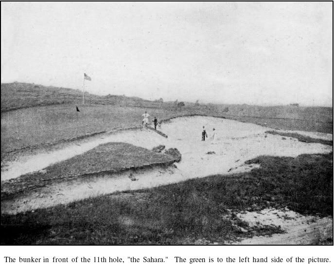
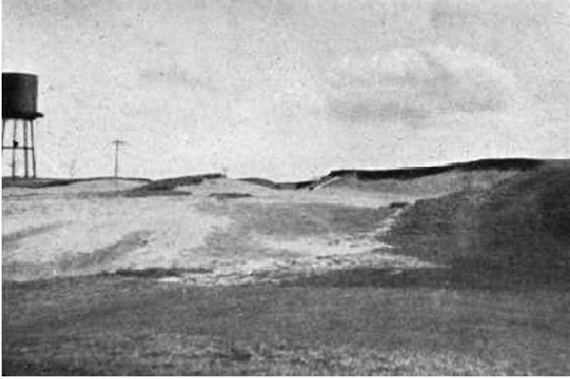
Here are the two photos you posted.
Look at where the steps are pointing in the first photo.
Then, look at where the steps are pointing in the second photo.
The green would be to the RIGHT of the steps in the 2nd photo.


Now look at the water tower in the second photo, it's beyond the steps, meaning that a vew from the water tower to the green is from an angle behind the green, not flanking or in front of the green.
Now look at the next two photos.


I think the angles in your lines are incorrect/inconsistent, and that the green would have to be further right and more toward the Sebonack property line, at an angle a little less than toward the 1st tee.
The one problem I'm having with this configuration is the distance issue.
The second hole is listed as 228 to 262.
We know that second tee is in the footpad of the first green.
If you measure 262 from that tee it takes you far beyond the indicated green area on your photos.
Was the 2nd hole, originally, a par 3 ?
It's hard to imagine it being a par 4 of less than 200 yards, even with the uphill topography.
The other thing that troubles me about the photo is the sharp hill climbing directly behind it.
When I next visit NGLA I will look at the property as it ascends to the Sebonack property line.
Is it possible that the 2nd green was on Sabin's property ?
The stairs in photo # 3 don't align properly with the stairs in photo # 1, especially in light of where you place the green in photo # 3.
Additionally, the topography in the area you allege the green resided, doesn't match the topography of the crest of the fairway hill.
Just take a look at the terrain on "Google Earth", from the Windmill, looking southwest, west and northwest and you'll see that the terrain doesn't match the terrain in the photos and your placement of the green.
If the pictures don't fit, you must admit ...... your explanation is flawed.
I've got to run, but, I'll be back