With the other thread going about final approval of the building of the course, I thought I'd resurrect this one to see if there is any discussion debate about the design and layout of the course.
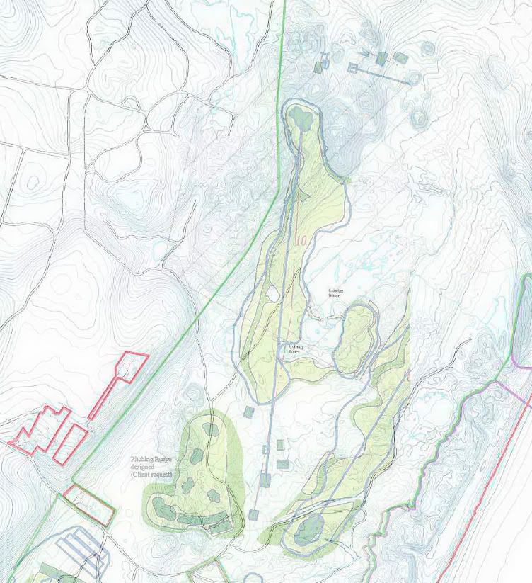
From the links to the planning commission it appears that the course layout has been altered a bit from a year ago to accommodate preservation of more natural areas. It's interesting to look at the topo map in conjunction with the layout and the aerial view.
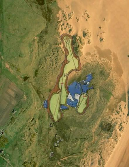
Getting back to the 10th hole, here is the overlay of the hole on the Google aerial. The current modified design for this hole is very close to this version with the exception that they appear to have recognized that they needed to connect the island fairway to the left hand fairway.

For fun, and to try to better understand the design intent, I overlaid the 10th hole onto the topo map. The island fairway to the right now makes a little more sense. Although it is longer to go that way, it does provide a head on approach up a 20 to 30 foot ridge to the green on the second shot. Playing the left fairway appears to offer two challenges - how to keep the drive in a fairway sloped left to right toward the water and in a bottleneck created by the ridge to the left and the natural wetland to the right; and how to play a second shot across the ridge that leads up to the green. The green appears to be in a nice dell nestled in below a massive 50 foot dune on the right. Looks like it could be a interesting and challenging and picturesque par 5.
