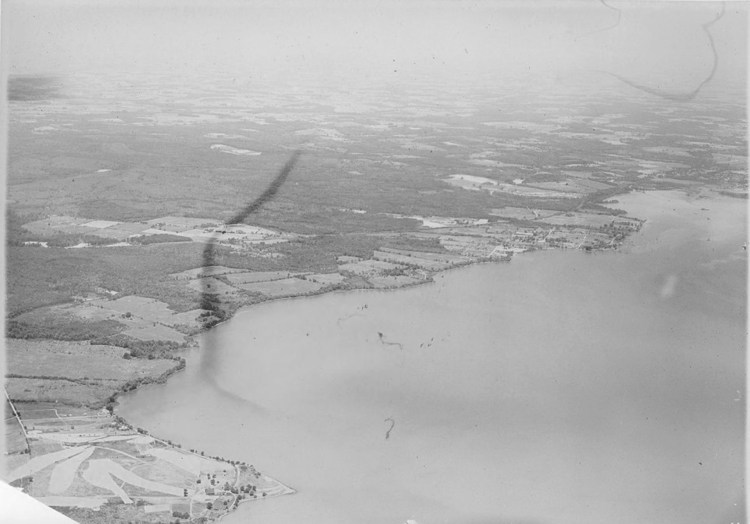
2. A course near Elk Neck, MD (1927) -
Sven,
This is a guess, but a pretty good guess since you said "near Elk Neck".
I worked for the Muller-Thym family for 6 summers on their boat at the Jersey Shore, and they had an industrial farm, over in Carpenter's Point, Maryland which is just across from Elk Neck, MD. We used to deliver the boat from the Jersey Shore to MD via the Chesapeake and Delaware Canal every September. This was in the early 1980's, and I was told that they used to have a 9 hole course on the farm property which was hundreds of acres on the Chesapeake/NE River. Here is the farm location today on "Muller-Thym Lane:
https://www.google.com/maps/place/Muller-Thyme+Farm+Ln,+5,+North+East,+MD+21903/@39.4809325,-76.0549554,22934m/data=!3m1!1e3!4m8!1m2!2m1!1stoy+thyme+farm+carpenters+point+md!3m4!1s0x89c7b94bc6477c57:0xea115013c91052f6!8m2!3d39.5454522!4d-76.0132027The course was built by Chap Muller-Thyme's father, who I never met, and Chap is long gone now. Chap let the course go to seed as it was too expensive to maintain and he was a hunter and fisherman first. I don't remember seeing any holes or outline of holes in 1980ish time frame when I was on the property during those trips.
Chap and his father belonged to Merion and Atlantic City, and the family was originally from Philly Main Line.
[size=78%]I think I mentioned this to Wayne Morrison and Tom Paul back in the day, because my guess is Grandfather Muller-Thyme would have used Wilson or someone from Merion to build the course. [/size]This is the first time that I have ever seen any even potential reference to that golf course, if in fact that is Carpenter's Point and not Elk Neck. I am pretty sure they did sell off some land where those houses are on the map on Carpenter's Point. I lost touch with the family when Chap died, so that is about all that I know and can offer.