While people are digesting the letter, I thought I'd post some more info on the borders.
NOTE: ALL MAPS BELOW ORIENTED NORTH TO THE RIGHT.
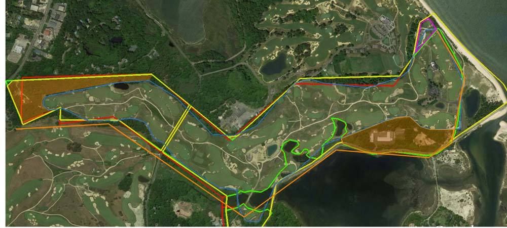
The articles quote CBM as saying that they had two miles at their disposal and about one mile of frontage on Bullshead Bay, and about a quarter mile of frontage on Peconic Bay. The orange line is 2 miles, exactly. The long blue line is exactly 1 mile. The small blue line is a quarter mile.
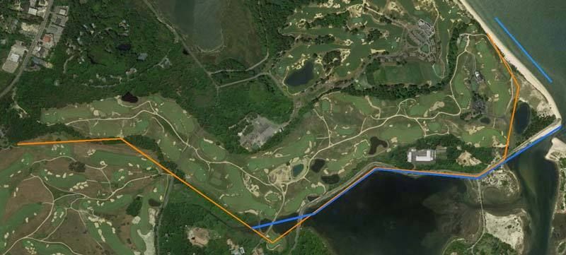
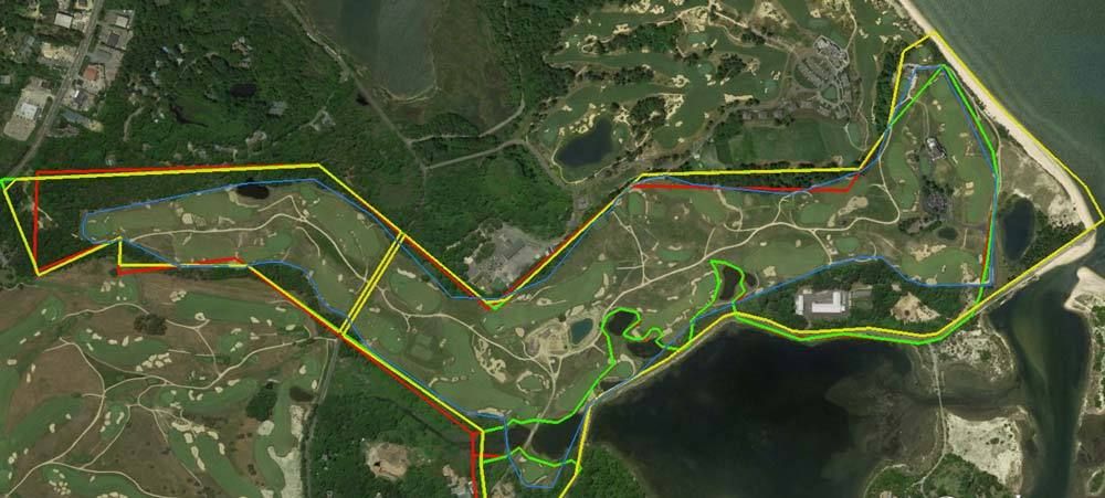
Below is my attempt at placing the blueprint borders on an aerial. (The area on the blue print at the northern end is not decipherable, so I used old course maps to estimate the approximate edge of the bluff.) The marked area measures 200 acres.
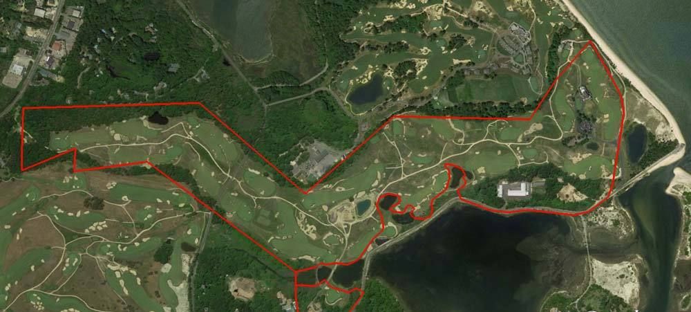
Next in yellow are the current property lines of the two golf course parcels from the Suffolk County map. The acreages as measured are 52.3 and 185.3, for a total of 237.6 acres, as measured.
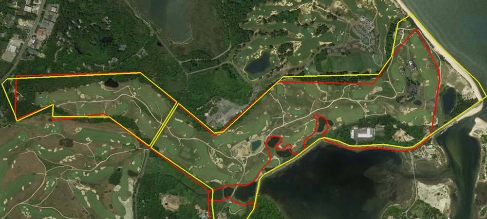
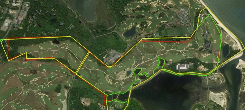
Next is green is my estimate of the land original purchased by CBM. It combines the lines from the parcel map (excluding the 2.4 acre parcel purchased in 1910 or 1911 and used for the pro shop) with the shoreline from the blue print and early map. It measures 205 acres.
Next in blue is another estimate of the land currently used for golfing. It measures 162 acres. About the same as Steve's, but mine excludes the pro shop.)
Next one shows the only two areas of any significance that aren't used for golfing. The area near the 9th green was going to be the site of the bath and locker house, and possible the site of a future clubhouse. It measures 14 acres. The low lying area next to the 17th measures about 18 acres.
Hope this helps.