News:

Welcome to the Golf Club Atlas Discussion Group!

Each user is approved by the Golf Club Atlas editorial staff. For any new inquiries, please contact us.


George Pazin

  • Total Karma: 0
Re: My visit to Apache Stronghold (Arizona), with photos
« Reply #25 on: May 30, 2013, 03:04:40 PM »


1a. "It's not a cow pasture. That's flat, boring, up and down parallel holes. At Apache Stronghold, you have to think about the shots. It's not boring. Despite the conditions, the elements are very strong. The average golfer would find it difficult enough being in some of those bunkers, and with sand in them, that much harder." (words out of my wife's mouth after I just yelled your question to her in the living room). Not sure she answered your question!
...

Having learned my golf on cow pastures, I don't think you have the same idea about cow pastures that I do. It's a cow pasture, because you can't farm it. Much like links. I have played many grassed courses that are flat, boring, up and down parallel holes. The proper analogy would be farm land, and row crops.


Garland, my friend, you cannot expect city-folk to understand the nuances of cow pastures. Or even linksland. :)

Thanks for the pics, Jim.

Nice to see that some dreams never die...
Big drivers and hot balls are the product of golf course design that rewards the hit one far then hit one high strategy.  Shinny showed everyone how to take care of this whole technology dilemma. - Pat Brockwell, 6/24/04

Jim Johnson

Re: My visit to Apache Stronghold (Arizona), with photos
« Reply #26 on: May 30, 2013, 03:21:16 PM »
Bill, from the Apache tee (yellow) that I played, Google Earth shows me that it's 280 yards to the edge of the putting green. It shows me that it's 270 yards to carry the sand on that side of the green. But the line is directly over the small hill left of the fairway, and the top of that hill is about 240-245 yards out from the (Apache) tee. If you hit left of your intended line, you're dead (back side of the hill). If you drop down somewhere on the top of the hill, you're dead. And it's 50+ yards to the right of your line before your ball finds grass, anything closer to your intended line is dead. So yeah, I guess BIG hitters could pull it off, but their ball would have to clear the top of that hill. Just don't know if that's possible. And they'd probably be playing the Warrior or Stronghold tee instead, which looks like 320 yards to the edge of the green.

I just don't think the risk is worth the reward.

If you hit it out there 245 yards (from the Apache tee) or 300 yards (Warrior or Stronghold tee) over the right edge of the fairway bunker in the corner of the dogleg, you're left with a 100 yard approach shot.

Matthew Petersen

  • Total Karma: 0
Re: My visit to Apache Stronghold (Arizona), with photos
« Reply #27 on: May 30, 2013, 03:40:40 PM »
Bill, from the Apache tee (yellow) that I played, Google Earth shows me that it's 280 yards to the edge of the putting green. It shows me that it's 270 yards to carry the sand on that side of the green. But the line is directly over the small hill left of the fairway, and the top of that hill is about 240-245 yards out from the (Apache) tee. If you hit left of your intended line, you're dead (back side of the hill). If you drop down somewhere on the top of the hill, you're dead. And it's 50+ yards to the right of your line before your ball finds grass, anything closer to your intended line is dead. So yeah, I guess BIG hitters could pull it off, but their ball would have to clear the top of that hill. Just don't know if that's possible. And they'd probably be playing the Warrior or Stronghold tee instead, which looks like 320 yards to the edge of the green.

I just don't think the risk is worth the reward.

If you hit it out there 245 yards (from the Apache tee) or 300 yards (Warrior or Stronghold tee) over the right edge of the fairway bunker in the corner of the dogleg, you're left with a 100 yard approach shot.

You're right, Jim. Anyone long enough to even consider the idea would be playing a tee where the carry is 320 just to find grass, and that's going over a pretty big hill to a small target. Sanding on that tee, the way the hole sets up and the hill sits, it's not something anyone would consider. Even picking the exact aiming point wouldn't be simple. Meanwhile, it's not a difficult drive and pitch hole if you hit a decent drive.

Jim Johnson

Re: My visit to Apache Stronghold (Arizona), with photos
« Reply #28 on: May 31, 2013, 10:08:23 AM »
Glad to see the conditions at Apache Stronghold are much improved. It is an excellent golf course, and I have always enjoyed going out there

Unfortunately, hole #6 is next on the tour.

Jim Johnson

Re: My visit to Apache Stronghold (Arizona), with photos
« Reply #29 on: May 31, 2013, 04:02:02 PM »
Jim,

Good report and pics. First time I've seen summer grass there. I'm not sure but wasn't Troon Golf involved in management there at the beginning?


Steve, I understand that several other management groups were actually bidding on it several years ago, but in the end the Tribe decided not to pursue it...

Jim Johnson

A visit to Apache Stronghold (Doak) May 15-16, 2013...with photos New
« Reply #30 on: May 31, 2013, 09:14:30 PM »
December 2003 … Matt Ward wrote …                                                                                                                        
I have always liked Apache Stronghold because it doesn't follow the motif of so many courses you play in Maricopa County. The course is blessed with being situated away from all the commotion and crowds and when you venture onto the course it's great to hear nothing but the wind blowing through the site. You also have a solid routing plan that takes advantage of all the uniqueness of the site. Predictability is rarely on the menu card when you play AS.


Hole #6, “Javelina’s Back” (260/284/310/311/325), a picturesque, drivable par-4 heads southwest and plays from an elevated tee over bunkers to another perched green. The 6th at Apache Stronghold is a fun hole.  It’s all there for you, daring you to have a go at the green. The hole rewards bold play but punishes an overly aggressive drive. The overall slope of the fairway is from right to left, so it’s better to aim well right (if not going for the green) and allow for the ball to move over to the left. The large swale in front of the green dares you to putt across it. There is a 12-15 foot dropoff (see photo) at the back left of the green. Running down there makes for a tough recovery shot, and the green sloping from back to front makes it that much more difficult.

By far, this hole was the worst – condition wise – on the golf course. The tee boxes were in good shape, the green was in great shape, but the fairway was not. It has wonderful rolling contours, and I noticed (see photos) that there were sand/gravel patches in numerous spots throughout the fairway, all seemingly occurring wherever there were “high” spots. Meanwhile, most of the swales (dips) seemed to be in decent shape. Again, I’m not sure if this is a soil issue, or water issue, or both. It did detract somewhat from the enjoyment of this hole. And, it obviously added to firm and fast conditions on this hole, if that is what one is after! In playing on fescue surfaces or other tight, firm and fast fairways, I’ve found that the ball (usually) gravitates to a lower spot on its own anyway, so with the swales being in better shape than the high spots, the actual playing turf for the shots seemed okay, but the fairway overall is a bit of an eyesore.

The architectural merits of the hole still shine through, though. The temptation to go for the green (although for this hitter, 310 yards is no temptation off the tee) is there for a lot of players, the natural contours of the fairway are absolutely fantastic, it has a beautiful greensite, the back dropoff is lurking for anyone who’s playing aggressively to a back pin, the swale in front of the green forces the decision to putt across or wedge over (I putted from 50 yards in front of the green and finished 8 feet away), etc. etc.


The view from the Apache tee…


Middle of the fairway, 125 yards out…


In the right center of the fairway…


A swale in the fairway, one of several…


The swale in front of the green; teeboxes for hole #7 are behind the flagstick...


Just in front of the green…


Looking back on Hole 6. The tees are just left of the washroom, just left of the flagstick…


A look at the STEEP drop-off behind the green…


Standing on the 7th teebox, looking back to #6. There’s lots of fairway to the left…


« Last Edit: July 05, 2013, 01:18:52 AM by Jim Johnson »

Jim Johnson

A visit to Apache Stronghold (Doak) May 15-16, 2013...with photos New
« Reply #31 on: June 01, 2013, 01:32:16 AM »
September 2005 … Tommy Naccarato wrote …                                                                                                              
In terms of golf course design, I still think I like Apache Stronghold—as a GOLF COURSE DESIGN--better than Pacific Dunes … the architecture--what's in the ground--at Apache Stronghold is for the most part an excellent study to see one of Golf's Greatest Architecture Students--at a time when he was literally dying for any kind of a job--build what I consider to be a golf course of a World Class variety.
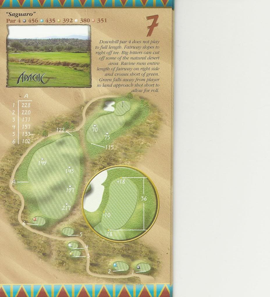


The 7th at Apache Stronghold, “Saguaro”, is a fairly long downhill left to right par-4 around a hillside to a narrow green protected on its left, with a fairway bisected by an arroyo. A ridge juts out into the fairway and the hole bends around the ridge on the right. The first half of the fairway slopes from the left down to the arroyo. The tee shot on the 7th descends 20 or 30 feet to the landing zone, just before the arroyo (which cuts across between the forward and back tees, hugs the fairway on the right, and then angles  back to the left across the fairway about 100 yards from the green). It’s best to challenge the arroyo with your tee shot, as your angle into the green will be better than coming in from the far left side of the fairway, particularly if the pin is in the back left, tucked behind the greenside bunker. Cutting the dogleg too tight and getting too close to the arroyo may mess things up, however, as there is a big bush and a tree in the arroyo.

The approach shot, straight south, looks flatter than it actually is, due in part to the scale of the surrounding hills. Past the arroyo, the fairway slopes down to the green and the green slopes gently from front to back, so it’s best to land your approach shot short and watch it run onto the green, which is fairly tame with small undulations. There’s plenty of room right of the green for a bailout or missed shot, but the green slopes subtly from front right to back left, and can make recoveries from the open right side difficult.

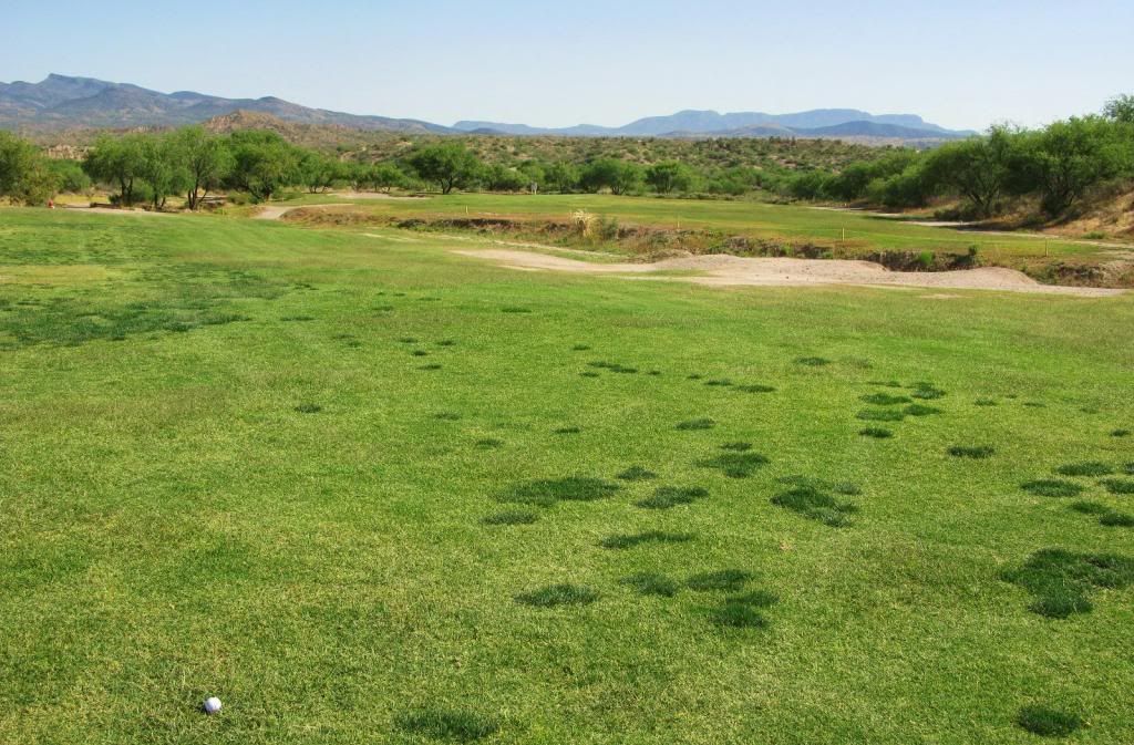
Teeboxes were okay, the green was in good shape, and there was good sand in the greenside bunker. The fairway, however, had numerous small spots of darker turf (crabgrass?) on each side of the arroyo, and had a couple of sandy spots close to the arroyo. Still very playable, but those spots just looked a bit strange.

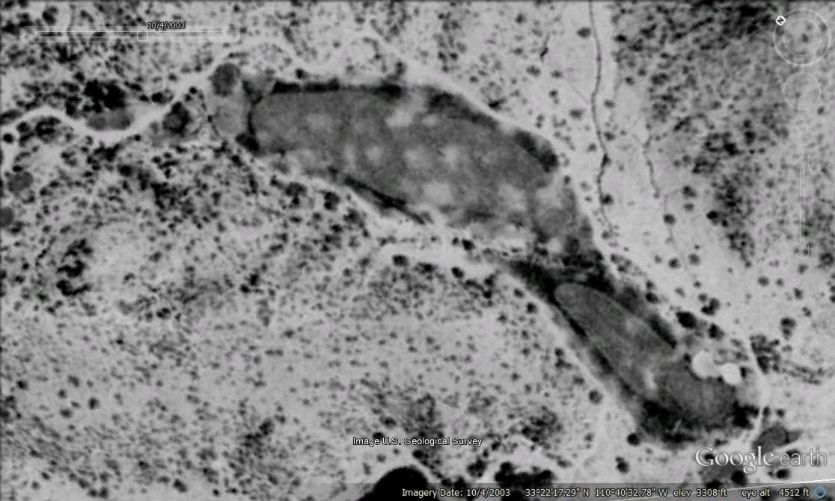
For two days, while golfing at Apache Stronghold, I walked around wondering why (some of) their fairways were in such bad shape. Afterwards, I noticed in the 2003 aerial photo (below), the circles on the 7th fairway. Perhaps this alludes to a comment by former super Ron Mahaffey, about 10 years ago, when he said on Golf Club Atlas that their irrigation spacing "sucks" and that they were trying to fix that. It almost appears as though there are dry and wet circles on that 7th fairway, looking at the photo.


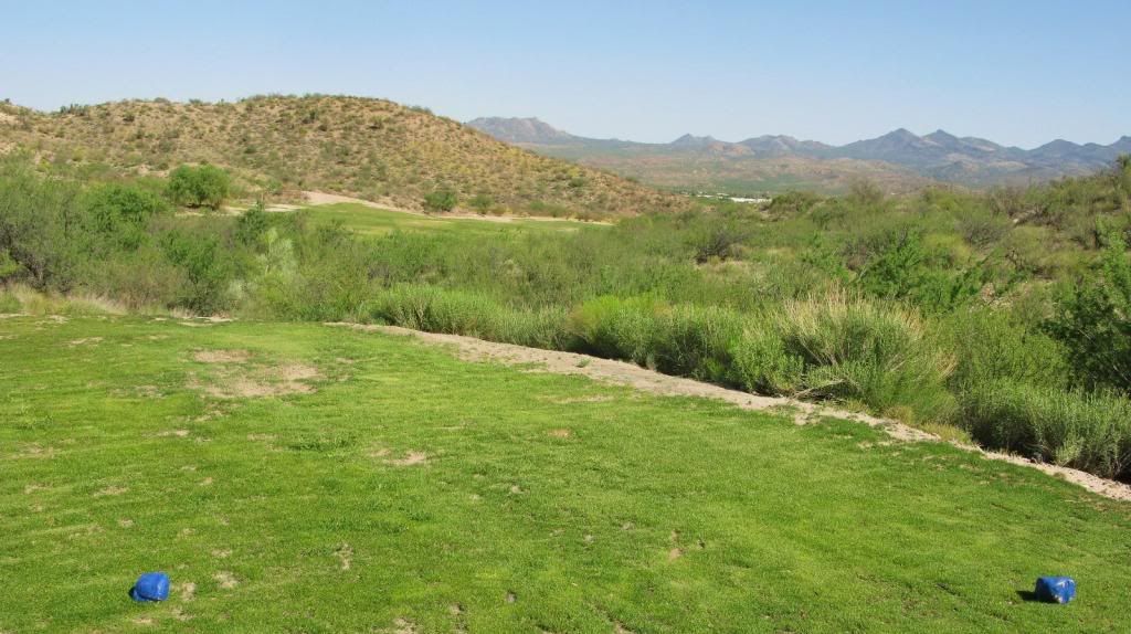
The view from the blue (Warrior) tee. The fairway curves around hard to the right...

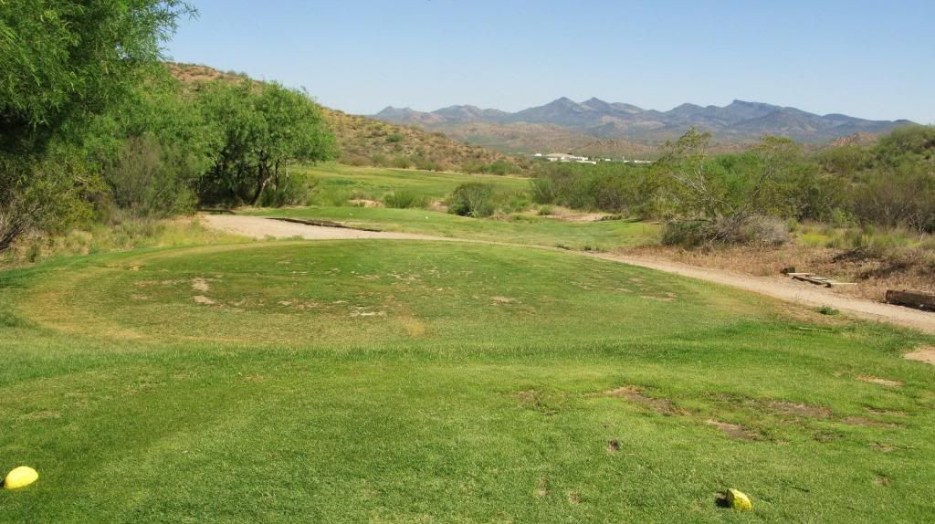
The view from the Apache tee. You'll want to aim at the casino resort in the distance...

Fairway…
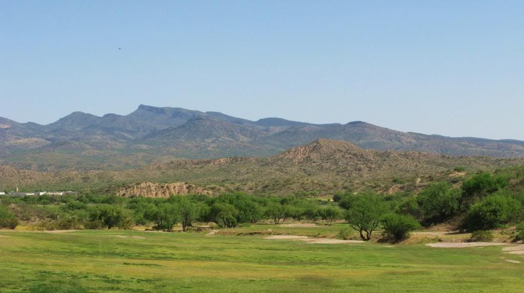

The fairway, and a good view of the arroyo which slices across the fairway diagonally…
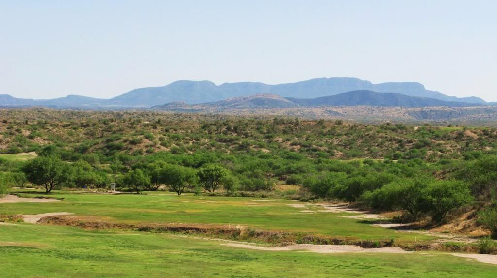

An example of the fairway turf on #7…

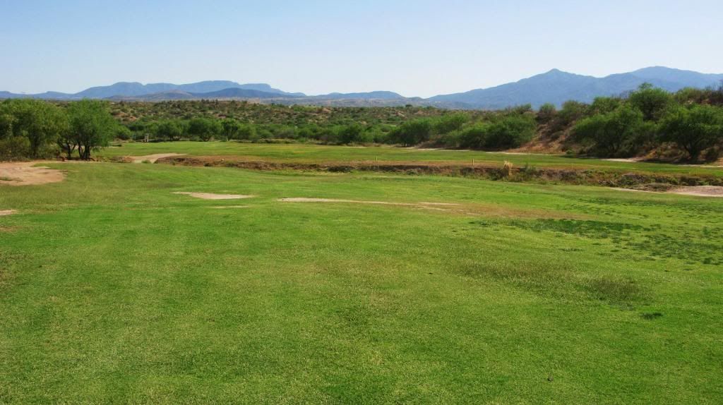
Middle of the fairway…

The arroyo…
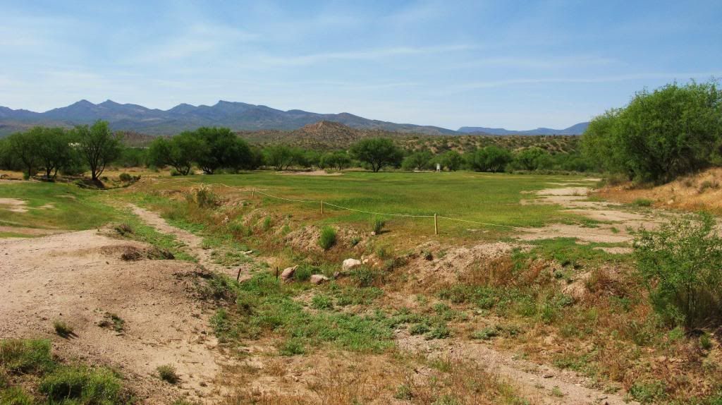

Standing behind the green…
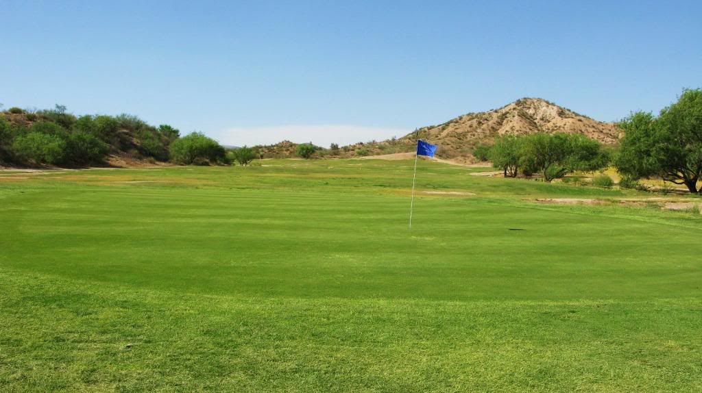

From back left of the green…
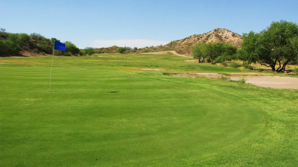

Standing on the 8th tee, looking back on Hole 7…
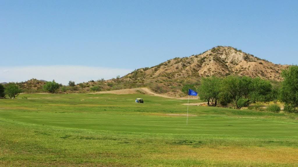

The greenside bunker…
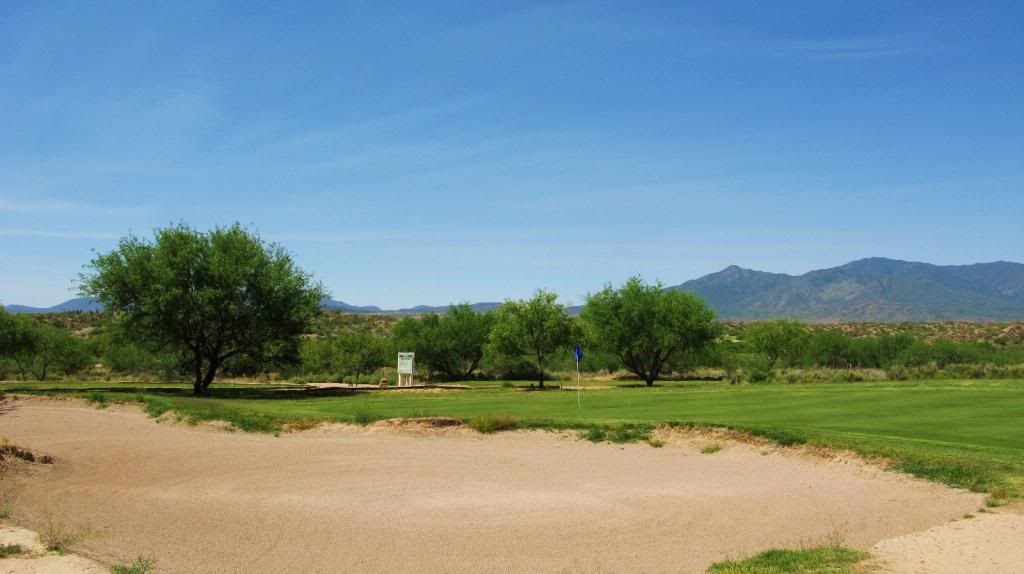

A bit closer look at the 7th green. The teeboxes on #8 are directly behind the green…
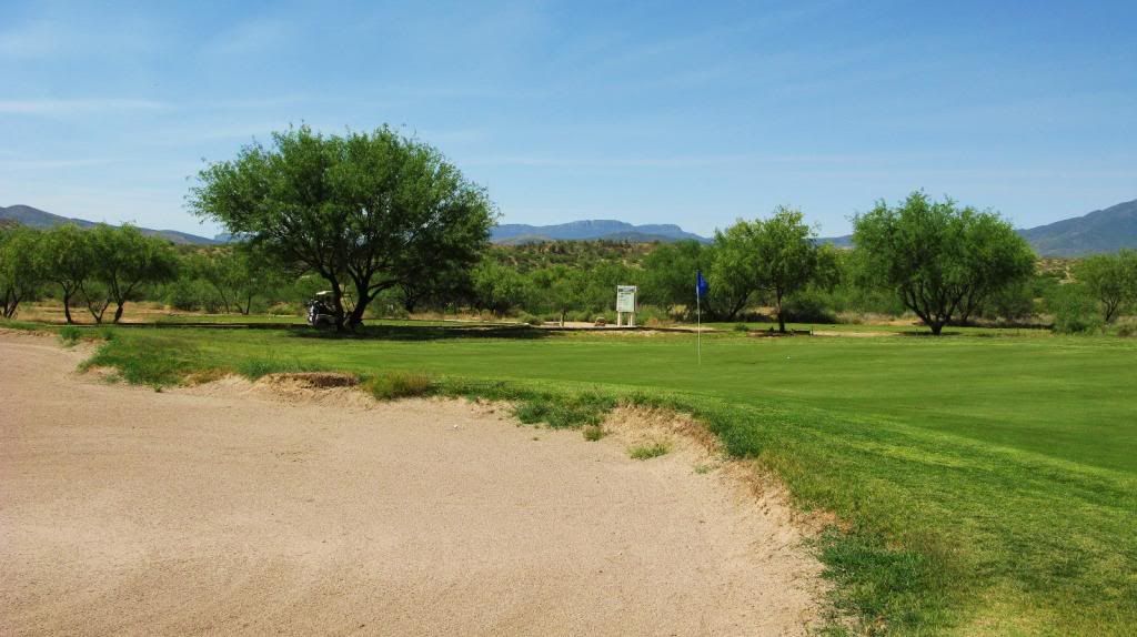
« Last Edit: July 05, 2013, 01:19:43 AM by Jim Johnson »

astavrides

  • Total Karma: 0
Re: My visit to Apache Stronghold (Arizona), with photos New
« Reply #32 on: June 01, 2013, 01:55:27 AM »
.
« Last Edit: July 31, 2013, 12:24:06 PM by astavrides »

Jim Johnson

Re: My visit to Apache Stronghold (Arizona), with photos (holes 1-7)
« Reply #33 on: June 01, 2013, 11:59:46 AM »
I'm not sure if Dave Russell is lurking out there, at Apache Stronghold, but if you are Dave, please email me (address is on my signature line at the bottom of each of my posts) what you've done there since arriving last August, your thoughts of the golf course, and future plans ... I'd love to share them with the discussion group for you, if you don't mind.

Jim Johnson

A visit to Apache Stronghold (Doak) May 15-16, 2013...with photos New
« Reply #34 on: June 01, 2013, 02:47:27 PM »
December 2005 … Ari Techner wrote …                                                                                                                    
This was the second time I had the chance to play the Stronghold and I was as impressed this time as I was the first time.  I love the natural contours of the fairways and the wonderfully contoured greens.  I also love the feeling that you get on this course on almost every hole, the feeling that you are alone out there with no other holes or golfers within sight. That and the Stronghold has a seriously strong set of Par 3’s.


The routing continues to head in a southerly direction, and hole #8 at Apache Stronghold, “Vanishing”, to what some might initially see as nondescript, is in reality an interesting hole. There is a huge bunker complex about 250 yards off the tee on the right side of the par-5 8th hole.  The landing area for the tee shot is to the left of the bunkers, and there’s lots of room out there for your shot. The fairway slides a bit down to the right in the layup area. The bunkerless green is reachable with a long drive and a blind second over a hillside on the left to a green tucked around a left-bending corner.

Some think that the hole is a rather average three shotter, where the second shot is an afterthought for all but the longest of hitters. I disagree. A tree in the right center of the fairway, just 25 yards in front of the green, dictates the position of the layup shot (see photo). The best angle to come in to the green is from the right side but that tree makes it that much more of a challenging shot. Another long green (40 yards in depth), it’s angled to that precocious little tree, and for long hitters trying to reach the green it makes the second shot that much more difficult from the roomy left side of the fairway, unless one busts it over the large fairway bunker (270 yards to clear it from the Apache tee; 300 yards from the Stronghold tee) and approaches the green from the right side of the fairway, an ideal approach route.

Interestingly, the timeline on Google Earth imagery shows that the fairway (just past the large fairway bunker) was 85 yards wide in 2003, 95 yards wide in 2007, 90 yards wide in 2010, and on September 1st 2012 was 45 yards wide. The total width of the turf (fairway + rough) at that spot is about 105 yards. The large fairway bunker juts out about 50 yards from the edge of the desert into the fairway.

The teeboxes were in great shape, the fairway was in decent shape (as on other parts of the course, there seemed to be several “dry” spots, as evidenced by the yellower areas), the green was in really good condition except for some small sandy patches near the edges, but the huge fairway bunker needs some TLC.

“The 8th fairway contains all of the fill dug out of the irrigation pond (around the corner to the right of the 7th green).” (Tom Doak Nov ’03)      

2007 (top) and 2012 (bottom) aerials...


The view from the Apache tee…


Zoomed in on the fairway and the large bunker on the right side…


In the large fairway bunker…


Just past the fairway bunker; best angle for a long approach shot…


Middle of the fairway…


In the middle, 150 yards out…


100 yards out…


That darn tree…


From the back of the green…


« Last Edit: July 05, 2013, 01:20:52 AM by Jim Johnson »

Andy Troeger

Re: My visit to Apache Stronghold (Arizona), with photos (holes 1-8)
« Reply #35 on: June 01, 2013, 10:22:33 PM »
Jim,
Thanks for posting all these photos. It is encouraging to see more grass on the course than in previous photo tours. In looking at the holes and photos it reminds me that there is a lot to really like design-wise out there, as many have stated. Its a great setting, but a tough situation and location for a course.

Jim Johnson

A visit to Apache Stronghold (Doak) May 15-16, 2013...with photos New
« Reply #36 on: June 02, 2013, 01:07:18 PM »
April 2006 … Adam Clayman wrote …                                                                                                                          
The golfers who comprise the "golf club" at Apache Stronghold, love their golf course. When I saw the smiles on their faces, it showed me how fortunate they are.


A par-4 finishes the front nine and returns the golfer to the clubhouse.  “Ambush” plays as a slight dogleg right with a superb greensite and features a green with multiple pin positions and slippery slopes. The hole is not overly spectacular but it works and it rewards solid play.

The tee shot heads south and descends 15 or 20 feet to a reasonably wide landing zone, and the golfer then plays across the Gilson wash, 50 yards in front of the green, with an approach shot some 10 feet uphill to a boomerang shaped green, its sides higher than its middle. Behind the green is a statue of Geronimo on horseback, keeping watch over the action on the course/waiting to ambush you if you three-jack on the challenging green.

There's an interesting squigly fairway bunker on the right side - I'm guessing was created by Kye Goalby - which has evolved over the years. See aerials.

The teeboxes were a bit scarred up in spots, the fairway was in really good shape, the front greenside bunker had good sand, and the green was in excellent condition other than a small sandy spot on its front edge. There are some nice fairway contours in the landing area and the Gilson wash seems “fair” in that there is a large landing area just on the other side of it and short of the green for the shorter hitter. The hole is not overly long but the contours of the green protect par and a birdie is a well-executed reward.


2003, 2007, 2012 aerials...


The view from the Apache tee…


Fairway…


Landing zone – note the contours in the fairway…


A closer look at the fairway contours…


Way left of the fairway, crappy lie…


Entering Gilson Wash…


In Gilson Wash, and our first good view of Geronimo keeping watch over the golf…


Just past Gilson Wash…


Cool statue of Geronimo on horseback…


My wife pitching to the green…


A view of the multi-level green…


Behind the 9th green...


« Last Edit: July 05, 2013, 01:21:30 AM by Jim Johnson »

Jim Johnson

A visit to Apache Stronghold (Doak) May 15-16, 2013...with photos New
« Reply #37 on: June 03, 2013, 02:33:36 PM »
Another look at the golf course routing. The back nine, like the front nine, is essentially a counter-clockwise loop away from and back to the clubhouse.


April 2006 … Jay Flemma wrote …                                                                                                                                  
We often talk a lot about GCA building or buying a course ourselves.  You know, if we were to buy Apache I wonder if conditions might improve...I can say I think we'd all have a hell of a home course.

Steve Shaffer replied …                                                                                                                                            
Jay, Apache Stronghold will never be for sale. It's on Indian land. Maybe they would lease the course but they won't sell the land.


Carefully make your way past the statue of Geronimo on horseback and head to the back nine.

 “Punch Bowl”, which heads northeast away from the clubhouse, is a fairly long par-4 with a split fairway, a difficult driving hole to a fairway bisected by swales, waste areas, and trees, to a green in a shallow punchbowl setting. The left fairway is wider than it looks from the tee. A long serpentine bunker which zigzagged between the two fairways, creating numerous avenues of play, has largely become grassed in and doesn’t provide the challenge it once was. There’s a decent sized tree about 90 yards in front of the green. If you hit it long but too far right off the tee you may have to contend with this tree on your approach shot, so like other holes on this course with an arroyo, it’s better to challenge the arroyo off the tee and leave yourself a better angle into the pin.

The arroyo which is immediately left of the green is some 25 yards wide. The “punchbowl” green is set in a shallow bowl, somewhat hidden by a small mound before the green.

The teeboxes were okay, the fairway was good, other than some scruffy areas nearer the green, and the green itself was in good shape. I just think it would be far more interesting (read: challenging) if there was sand in that grassed area/arroyo dividing the two fairways. As it is, you can basically just blast away off the tee and other than perhaps unluckily receiving a bad lie, you should have no trouble reaching the green in two.

Note the changes over the years, in the aerials below.

“On hole 10, we dug the second half of the wash from the landing area up toward the left side of the green.” (Tom Doak Nov ’03)

Evolution of a bunker ... aerials from 2003, 2007, 2010, and 2012...


The view from the Apache tee. Best to take it over the tree 150 yards out…


The original long serpentine bunker is now grass…


Fairway, 200 yards out…


150 yards out…


Zoomed in on golfers putting on the "punchbowl" green…


50 yards in front of the green…


Looking back at the 10th green from the 11th tees; the dead patches are 20 yards from the putting surface and basically out of play…


« Last Edit: July 05, 2013, 01:22:37 AM by Jim Johnson »

Jim Johnson

A visit to Apache Stronghold (Doak) May 15-16, 2013...with photos New
« Reply #38 on: June 03, 2013, 11:20:55 PM »
April 2007 … Ryan Farrow wrote …                                                                                                                        
This has to be one of the most natural golf courses ever built. Everywhere you look the natural landforms transition seamlessly into the golf course. Like no other, this course really blurs the line between nature and golf. You can even see it on the greens where the surrounding hillsides topography significantly influences the contours on the putting surface.


As the routing continues to head northwest, the golfer walks off the back of the 10th green directly to the tees of the 11th hole, which is aptly nicknamed “Crater”, a short par-3 which plays over a wide circular depression.

The teeboxes are spread around an almost 90-degree arc, providing numerous angles to the green. My wife’s forward tee actually played closer to 85 yards than 110 (as indicated on the scorecard), and with the greenside bunkers situated front left, left, and back (from the back tees), there’s ample room for the novice to knock it on the green. Meanwhile, from the back tees, it’s pretty well all carry to one of the smaller greens on the course. That open front area for the golfers on the forward tee provides a bailout right for the shooters on the back tees.

There’s a subtle swale in the green which runs from front right to back left, and the swale is clearly visible from the tees. The pin was cut on the shelf in the back right (I don’t think they moved it for the morning round on the second day we were there) and my tee shot that morning ended up on the front left of the green, making for an interesting 50+ foot putt.

The tee boxes were in fair shape, the green was in absolutely excellent condition, but the back bunker had water in it, where my wife happened to lose a tee shot.


The view from the back of the Warrior tee…


The view from the Apache tee…


Zoomed in on the green from the Apache tee; note the grass in the left bunker. From here on the tee, you can clearly see the swale running through the green from front right to back left…


Standing behind the green…


« Last Edit: July 03, 2013, 08:45:43 PM by Jim Johnson »

JC Urbina

  • Total Karma: 2
Re: A visit to Apache Stronghold (Arizona), with photos (holes #1-11)
« Reply #39 on: June 04, 2013, 09:01:34 AM »
Jim,

You have put together a very nice review of Apache Stronghold.  The golf course is looking a lot better now.  The tees on # 11 were mostly dead grass and the green on # 10 had a lot of disease. The greens are really looking good as compared to my last visit.

As I look at the hole by hole review I think of the interaction we all shared with the Apache Nation.  It is amazing the work that Kye Goalby and Randy Ray put into building this golf course. From the very first green that Kye shaped to the sand wash bunkers that Randy created with the excavator, it is amazing how well the features blended into the land. 

I was looking forward to seeing what the 5th green looked like.  Kye shaped in the most creative green on the landform that he had to work with.  The 9th hole had a dry wash bunker that Randy created all along the right side of this fairway, both of these features were just a small part of the creativity that this golf course offered.

The crater that hole # 11 plays over was a borrow pit.   It is one of the coolest short holes that I have ever played.  Someone excavated dirt from this area for years and it had all grown back in with vegetation.  In fact the whole area around # 10 and # 11 was a mini sand pit that was used for generating material way before we showed up.

Your photo essay and description of the golf course is appreciated.


Jim Johnson

A visit to Apache Stronghold (Doak) May 15-16, 2013...with photos New
« Reply #40 on: June 05, 2013, 12:26:16 AM »
January 2009 … Tom Yost wrote …                                                                                                                              
About the course - a delightful journey away from civilization and into the wild Arizona high desert.  Each hole essentially isolated from any other, it is rare to see any other humans and the only sounds are the wind rustling the bushes and the occasional screech of a soaring hawk.  The routing seems to take perfect advantage of the terrain and each hole seems to have been laid upon the topography with a minimal touch from the hand of man.


The par-4 12th hole, nicknamed “Grand Canyon”, plays southwest and features a bunker just short of the green and a shallow arroyo running across in front of that bunker and to the right of the green. The hole calls for a draw off the tee and a short approach from the left side of the fairway into the long (40 yards deep) angled green.
 
The fairway bunker had good sand in it, as did the fronting greenside bunker, and the green was in good condition, but the fairway was not. After reviewing my photos of the course, I think it actually looks worse than the 6th fairway, with numerous areas with little to no grass on them. The only “good” thing about it was that the worst areas were between the landing zone and the green, much like a spectators’ walkway crossing a fairway at a PGA tournament – basically not where one would hit a ball.

It was good to see fresh sand in the front bunker, and the arroyo slicing across in front of that bunker and the green makes things interesting. It would have been neat to see the original greenside bunker that Tom & company built (see quote below). I'm guessing it was lower, closer to the arroyo, and deeper.

“Those ravines at Apache Stronghold occasionally have a lot of water going down them ... the 12th once had a great deep natural bunker in front, but it was washed away, and is a shadow of what it was.” (Tom Doak Nov ’03)


The view from the Apache tee…


In the right fairway bunker…


In the fairway, just left of that bunker…


93 yards out…


My wife in the front bunker (the arroyo is in front)…


From back right of the green; the tees are on the left edge of the photo…


From behind the green. The arroyo runs from the left and crosses in front of the green and the bunker on a diagonal…


« Last Edit: July 05, 2013, 01:23:18 AM by Jim Johnson »

Sean_A

  • Total Karma: -2
Re: A visit to Apache Stronghold (Arizona), with photos (holes #1-12)
« Reply #41 on: June 05, 2013, 04:41:48 AM »
Whenever I see photos of Apache I become more impressed by the use of various depressions. 

From photos, this is still the only desert course which entices me to play.

Thanks Jim

Ciao
New plays planned for 2025: Machrihanish Dunes, Dunaverty and Carradale

Jim Johnson

Re: A visit to Apache Stronghold (Arizona), with photos (holes #1-12)
« Reply #42 on: June 05, 2013, 09:57:02 AM »
It was interesting to me, Sean, that I found the architecture so good, the setting so perfect, the routing so strong and the use of the land (Gilson wash, smaller arroyos, ridges, elevation changes, etc.) so compelling, that I really didn't notice the (bad) conditions wherever they did exist.

Or perhaps I didn't care. I fell in love with this golf course.

Matthew Petersen

  • Total Karma: 0
Re: A visit to Apache Stronghold (Arizona), with photos (holes #1-12)
« Reply #43 on: June 05, 2013, 11:04:48 AM »
It was interesting to me, Sean, that I found the architecture so good, the setting so perfect, the routing so strong and the use of the land (Gilson wash, smaller arroyos, ridges, elevation changes, etc.) so compelling, that I really didn't notice the (bad) conditions wherever they did exist.

Or perhaps I didn't care. I fell in love with this golf course.

There is a certain, limited extent to which the rough conditions of the course so well match the hardscrabble nature of the area and the generally undisturbed feeling of the way the course sits on the ground that it seems almost right. More so, in a way than lush Troon North-like conditions would seem out there.

Jason Topp

  • Total Karma: 1
Re: A visit to Apache Stronghold (Arizona), with photos (holes #1-12)
« Reply #44 on: June 05, 2013, 12:43:39 PM »
I really enjoy the way you have put this together Jim.  The course looks like it is in about the same shape as it was when I played there many years ago when the course was in decline but had not yet reached bottom.  I may need to return if I get down there at the right time of year.

Jason Topp

  • Total Karma: 1
Re: A visit to Apache Stronghold (Arizona), with photos (holes #1-12)
« Reply #45 on: June 05, 2013, 12:46:57 PM »
For those that have been there in the summer - does the extra elevation cool the temperature enough that a well run great course in good condition would be an attractive destination for Scottsdale residents in the summer? 

My guess is no. 

Wade Whitehead

  • Total Karma: 0
Re: A visit to Apache Stronghold (Arizona), with photos (holes #1-12)
« Reply #46 on: June 05, 2013, 02:08:07 PM »
I really like this tour, and appreciate all the time Jim has taken to put it together.  Apache has always interested me and I would go out of my way to play it in a heartbeat.

There's something sad about the pictures, though; it's just so unusual to see bones like these that suffer from such neglect.  Can anyone name a course this good that's in the same - or worse - condition?

WW

Jim Johnson

Re: A visit to Apache Stronghold (Arizona), with photos (holes #1-12)
« Reply #47 on: June 05, 2013, 02:24:33 PM »
Here's an interesting post that I came across ... Tom Doak (November 2003)

Earthmoving at Apache Stronghold:
1-2-3 ... nothing.
4 ... lowered green / back of green profile about five feet to open up the view through.
5 ... a minimal amount of fill for back half of green.
6-7 ... nothing.
8 ... fairway contains all of the fill dug out of the irrigation pond (Did you see it? Around the corner to the right of the 7th green).
9 ... nothing.
10 ... we dug the second half of the wash from the landing area up toward the left side of the green.
11-12-13 ... nothing.
14 ... reduced tilt of Redan (natural slope about 10%).
15-16-17-18 ... no real earthmoving.
Total: about 40,000 cubic yards I think.

Matthew Petersen

  • Total Karma: 0
Re: A visit to Apache Stronghold (Arizona), with photos (holes #1-12)
« Reply #48 on: June 05, 2013, 03:46:35 PM »
For those that have been there in the summer - does the extra elevation cool the temperature enough that a well run great course in good condition would be an attractive destination for Scottsdale residents in the summer? 

My guess is no. 

During the summer, high temps in San Carlos are maybe 3-5 degrees cooler than in Scottsdale. Tucson is usually a few degrees cooler than Scottsdale, as well.

So, no.

If you're in the Valley and looking for some cooler summer golf you head north to the mountains--Prescott, Payson, Flagstaff. That's real elevation that means much cooler weather.

Jim Johnson

Re: A visit to Apache Stronghold (Arizona), with photos (holes #1-12)
« Reply #49 on: June 05, 2013, 07:25:22 PM »
Globe (Arizona) weather:
Month   Temperature °F
   Average
   max   min
January   68.5   44.6
February   72.1   47.7
March   79.0   52.7
April   87.1   59.2
May   96.1   68.4
June   104.9   76.6
July   107.4   82.9
August   105.6   82.2
September   101.5   76.6
October   90.5   64.0
November   77.7   52.0
December   67.6   43.7


« Last Edit: June 05, 2013, 10:48:20 PM by Jim Johnson »