It was fun to try and come up with a routing for the original topo. I did not use google earth to route the course as I thought the topo was what we had to work with. .
I appreciate the time and effort Alex and Jim have put into the contest.
I never viewed the initial one page entry as a proposal to an owner as I've never heard of giving a prospective client one page of material.
Given the quality of the courses in the Sand Hills region, I felt it would be dumb to try and out do Doak, C & C, Nicklaus, Bunker Hill, or anyone else who has built some of the world's greatest golf out there. I wasn't going to try and compete with those guys. I thought something different might be cool.
I struggled with the idea of drawing grass lines on a piece of ground I'd never walked. It just seemed silly, but it is really a contest about imagination, and so I tried to be imaginative.
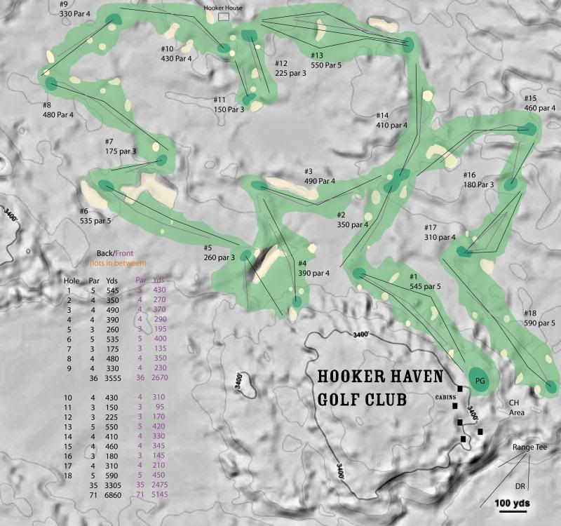
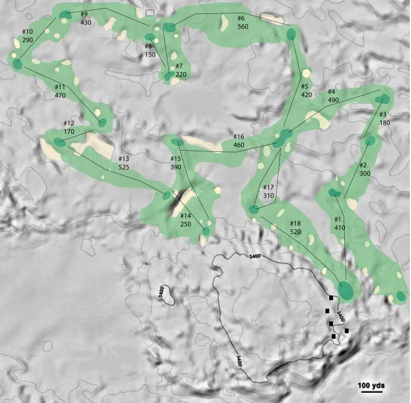
I didn't just want sunset golf; I wanted cross country golf as well. The two images below offer numerous routes around and across the course. Although much of the golf is separated, I tried to keep it close enough to allow clever players to take different routes if they wanted to have some fun at the end of the day.
I was criticized for the size and quality of my practice area. If golfers make the effort to travel to the sand hills, and they decide to spend hours practicing instead of playing, then I've built a shitty course.
The club house is small and set into the side of the hill so it can only be seen as you enter and from the 18th hole. I don't want any building architect thinking he can compete with the raw beauty of the Sand Hills.
With the two different routes I tried to use bunkers to dictate play from one direction, and slopes or bumps to dictate from another.
It is a big golf course, but I could develop a maintenance plan to care for her in a reasonable manner.
Hooker Haven Forward:

Reverse
