News:

Welcome to the Golf Club Atlas Discussion Group!

Each user is approved by the Golf Club Atlas editorial staff. For any new inquiries, please contact us.


Mark_Rowlinson

  • Total Karma: 0
1920s aerials of British Courses 4
« on: October 20, 2012, 04:28:50 PM »
Some more UK golf courses photographed in the 1920s or thereabouts.

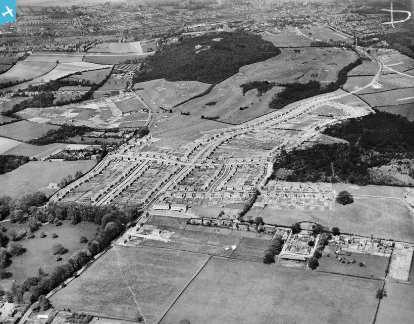
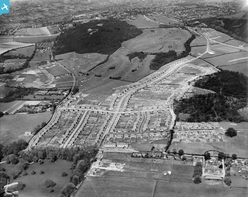
First, Croham Hurst, a Braid/Hawtree course in the Croydon area of 1911 origin
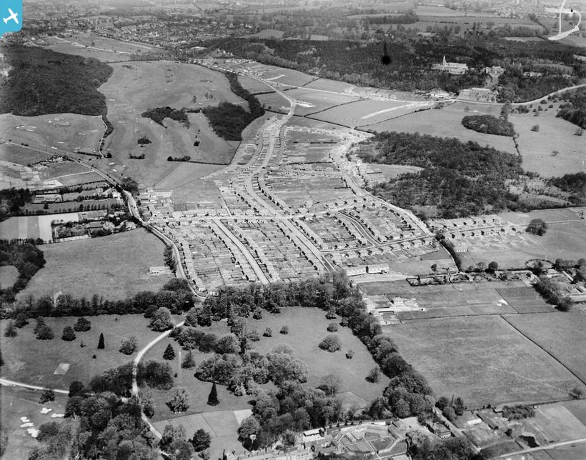


This is Ouse Valley in Bedfordshire. As far as I know it no longer exists, but it looks very virile in this picture.


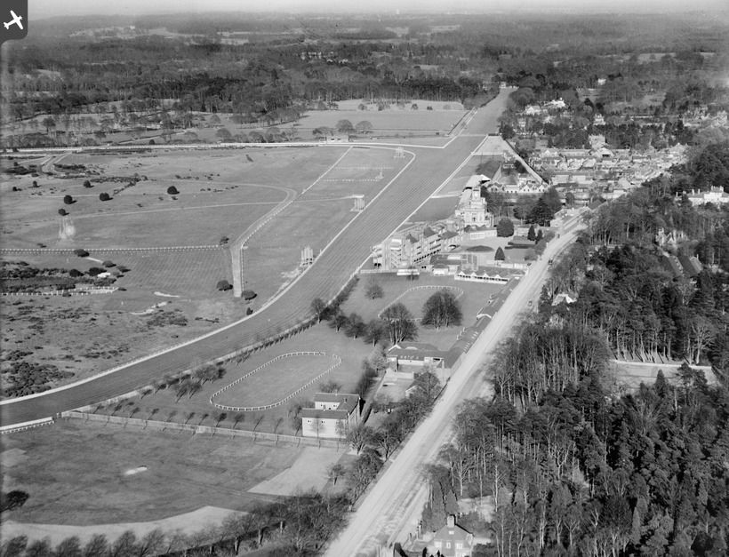
Royal Ascot Racecourse, until very recently, had a golf course within its course. They’ve moved. Here is the original.
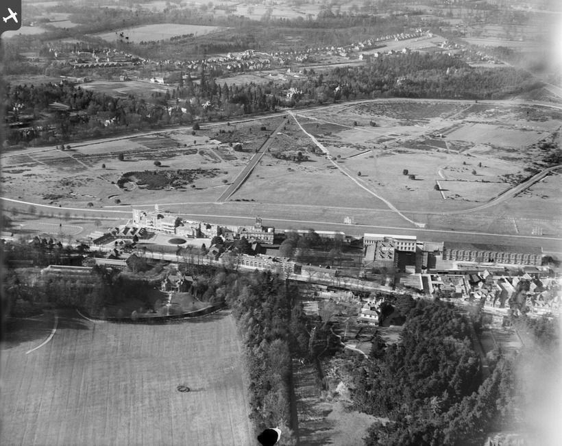
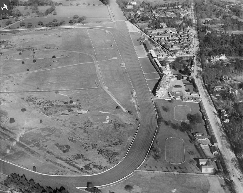
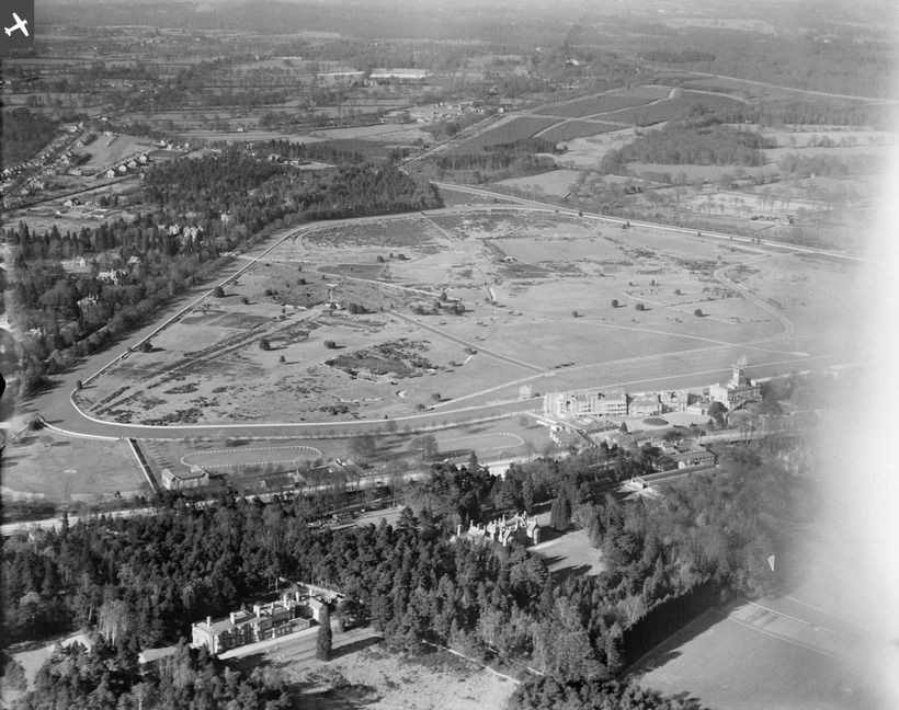


Here is the Wentworth clubhouse 5 years after it opened as a golf club.
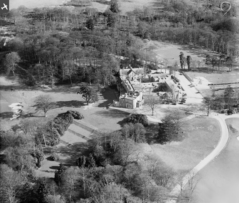


This says it’s Camden Park, Chislehurst. I think we now call it simply Chislehurst, a club started in 1894. The bunkering when that aerial was taken is a lot more ferocious than it is today if Google Earth is to be believed.
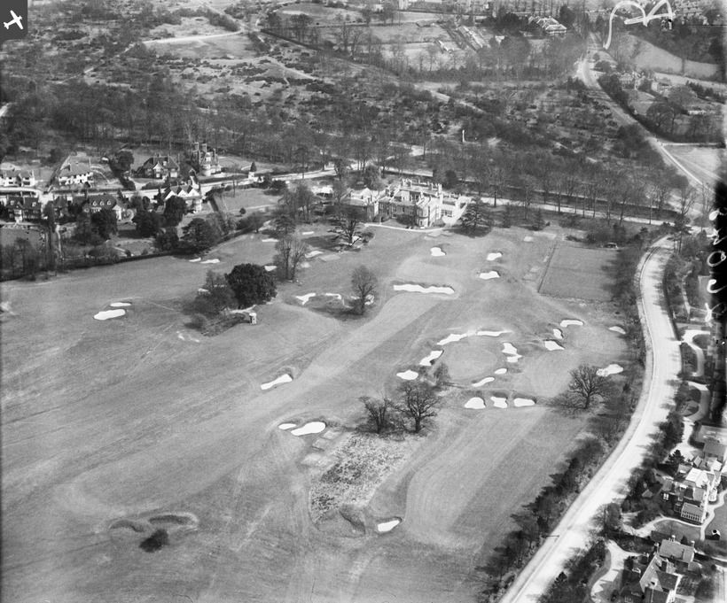


This is for the collectors. This is Hanger Hill near Ealing in west London. I think a pitch-and-putt course remains in Hanger Hill Park, but this is surely somewhere nearer the A40. I lived in Ealing from 1974 to 1977, but it surely didn’t look like this in those days! But how many holes are there here? Two?
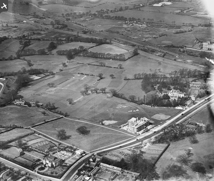
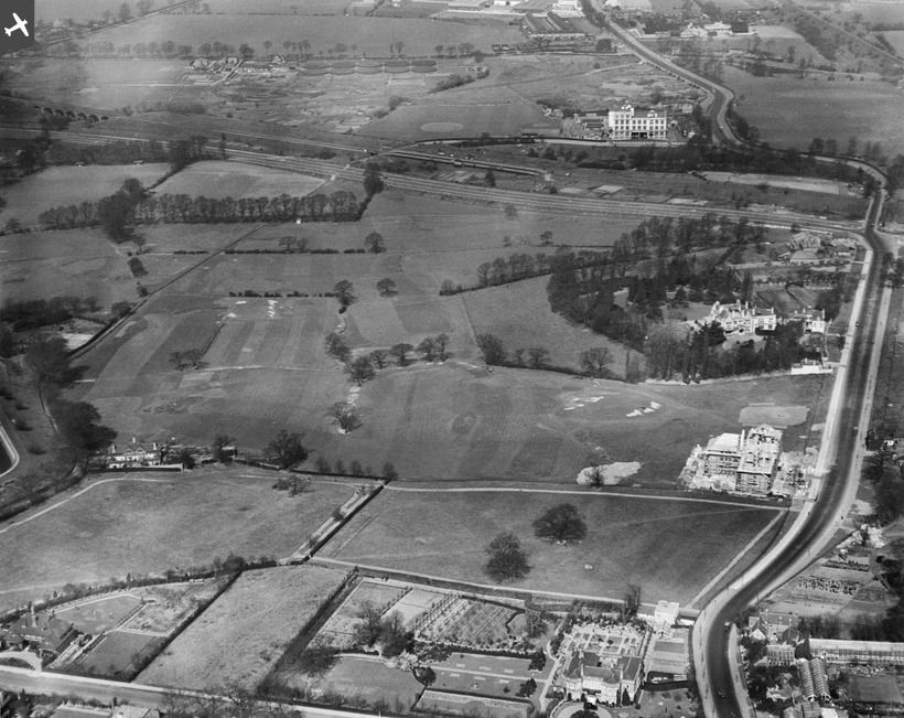
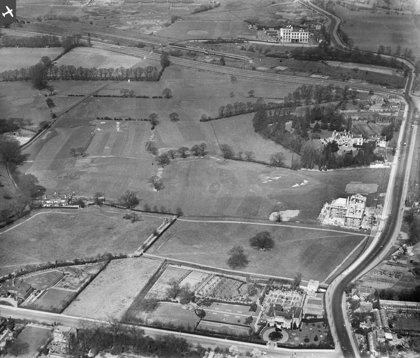


Where is this? It says Wrotham Park 1928 on the source, and there is a Wrotham Heath in Kent dating back to 1906. Chances are that it is the same place. Note the shape of the greens – as with quite a number of former pictures.
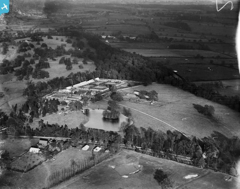


Finally, Temple Newsam, a lovely house in the Leeds suburbs (now a museum) with two MacKenzie golf courses. You don’t get to see a lot here – the house was, obviously, of greater interest to the photographer, but you get a little bit of MacKenzie bunkering – and you will have to wait a while until they scan any pictures they may have of Alwoodley or Moortown.
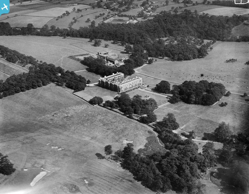
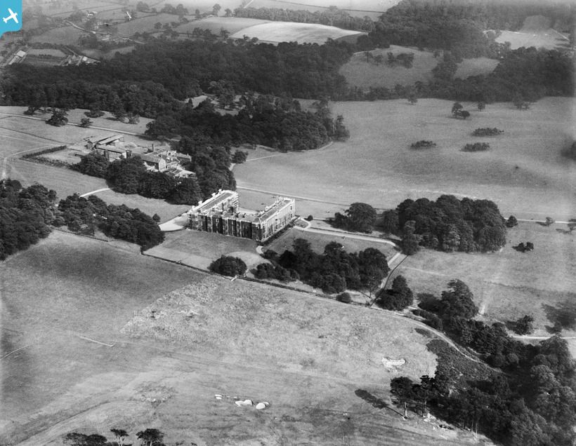


More to follow when I download some more.

Will Lozier

  • Total Karma: 0
Re: 1920s aerials of British Courses 4
« Reply #1 on: October 21, 2012, 01:11:41 AM »
Mark,

The Ouse Valley Golf Club appears to live on and in what looks like a fairly well-preserved manner with the obvious exception of tree overgrowth with a few lost bunkers and certainly less penal ones all around...from aerials and the few pics I could find.  Here is the Google Map...

https://maps.google.com/maps?hl=en&client=firefox-a&q=bedfordshire+england&ie=UTF-8&hq=&hnear=0x4877b5a83174bd03:0x614a9a7ce469a168,Bedfordshire&gl=us&ei=PYKDUJzQLoic9gSShYCACw&ved=0CIoBELYD


Cheers
« Last Edit: October 21, 2012, 01:25:02 AM by Will Lozier »

Tony_Muldoon

  • Total Karma: 0
Re: 1920s aerials of British Courses 4
« Reply #2 on: October 21, 2012, 03:33:24 AM »
All these pictures are wonderful Mark, thank you for posting them.

I was at School in Ealing in the 1970's and I struggle to place those large houses.  There are local roads e.g. Golf Rd and Links Rd to give a clue as to where it sat.

Are you familiar with this site? Golf's Missing Link's, it's a real labour of love and an amazing achievement. Here’s Hanger Hill's entry

http://www.golfsmissinglinks.co.uk/index.php?option=com_content&view=article&id=771:gl-hanger-hill-golf-club&catid=71:greater-london&Itemid=122
« Last Edit: October 21, 2012, 03:47:07 AM by Tony_Muldoon »
2025 Craws Nest Tassie, Carnoustie.

Mark_Rowlinson

  • Total Karma: 0
Re: 1920s aerials of British Courses 4
« Reply #3 on: October 21, 2012, 07:27:00 AM »
Will, Thanks for pointing out the Ouse Valley survives. It's not in my copy of R and A Golfer's Handbook, and having looked on the club website I see that it was closed in 2008 when my 2009 copy was prepared. I hadn't realised that Henry Longhurst played there, when it was known as Bedford GC (later Bedfordshire).

Tony, Thanks for the link about Hanger Hill. Of it a pitch and putt course survives in Hanger Hill Park, off Hillcrest Road. The rest of the course must now be under the A40 tunnel at Hanger Lane round about.

Mark_Rowlinson

  • Total Karma: 0
Re: 1920s aerials of British Courses 4
« Reply #4 on: October 21, 2012, 07:39:59 AM »
Tony, The house being built in the Hanger Lane pictures is Greystoke Court. I don't know if it survives, but my A to Z suggests that the part of the A40 just west of Hanger Lane station is called Greystoke Park Terrace. Fox Reservoir is also seen in some of the pictures, It doesn't seem to survive unless it has been covered in.

Niall C

  • Total Karma: -1
Re: 1920s aerials of British Courses 4
« Reply #5 on: October 21, 2012, 07:51:13 AM »
Mark

That Chiselhurst photo is remarkable. Not only very bold bunkering with steep faces but a fair bit of alpinisation by the looks of it with the odd grass bunker thrown in. I'd love to see the course now to see how it compares.

Niall

Mark Bourgeois

Re: 1920s aerials of British Courses 4
« Reply #6 on: October 21, 2012, 08:18:03 AM »
Chiselhurst's website "attributes" the design to Colt, saying the course opened in 1894 and Colt drove himself in as captain in 1900. And that no major alterations have occurred since.

Can this be possible?

From the holes shown it appeared appeared to be a very challenging course off the tee.

Great stuff, Mark!

Mark_Rowlinson

  • Total Karma: 0
Re: 1920s aerials of British Courses 4
« Reply #7 on: October 21, 2012, 01:41:18 PM »
Yes, the bunker designs and their sheer numbers are remarkable. I've just been downloading some more and will post them later and even quite lowly courses have some really funny one, as if they had seen the Church Pews or one those bunkers with a grassy island in the middle, like as at Muirfield.

I've got through 7,900 images so far! You have to because often the photo is apparently of something else, such as a factory, but there might be a few holes lurking in the background. The search engine is quite unspecific.

David_Tepper

  • Total Karma: 0
Re: 1920s aerials of British Courses 4
« Reply #8 on: October 21, 2012, 02:37:00 PM »
Mark R. -

Thanks for all these photos. Very interesting stuff.

With regards to the pictures of Croham Hurst, the course appears adjacent to one sizable wooded area (on the left) and a much smaller wooded area (on the right).

I don't think it is unreasonable to think that most of the land between the two wooded areas was also filled with trees at one time. It would be interesting to know (to me at least ;)) if this was the case and if the trees were cleared to build the golf course specifically or if the trees had been cleared before that to put the land to use for either farming or grazing.

If the trees were cleared specifically for the golf course, it would be interesting to know why some of them were not retained to be incorporated into the design of the course. I suppose the answer would be that Braid/Hawtree were after a linksy look, where trees had no place, but I am curious.

DT 
 

Jon Earl

  • Total Karma: 0
Re: 1920s aerials of British Courses 4
« Reply #9 on: October 22, 2012, 11:01:24 AM »
David

Being a member at Croham Hurst let me attempt to answer your question.


Essentially the course was built on a mixture of mainly arable and pasture land. The club was formed in 1911 and a rudimentary nine-hole course was built on the pasture land. This is marked in blue. This opened in 1912 and was designed by Norman Lindsay, the secretary at Bushey Hall GC.

This was always meant to be a temporary measure whilst the 18 hole course was being constructed. This was designed by Fred Hawtree (his first as a architect and designer) and Braid. There was initially a problem with space for the 18 hole course and Braid's initial plans were not considered good enough by the board. Colt was asked to quote but the board would not pay his 10 guinea fee for an initial site attendance and a further 8 guineas for each visit!

Both Braid and Lindsay informed the board that they didn't really have enough land for 18 holes. A few deals with local farmers and land owners later (including the area marked in green) the final plans were authorised and work commenced. The 18 hole course was officially opened in October 1913.

During the 1914-18 war the area marked in green (containing 2 holes) was ear-marked for agricultural use by the government to grow food. Losing these 2 holes was not thougt to be a problem as they were considered fairly uninteresting. Two new holes were bulit in the area marked with red (part of Thrift Wood) and this involved clearing around 80 trees. These new holes (the par 4 15th and
par 3 16th) are now considered to be 2 of the best holes on the course.

The large wooded area top left is Croham Hurst itself. Here is a bit more info
http://www.croydononline.org/history/places/parks_and_open_spaces/crohamhurst.asp

I think it would be fair to say that not many changes have been made to the course since the photo was taken apart from a reduction in the number of bunkers, a few holes being extended and the growth of
a number of trees internal to the course.

Hope this helps.

Cheers

Jon
Splosh! One of the finest sights in the world: the other man's ball dropping in the water - preferably so that he can see it but cannot quite reach it and has therefore to leave it there, thus rendering himself so mad that he loses the next hole as well.

David_Tepper

  • Total Karma: 0
Re: 1920s aerials of British Courses 4
« Reply #10 on: October 22, 2012, 01:12:55 PM »
Jon E. -

Many thanks for the complete story.

DT

Mark_Rowlinson

  • Total Karma: 0
Re: 1920s aerials of British Courses 4
« Reply #11 on: October 22, 2012, 02:08:03 PM »
Jon, I think, if memory serves me correctly, there are more Croham Hurst pictures to come in the next batch. I've now ploughed through 12,000 images and have only 7,000 to go! You have to look at them all because the search engine doesn't recognise everything and in many cases the golf course is not mentioned because the main focus of the picture is a house, factory or reservoir. Thanks for your helpful response.

Jon Earl

  • Total Karma: 0
Re: 1920s aerials of British Courses 4 New
« Reply #12 on: October 23, 2012, 05:02:01 AM »
Mark

Look forward to seeing the next batch. Many thanks for your work in putting these pictures up.

It's always facinating comparing then to now.

The course may not have changed much but suburban sprawl anyone?


Jon
« Last Edit: October 23, 2012, 07:04:34 AM by Jon Earl »
Splosh! One of the finest sights in the world: the other man's ball dropping in the water - preferably so that he can see it but cannot quite reach it and has therefore to leave it there, thus rendering himself so mad that he loses the next hole as well.