News:

This discussion group is best enjoyed using Google Chrome, Firefox or Safari.


Kalen Braley

  • Karma: +0/-0
This past weekend, I took a drive out to the Palouse as it was a terrific day weather-wise and the visibility was fantastic.  Plus being Super Bowl weekend, it gave me something to do before the big game.

As I mentioned in my original thread, I’ve always felt the area south of Spokane has plenty of interesting terrain and would make for some terrific golf holes.  The area was originally gouged out during the glacial flooding as a result of the massive melting during the end of the last ice age.  Then all the lightweight, silty dirt was eventually blown back over the same area as the prevailing winds come from the South/SouthWest, but without all the heavier material that was originally there.  As a result, it made for some unique/interesting landforms in addition to ideal agricultural conditions to grow grains, specifically wheat, which is now king in the area.

In the following pictures, I hope to show just how extensive this area is.  The neat part I think, is I never ventured more than 50 miles away from Spokane, which is key because if a club or two would be located out here, it would be hugely beneficial as its less than an hour away from the nearest major airport… as opposed to a place like Wine Valley which is 3+ hours away.  So it could still get local play from the population living in Spokane, in addition to attracting visitors, given the assumption that it’d be a top notch kind of attraction.

So without further ado, here is a synopsis of my journey…enjoy!

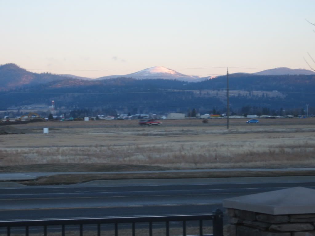
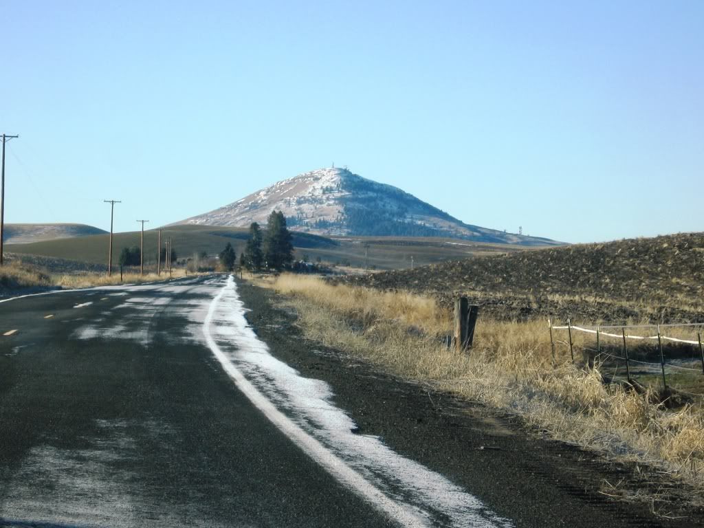
A look at Mt. Spokane from near my place, as I'm ready to embark at the crack of dawn:
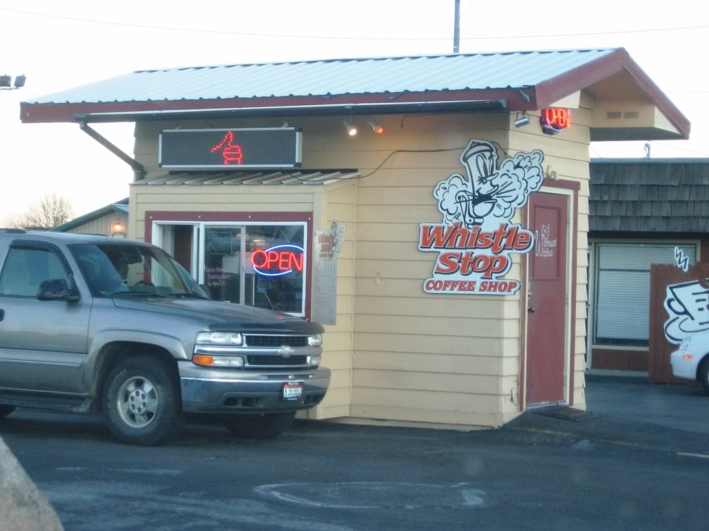


It’s a chilly morning, so I’d better fuel up at my local pit stop on the way out of town:


Within 15 minutes, I’m away from the suburbs and into the transition area before I hit the Palouse:


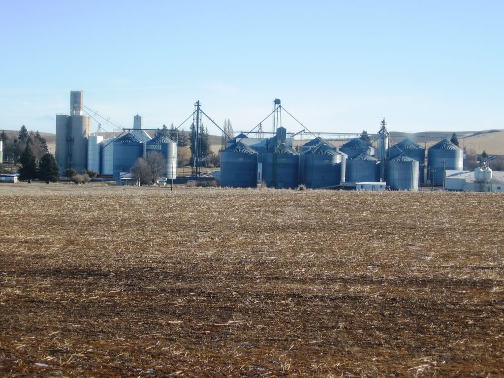
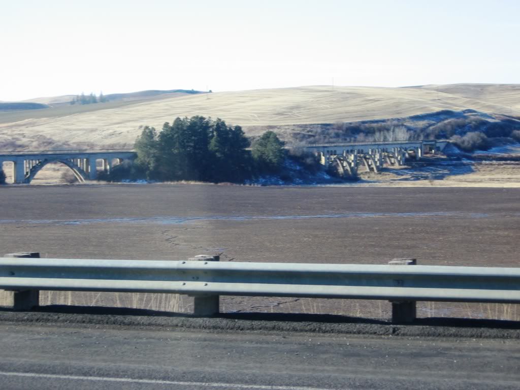
As this is wheat land, storage is huge.  These silos dominate the landscape in every small town dotted all over the region:


One of my 1st glimpses of the Palouse as I’m starting to move away from the small mountains that ring the southern edge of the Spokane Valley:


I’ve fully arrived now and sipping on my cup of Joe and loving the scenic Palouse byway:


I encounter a bit of fog, but the landforms look primo:


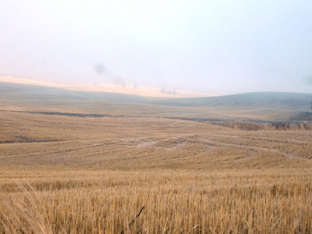
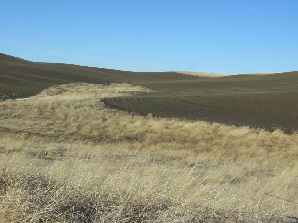
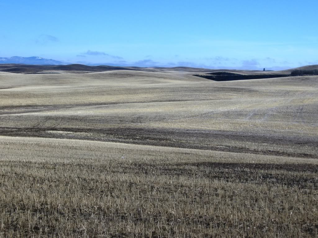
Some interesting wavy landforms:


Oh yea….miles and miles and miles of just rolling goodness.  I’m in full-on geek mode now!!


An example of some land with the larger land forms.  As mentioned in the previous thread, there are no doubts large parts of this terrain that is just too massive for a golf course…but there’s plenty leftover that’s just perfectly fine.


A perfect example of some relatively flattish land that would make for some gently rolling holes:


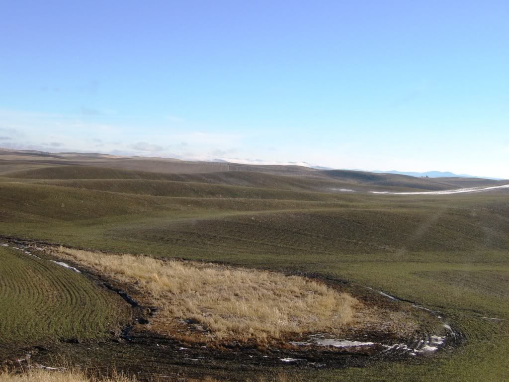
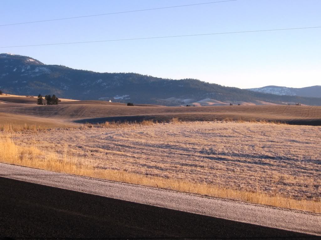
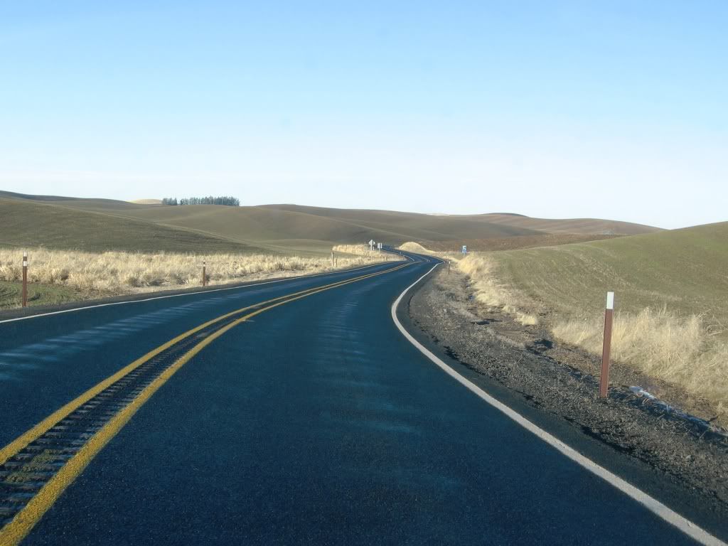
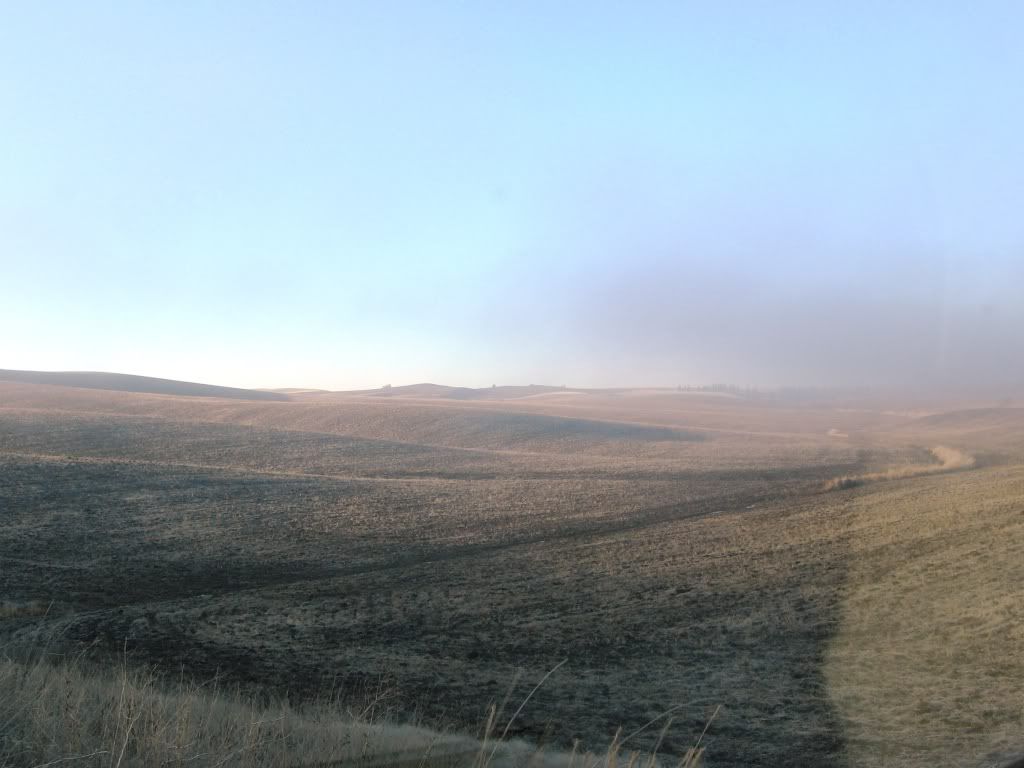
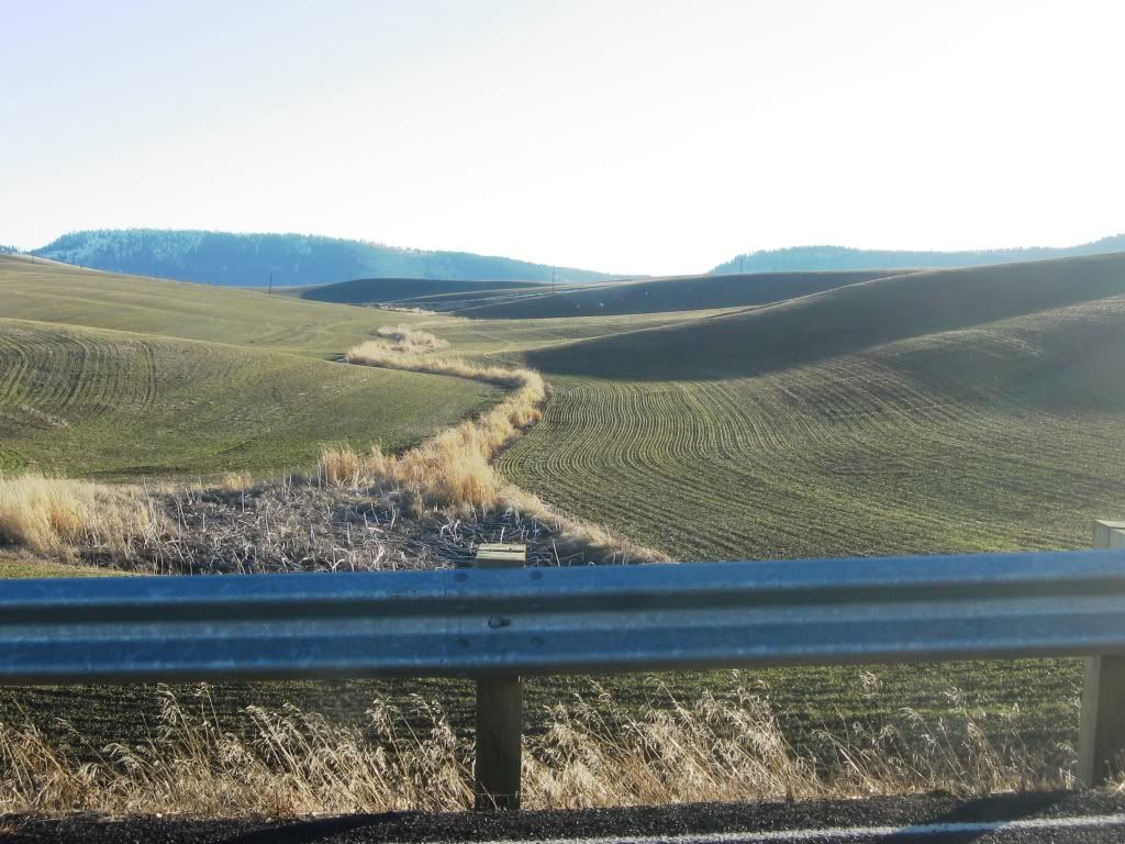
As I carry further on, the terrain gets a little more varied…I can see the bunkering now!  
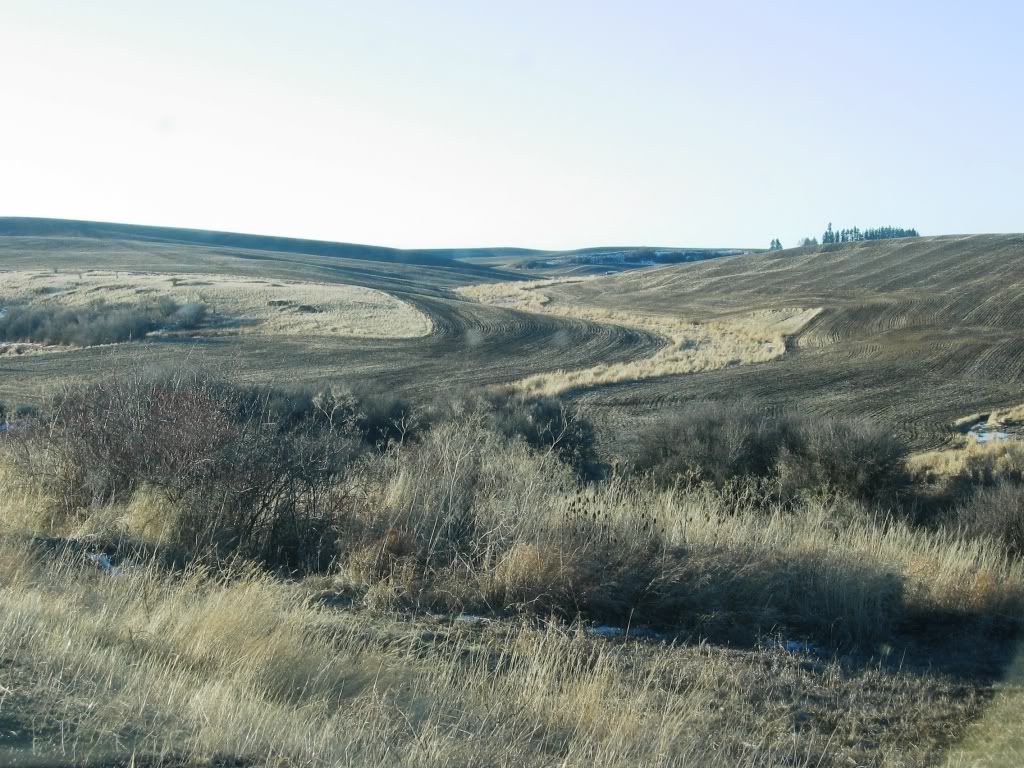
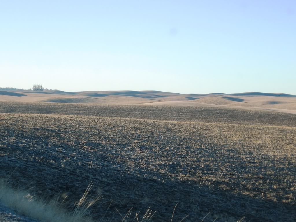


More goodness:


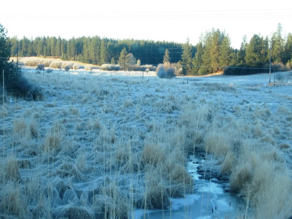
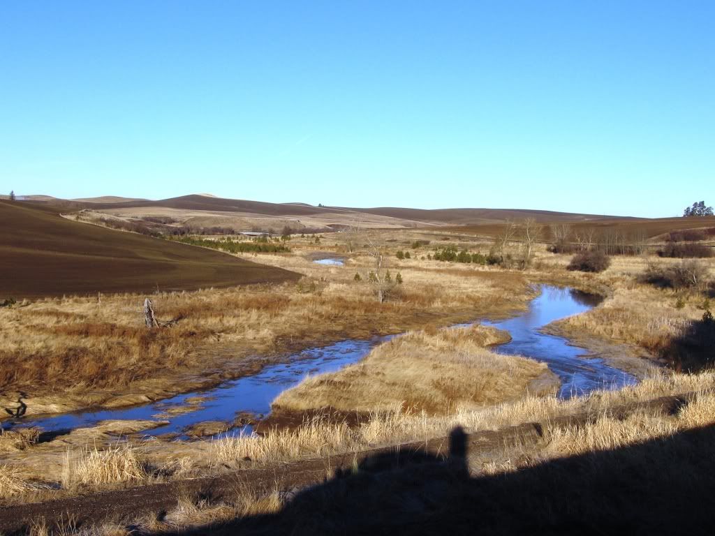
The area is certainly not devoid of water or scenic natural features otherwise:


And the entire region is littered with train tracks and cool features like this for you sentimental types:


We’re now getting close to my destination….Steptoe Butte. (http://en.wikipedia.org/wiki/Steptoe_Butte). Its an ancient landorm that wasn’t washed away and now provides a terrific lookout point.  This is the southernmost point on my journey.


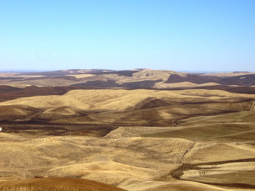
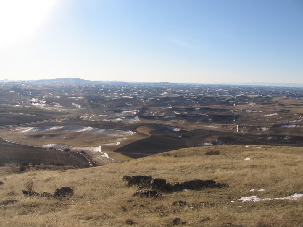
The views are now more expansive as I climb the access road and provide a better look at just how massive it is. This one is facing NorthWest:


This one is looking directly north where you can see snow-capped Mt. Spokane in the distance on the left hand side of the picture.  From here its about 75 miles away:


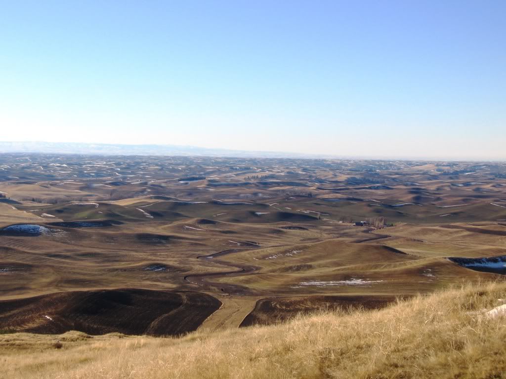
This is looking to the NorthEast…just fantastic undulations…and an even better view.


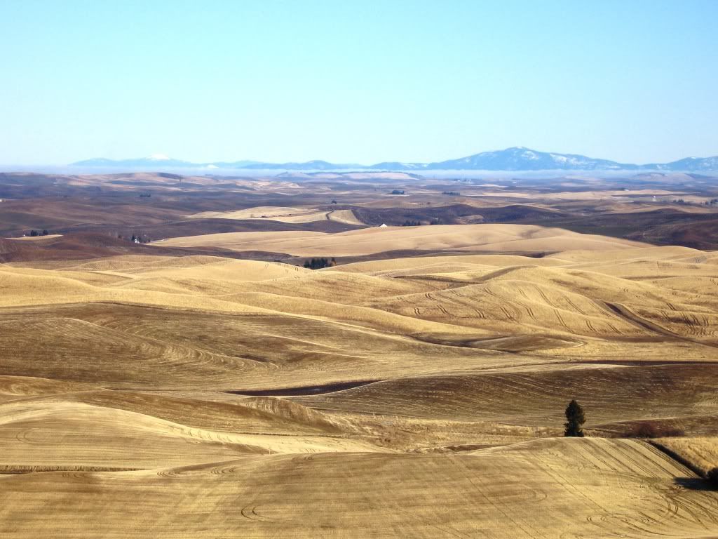
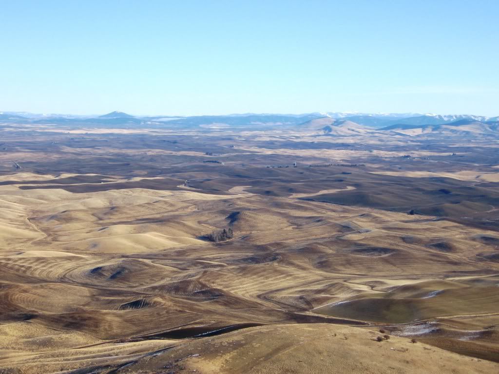
From the other side of the butte, this view is looking to the Southwest.  You can see the seemingly endless sea of what appears to be dunes like formations of the silty soil.


Looking to the southeast, more interesting stuff:


One last final view to the Northeast from the very top of the butte:


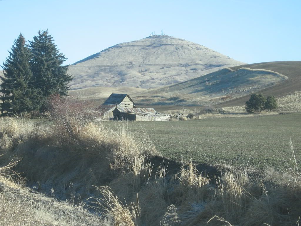
On the way back to Spokane, a picture of an old farmhouse.  There are tons of old structures like this out there as they’ve been farming it for over 100 years.


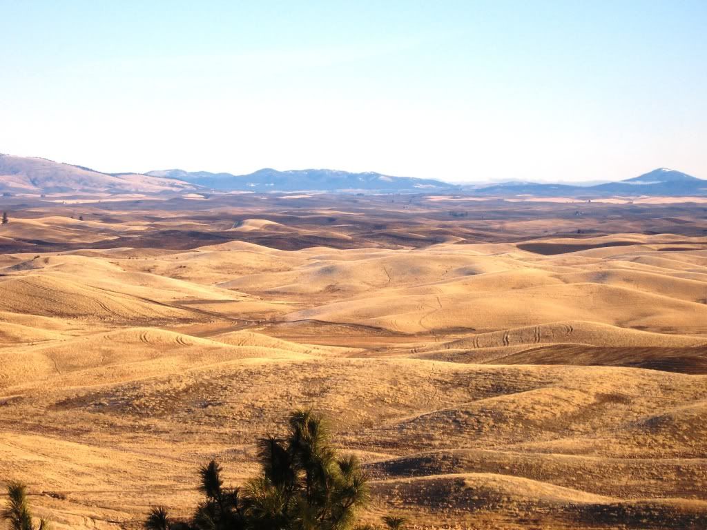
An interesting landform just off the highway…
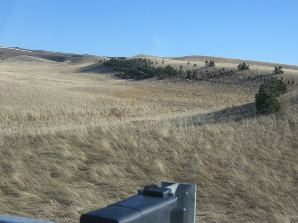
looks like some Pines have taken root 40 miles or so south of where they are normally found.


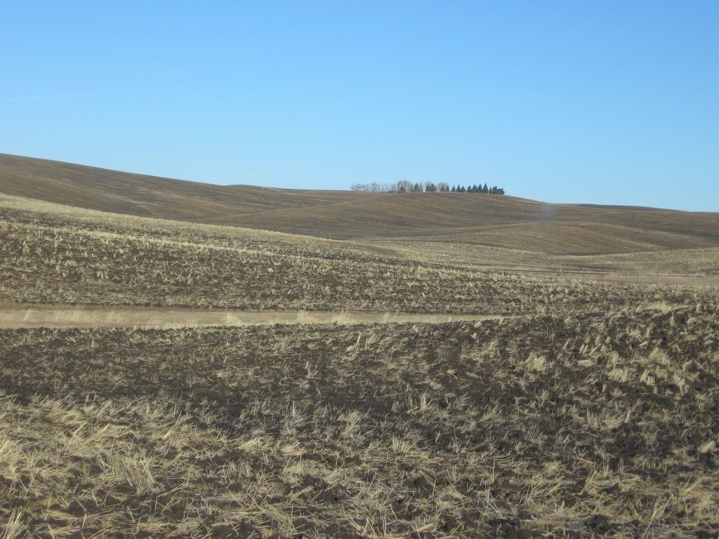
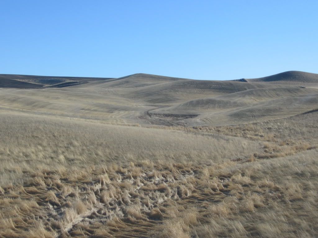
More interesting landforms…just imagine how one could route this section:


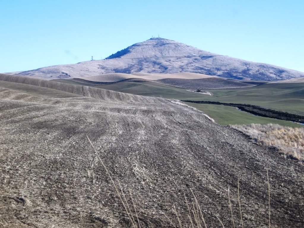
A last look at Steptoe before continuing back north:


A few last interesting pics of the gently rolling land….land certainly very well suited for golf!!


« Last Edit: February 08, 2012, 12:34:28 PM by Kalen Braley »

Anthony Gray


  I see dead people


Tom_Doak

  • Karma: +1/-1
Kalen:

A colleague of mine pointed out twenty years ago that what looks like great land for golf is usually a bit too hilly.

I thought he was wrong at the time, but over the years, my experience has confirmed his premise.  Your pictures are beautiful, but for most of them, if you tried to lay out a golf course at real scale, you'd find a lot more ups and downs than you really want.

Mike Nuzzo

  • Karma: +0/-0
Kalen
I agree with Tom that the scale of ones view of raw land and golf don't usually mesh
But we sure could build a hell of a golf course (or 10) in those parts - it may even turn out a little different
Thank you for sharing
OSSS!
Thinking of Bob, Rihc, Bill, George, Neil, Dr. Childs, & Tiger.

Craig Sweet

  • Karma: +0/-0
Once when heading to Portland a buddy and I had a two hour conversation fantasying how we could build The Worlds Longest Golf Course out on the Palouse...it would take two to three days to play all 18 holes but accommodations and food and beverage would be offered along the way... ;D
LOCK HIM UP!!!

Jason Walker

  • Karma: +0/-0
Kalen-
Thanks for posting.  As an East-coaster my entire life I love seeing new picture of the West coast.  I've traveled extensively through California, but those pictures are new and fantastic.

Couple of questions-
Besides wheat farms, what else is out there?

As Tom and Mike mention, what's the scale of the landform?  i.e., what could you compare them to?

How far, drive time, to the middle of nowhere in your pics?


Colin Macqueen

  • Karma: +0/-0
Kalen,

Wonderful images of Palouse and as I was lost in them Melvyn's sound -bite, which you used, kept echoing in my head! It seemed to me to be a perfect wonderland for golf courses. What a disappointment as I was brought thudding back to earth when Tom Doak and Mike Nuzzo threw a bucket of cold water on the fantasy.
It just indicates to me how little I understand about golf course architecture but the scale argument makes a lot of sense. I went back and looked at the images again and it struck me that when you use the telegraph posts as some sort of perspective there is indeed an awful lot of undulation and sidehill traversing going on in the space of a "standard" golf hole. 

I like Craig Sweet's idea of "The Worlds Longest Golf Course" which hearkens back to when, in the mists of time, pall-mall or "jeu de mail", was played in open country and along roads to a specific target.
There you are Kalen, hope springs eternal and with Carig at your side pall mall in Palouse might yet become a reality!

Cheers Colin
"Golf, thou art a gentle sprite, I owe thee much"
The Hielander

Anthony Gray


 Kalen,

  How would you compare that land to the land at Wine Valley? Nice thread,it took a lot of work.

  Anthony


Sean Leary

  • Karma: +0/-0
Kalen:

A colleague of mine pointed out twenty years ago that what looks like great land for golf is usually a bit too hilly.

I thought he was wrong at the time, but over the years, my experience has confirmed his premise.  Your pictures are beautiful, but for most of them, if you tried to lay out a golf course at real scale, you'd find a lot more ups and downs than you really want.

This is exactly right. My in laws family owns a ton of farmland down in Colfax (just south of these pics)and it is too hilly for golf. But there are some areas where Kalen is talking about that would work for sure...

Garland Bayley

  • Karma: +0/-0
To provide an example to demonstrate Tom's point, compare Wine Valley to Palouse Ridge. I am sure Tom would think Palouse Ridge is too severe, whereas he would like Wine Valley (except of course for the ponds). I believe you can find areas in what Kalen showed that would approximate Wine Valley, thereby provide a good site. However, we have to wait for Melvyn's judgment before we can properly use (or not use) "land fit for golf".
"I enjoy a course where the challenges are contained WITHIN it, and recovery is part of the game  not a course where the challenge is to stay ON it." Jeff Warne

Kalen Braley

  • Karma: +0/-0
Hey All,

Thanks for the input.  I would agree that the majority of that land is likely way too hilly for golf, but remain fairly confident that some select areas would make for a terrific golf course.  In practical terms, I suspect the much more difficult task would be being able to find one of those select areas, and have it be available for purchase, and be able to get the permitting to put a course down.

The entire area is pretty much exclusively dedicated to wheat production.  I suspect this is the case because the landforms are so severe, it would be difficult/very expensive to get irrigation to many spots, so they grow a crop that relies only on mother nature for its moisture.  However, when you move West of Spokane, while the terrain is still a little undulating, its a lot more tame and so they are able to irrigate it, and they do! :)

Jason, other than wheat and various other grain cops...thats pretty much all that is out there....besides the occasional town with massive grain silos to get the product off to processing.  It literally is thousands of square miles of land just like that.  I'll post up a map of where I went a little bit later to show that this is only the "tip of the iceburg" in terms of raw land that is out there.  But I would agree, its still hard to get a sense of scale thru the pictures.  And because it is such a unique area in terms of landforms, I've been all over the west coast and haven't seen anything comparable.

I should also mention Jason, that in my entire trip, I was never more than 1 hour away from Spokane in terms of drive time...or in other terms, I was never more than 50 miles away from Spokane.

Anthony,

Most of the land in those pics is more severe than what one finds at Wine Valley, but there were a couple of pics where the land was comparable.

For example...this one was similar in undulation and otherwise to Wine Valley:


As well as this one...those undulations out there are not very big.


Melvyn Morrow

Kalen

Land fit for Purpose, OK so where is the sea??  Golf Course = Links = Fun, Fun, Fun

Water in the form of Island Greens just do not qualify, nor do lakes, Links golf, there is nothing in the world than playing golf on a true links course – and NO, the Castle Course does not qualify, first as a course or as a links.

Melvyn ;D

Garland Bayley

  • Karma: +0/-0
Kalen

Land fit for Purpose, OK so where is the sea??  Golf Course = Links = Fun, Fun, Fun

Water in the form of Island Greens just do not qualify, nor do lakes, Links golf, there is nothing in the world than playing golf on a true links course – and NO, the Castle Course does not qualify, first as a course or as a links.

Melvyn ;D


Sorry Kalen,

I guess you'll have to move to an island. ;)
"I enjoy a course where the challenges are contained WITHIN it, and recovery is part of the game  not a course where the challenge is to stay ON it." Jeff Warne

Kalen Braley

  • Karma: +0/-0
Unfortunately Melyvn's formula is off...

One does not need the sea to = very fun golf.  I present Wine Valley, Ballyneal, and RCCC as primary Exhibits A thru C to prove this.

Jason Walker

  • Karma: +0/-0
that's awesome stuff Kalen, thanks.  Cool pictures to look at, with or without golf in mind.


Kalen Braley

  • Karma: +0/-0
Re: Spokane Palouse...(Now with a map included). Land fit for golf??
« Reply #15 on: February 08, 2012, 12:35:50 PM »
So I've included a map of where I went.  As a reference point, its about 75 miles as the crow flies from Steptoe Butte to Mt. Spokane.

The orange line is the route I took, but it also gives one an idea of just how extensive the area is...


Anthony Gray

Re: Spokane Palouse...(Now with a map included). Land fit for golf??
« Reply #16 on: February 08, 2012, 06:17:59 PM »
So I've included a map of where I went.  As a reference point, its about 75 miles as the crow flies from Steptoe Butte to Mt. Spokane.

The orange line is the route I took, but it also gives one an idea of just how extensive the area is...


  Is it me or does it look like Kalen travelled around the coast of Italy.

  Anthony


Alex Miller

  • Karma: +0/-0
Re: Spokane Palouse...(Now with a map included). Land fit for golf??
« Reply #17 on: February 08, 2012, 06:29:46 PM »
The location of "Steptoe Butte (or Boot)" is also quite appropriate.

Kalen Braley

  • Karma: +0/-0
Re: Spokane Palouse...(Now with a map included). Land fit for golf??
« Reply #18 on: February 08, 2012, 06:42:22 PM »
Ha ha, I didn't even notice that till you guys pointed it out.

It kind of looks like a chucky ballerina on her toes with the calf poking out!!!  :D

P.S.  As a reference point, Walla walla is another ~125 miles south and west of the "toe"...

Neil White

  • Karma: +0/-0
Re: Spokane Palouse...(Now with a map included). Land fit for golf??
« Reply #19 on: February 09, 2012, 11:23:32 AM »
Kalen,

What is the geological history to the area you travelled around?

I looked at the area on Google Earth from about 6km up and the land looks like a paisley pattern with loads of what look like tributaries everywhere - I can't get a picture up at the moment - but it sure looks interesting.

Neil.

Kalen Braley

  • Karma: +0/-0
Re: Spokane Palouse...(Now with a map included). Land fit for golf??
« Reply #20 on: February 09, 2012, 11:57:50 AM »
Kalen,

What is the geological history to the area you travelled around?

I looked at the area on Google Earth from about 6km up and the land looks like a paisley pattern with loads of what look like tributaries everywhere - I can't get a picture up at the moment - but it sure looks interesting.

Neil.

Hey Neil,

For a more detailed explanation, follow this link.  Long story short is, the area has been subject to lava flows, glacial floods, winds, erosion, pretty much you name it.  So in the wake of all that its left some pretty unique land behind.

http://geology.isu.edu/Digital_Geology_Idaho/Module13/Geology_of_the_Palouse_geonote_09.pdf

Tim Nugent

  • Karma: +0/-0
Re: Spokane Palouse...(Now with a map included). Land fit for golf??
« Reply #21 on: February 09, 2012, 01:04:08 PM »
The highest non irrigated or dry land wheat yields in the nation are in the palouse
region of Eastern Washington and Northern Idaho. Winter wheat yields in Whitman county Washington averages 83 bushels an acre and Latah county Idaho averages 82 bushels an acre. Yields of up to 150 bushels an acre have occurred there.

Wheat generates between $6-$8/ bushel (current spot market is low at $6.50/b).  If you do the math, this would be some expensive land.  My guess is that the large undulations would eat up land so you would need a fairly sizeable tract to make it look/fit right.

Also. this is dry-land farming, not something good for turf grass.  You would need irrigation and that means relying on being able to tap surface flows as the layer of Basalt probably seals off any formation of underground aquafers (I could be totally wroing here).

If it were me, I'd look closer at somethng like the land just west of Rockford.  Near a small town (utilities) a water source, and closer to Spokane.

Of course, you have to wrestle with the morality of destroying some most productive farmland just to satisfy a recreational pursuit :)

And the boys are correct, scale is very deceiving.
Coasting is a downhill process

Neil White

  • Karma: +0/-0
Re: Spokane Palouse...(Now with a map included). Land fit for golf??
« Reply #22 on: February 09, 2012, 02:38:19 PM »
Kalen,

Thanks for the link.

17 million years in the making - amazing.......

Which archie would you give such a responsibility too?

Neil.


Kalen Braley

  • Karma: +0/-0
Re: Spokane Palouse...(Now with a map included). Land fit for golf??
« Reply #23 on: February 09, 2012, 05:00:18 PM »
Kalen,

Thanks for the link.

17 million years in the making - amazing.......

Which archie would you give such a responsibility too?

Neil.


If I was running the show?

I'd have 8 candidates submit bids of course and then make em sweat it out while i deliberated for months!!   ;D

Kalen Braley

  • Karma: +0/-0
Re: Spokane Palouse...(Now with a map included). Land fit for golf??
« Reply #24 on: February 09, 2012, 05:16:41 PM »
Tim,

You are correct about the land probably being pricey relatively speaking....I figured it had to be worth more as they farm the hell out of it almost year round.

I drove thru Rockford on my trip and its great terrain, just like everywhere else.  I don't think water would be as big of an issue as you think because the the entire Spokane area sits on a giant aquifer. 

Here's a map of the aquifer"


So while the Palouse doesn't sit on top of this aquifer, its my understanding water is a not a big issue, especially when you consider how much moisture the area gets most of the year anyways.  Most years, you'd only have to actively water the course for 3-4 months (June-Mid Sept) as we normally have fairly wet/cool springs here.  Last year I didn't even turn my sprinklers on until July, but that was not the norm.  By late September, the overnight lows drop a fair amount to illicit some dew accumulation...but its likely a tad drier out on the Palouse than it is here in the county limits.

As for the farmland issue, I'd only need 300 or so acres in the right spot. Compared to the entire area...thats a drop in the bucket!!  ;)

Tags:
Tags:

An Error Has Occurred!

Call to undefined function theme_linktree()
Back