One more belated post on the roads. And, not wanting Pat to have the last post.

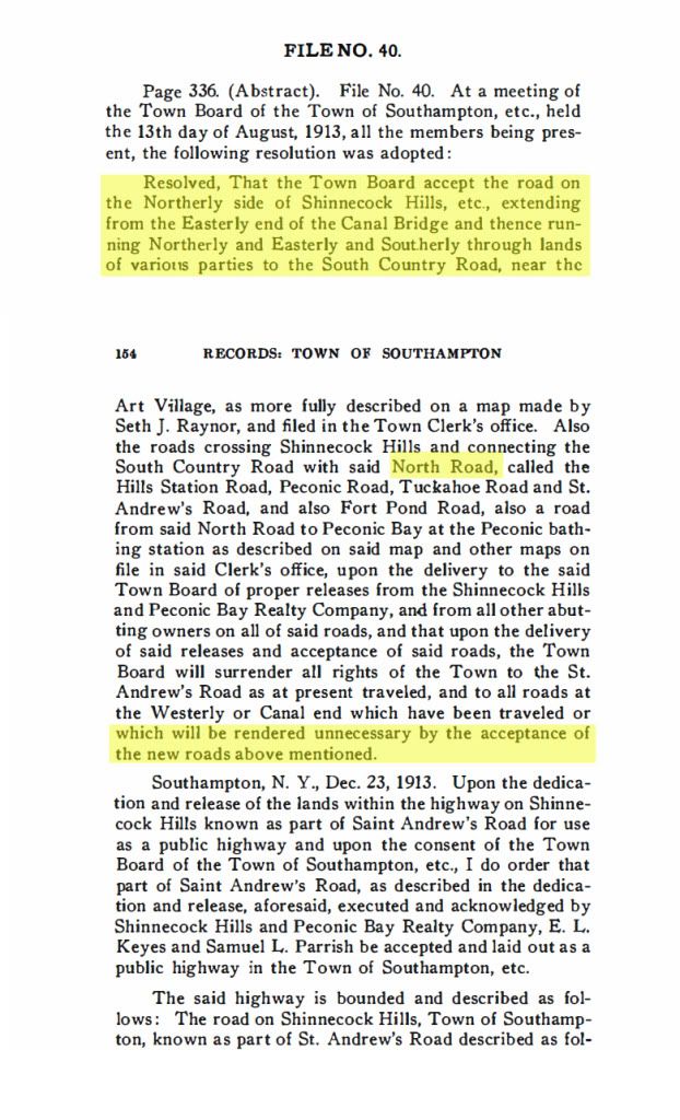
In the Southampton Records there was a File 40 from August 1913 that talked to dedication of a number of roads and trading of other roads to Peconic Bay Realty. I've reproduced it below. The first highlighted part describes in text a road through the Shinnecock Hills which it later refers to as the North Road. Further down, where I've also highlighted, it refers to the North Road as a new road which the Town is accepting while giving older unused roads back to Peconic Bay Realty. Based on this, I'd draw the conclusion that the North Highway as we know it in 1916, or today, was built closer to 1913 than to 1906. Clearly, there were parts of the road there, probably in unimproved states. in 1903 and up until the new road, in its entirety, was built. There was a section there in 1903, St Andrews Road, on which the Shinnecock Inn was built, but it must have been an unimproved road at the time.
Based on this file, it is clear that the new roads mentioned were built as private roads and then dedicated and released as public roads in 1913. The trade-of was that Peconic Bay received a number of rights-of-way (public?) that were for roads that would be displaced by the new roads.
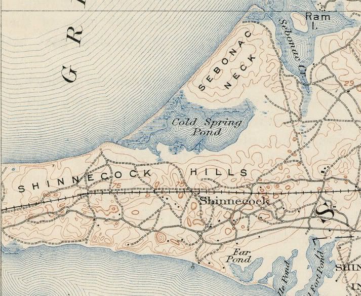
Here below is the 1903 USGS map of the Shinnecock Hills. I think it is the most accurate from that era.
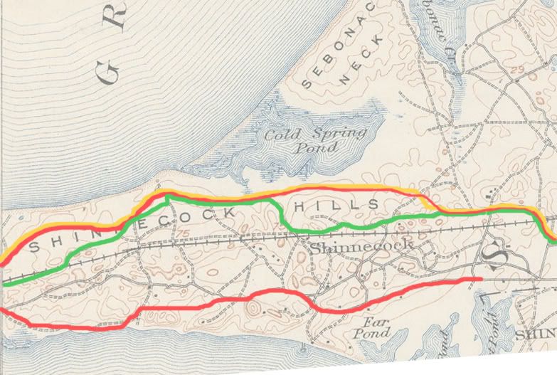
David has done a good job of overlaying the various maps from the era. I just wanted to add this one below, which shows, in
Mucci-green, the 1903 "North Highway" as Patrick has described it. I've also added, in red, the North Road/Highway provided by the metes and bounds of the Southampton Records that Andy found. And, I've added, in yellow, the 1916 Atlas map version of the North Highway. Both are consistent with the current routing of the road, with one exception. The eastern end that used to run through the Shinnecock Hills golf club, currently drops southerly and runs much closer to the LIRR tracks. No doubt a result of one of the later rebuilds of SH.
It should be noted that all the road rights-of-way were designated as 50 feet wide, much wider than the actual roads were built then, or now.
It also appears that the South Highway was not a complete contiguous road either in 1903, but was by 1913.
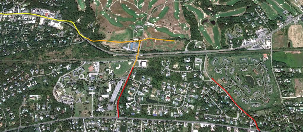
On the next picture, I've plotted the metes and bounds for parts of St Andrews Road and Tuckahoe Road that were dedicated as public roads in 1913. The orange parts are stretches that abut some part of the Shinnecock Hills Golf Club. The measurements are quite precise. They appear to match the related stretches on the 1916 Atlas map. Unfortunately there is no mention of roads that abut other boundaries of the club.
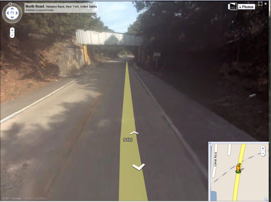
Finally, for Patrick, a picture of the still bustling

North Highway in the 21srt century. Next time you're out that way, maybe you could stop and see if there is a dedication stone on that bridge from the year it was built? Or, not.
