Mike,
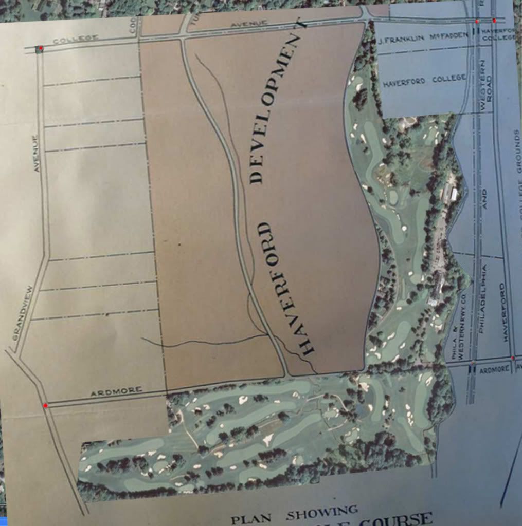
You mentioned yesterday that David had measured the area of the Golf Course as 123 acres on the plan of property. Although we know that the image of the plan we have is distorted and therefore of questionable value in measuring. I'd like to go through the following exercise.
We know that the Board of Governors of MCC write a letter to the members outlining the results of "The Committee"'s search for land for the new course. The Board announces that "The Club has secured 117 acres at $726.50 an acre, or $85,000."
We also know from the letter that the Board proposes to form a Corporation "which will buy outright, the 117 acres, shown on the plan in green, and marked "Golf Course".
We also know that the plan of property shows the location of GHR as "approximate".

So, the first question is - does the "approximate location of the road actual reflect 117 acres on the map, keeping in mind that Pugh and Hubbard are surveyors and civil engineers and the map is purportedly drawn to scale.
Previously I had distorted the plan of property and overlaid it on the current Google aerial. I distorted it to try to get the intersection points of roads and RR's to align between the plan and the current aerial. You can see in the picture below that there are red dots at intersections. Those are my matching points. So, it shouldn't be too bad in terms of ts location.

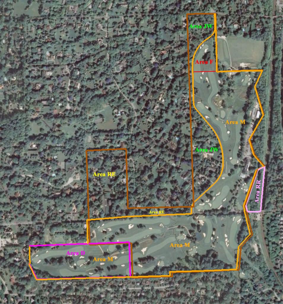
Here is my current picture showing the metes and bounds of the actual July 26, 1911 Indenture. The boundaries, apart from GHR align pretty well with the overlay above.

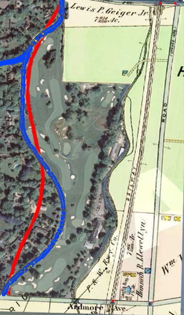
Also, previously I had done an overlay of the specifics of the routing of the GHR from the plan of property and it's as built location. See the picture below.

From this picture of the "approximate" alignment of GHR in November 1910 and the as-built alignment in July 26, 1911, I would make the following observations:
From the July 26, 1911 and looking backward, MCC appears to have gained a small area down near the junction of GHR and Ardmore, and lost a little area near the intersection of GHR and College. Both areas are small and I'd consider them a wash.
Opposite the clubhouse, MCC appears to have gained some area looking back to the "approximate" location of GHR. I'd estimate it at 6 acres.
Along the 14th and 15th fairways, looking backwards, they appear to have lost some area - I'd estimate at 2 acres.
So, from the July 26, 1911 perspective they had 120.01 acres and moving backward to November 15, 1910, they gained 6 acres and lost 2 acres.
That suggests that the plan of property map puts the area of the "Golf Course" at about 124 acres. That directly contradicts the Board's letter that says it's 117 acres.
So, there's the conundrum. We have two documents from the same mailing that contradict each other. Which is right?