News:

This discussion group is best enjoyed using Google Chrome, Firefox or Safari.


Garland Bayley

  • Karma: +0/-0
I was hoping that this contest (in contrast to most GCA photo discussions) would be judged on  how the holes fit the land, and not on the basis of bunkering, graphics, or narrative ... but I think that's hard to do.  I know the site pretty well, and even so, it's hard for me to look at the other plans in Sketchup and really judge them based on the contours alone.  Drawing a bunch of bunkers makes the strategies more obvious; that's why everyone builds too many bunkers.

This is worthy of its own thread, imho.

I'll second that.
"I enjoy a course where the challenges are contained WITHIN it, and recovery is part of the game  not a course where the challenge is to stay ON it." Jeff Warne

George Pazin

  • Karma: +0/-0
-- so even if I was confident that I could come up with the best plan, I'm not confident that the client would choose it. 

Any thoughts as to why many, maybe most, don't necessarily choose the best plan? Perhaps your earlier comment about the bunkers?

Any hints about getting a more accurate read? Does it require knowledge of the land?

Also, apologies if you mentioned this before and I missed it in my quick read, but was this routing done primarily from the topo or from a walking of the land?

Thanks in advance.
Big drivers and hot balls are the product of golf course design that rewards the hit one far then hit one high strategy.  Shinny showed everyone how to take care of this whole technology dilemma. - Pat Brockwell, 6/24/04

Charlie Goerges

  • Karma: +0/-0
I was hoping that this contest (in contrast to most GCA photo discussions) would be judged on  how the holes fit the land, and not on the basis of bunkering, graphics, or narrative ... but I think that's hard to do.  I know the site pretty well, and even so, it's hard for me to look at the other plans in Sketchup and really judge them based on the contours alone.  Drawing a bunch of bunkers makes the strategies more obvious; that's why everyone builds too many bunkers.

This is worthy of its own thread, imho.

I'll second that.


We're trying to get that type of discussion going on the main thread, at least the "how the holes fit the land" part. I think the judges did a good job of judging based on that criteria, but the discussion hasn't taken off.

I'm open to suggestions for how to facilitate this. Whether it's a separate thread or something else, I'd love to hear it. We've got a great field-study here on how different archies might use the same land. (and I'm not only talking about HFW and Tom D, the contestants have done a great job and brought up interesting possibilities)
Severally on the occasion of everything that thou doest, pause and ask thyself, if death is a dreadful thing because it deprives thee of this. - Marcus Aurelius

Tom_Doak

  • Karma: +1/-1
George / Garland:

I'll be happy to participate on the alternative thread you've suggested, if you start it, and explain what more you want me to talk about.

The fundamental problem is that not many people are good at visualizing and thinking in 3-D, so they tend to reduce everything to 2-D.  And in 2-D the greens will all be flat, so they need to be defended by bunkers (or water).

I did not pore through all the various contest entries, because I just don't enjoy looking at computer graphics that much.  But here's a simple test:  how many times did someone just lay a green on a sideslope, so that it would be easier to approach from the low side of the hole?  Did anyone even mention such a thing?

Dan Moore

  • Karma: +0/-0
In an effort to tie together the hole photos with the contour maps I added the entire map and individual hole maps to the thread above.  Hopefully we can visualize the the holes and the use of contours better this way. 

Tom,

How long a hole would #8 have been and where exactly would the green have been located.  Were you planning to flatten out the top of the kame (I think that is a kame) or would it have been terraced into the side. 

"Is there any other game which produces in the human mind such enviable insanity."  Bernard Darwin

Charlie Goerges

  • Karma: +0/-0
Dan, the last picture you provided looking down the Erin Hills second toward the TD 8th greensite really nicely shows what the hole would have looked like. You can see very easily where you could have used the back of the hill/mound on the left of the photo as a turbo-boost to drive the ball onto the green. But the player would really have to commit to that line because it is totally blind.


I'll repost my images from the previous page to illustrate the point. The flight path represents a carry of about 250 yards.

Aerial:


From Ground Level:


« Last Edit: March 24, 2009, 11:11:19 PM by Charlie Goerges »
Severally on the occasion of everything that thou doest, pause and ask thyself, if death is a dreadful thing because it deprives thee of this. - Marcus Aurelius

Tom_Doak

  • Karma: +1/-1
Dan:

Actually, I was amused that Yannick picked this out as his favorite hole on my layout, because I only remembered it as a "connector" hole ... a way to get over to the other side of the property.  I didn't think it was that special, but I hadn't spent much time trying to figure out the bunkering or green configuration yet.

I certainly wasn't thinking about a blind tee shot over the side of the hill getting a turbo boost.  But, that was 10+ years ago, and not so many golfers went for a 265-yard carry back then.

Dan Moore

  • Karma: +0/-0
The Back Nine

Holes 9, 10 and 11 circled the wetlands on the southeast corner of the property and were not included in the mystery golf architect's design.  Here we pick up the remainder of Tom's routing with Holes 12-18.  Tom has previously noted he was very happy with Holes 15-18 which form the interior holes on the routing plan with the 15th tee adjacent to the 18th green.  The four finishing holes move in a clockwise direction encountering the wind from all directions at the conclusion of the round. 

Contour Routing Map of Holes 12 and 13


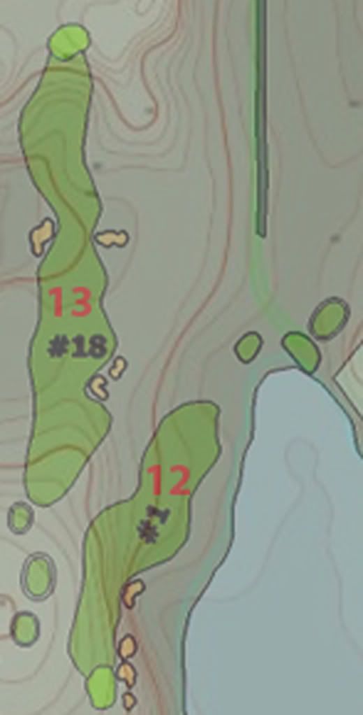
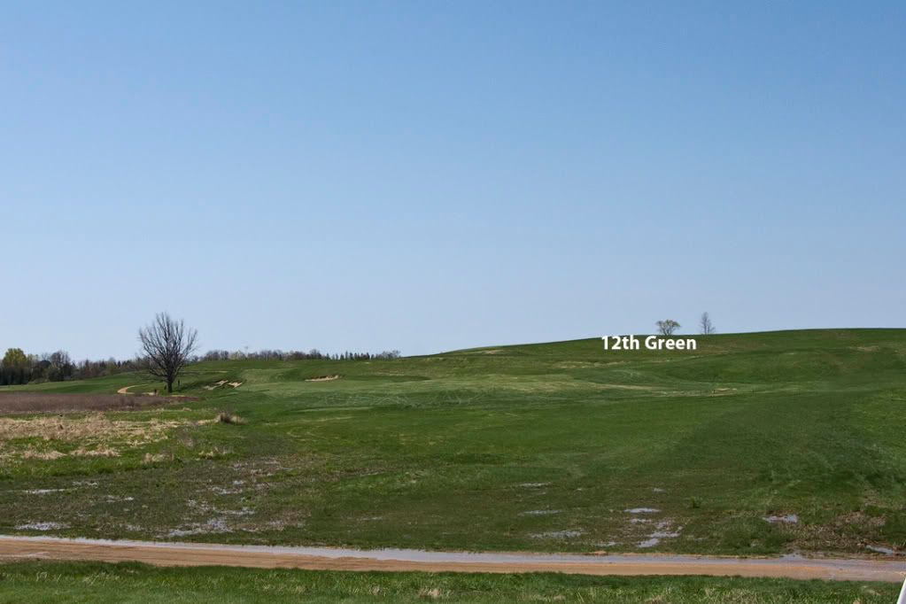
Hole 12 occupies the corridor of the controversial 1st hole.  However, instead of a par 5 this par 4  locates the green on top of the ridge  which is the landing area for the second shot of the exisiting course.  As this is one of the areas where significant earth was moved to create a landing area atop the ridge the photo may be misleading.  The tee here would have been farther back and to the left and I think the fairway would have played up on the side slope right of the exisitng fairway. 


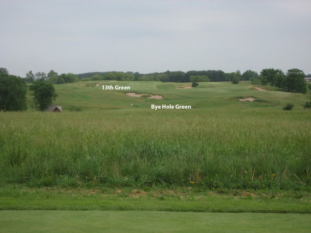
Hole 13, a par 5, turns back to the north.  Starting near the teeing area for the Dell Hole it crosses what is now the 18th fairway proceeding directly through to uneven ground of the Bye Hole in route to a green that would be located in the fairway of the 10th hole.  I seem to recall Eric Terhorst pointing out a hole this direction as holding promise, but I think he had the tee starting closer to the current 1st green. 


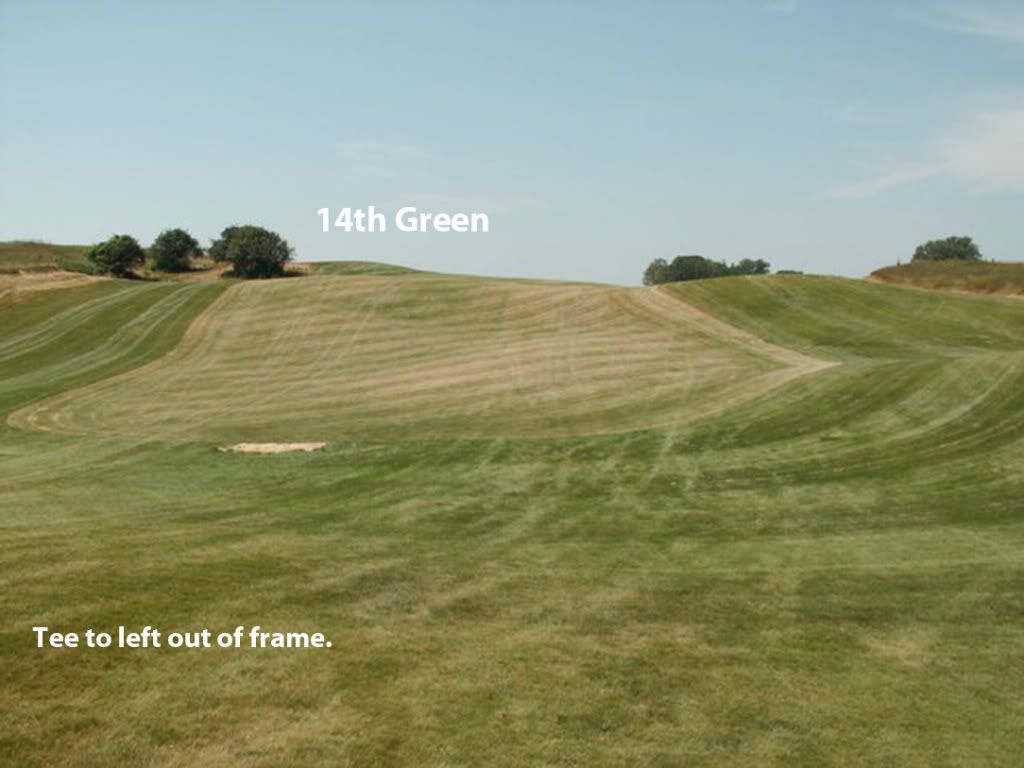
Contour and Routing Map of Hole 14


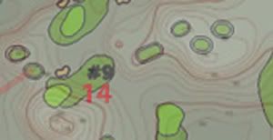
This dramatically uphill par 3 has a tee near the ninth tee and proceeds to a green located on the rise of current 12th fairway.  The angle of approach in the photo is wrong as the tee would be farther left but In think it gives the general idea.  This portion of the course is one of the most dramatic Hurdzan Fry and Whitten fashioned a very neat par 4, the 12th from it while Tom chose to use it for two par 3's the 3rd and 14th.  Tom can confirm but it looks to me like the green would have been in the little hollow where the three hawthorne trees are located. 


Contour and Routing Map of Holes 15-18


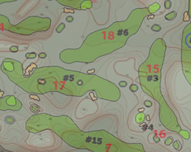
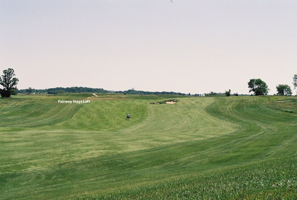
Hole 15 is a slight dogleg left par 4 starting from an elevated tee located on the rise in the fairway of the current 9th fairway and  is routed across the 18th and 8th fairways and through the narrow valley used as the greensite of the Dell Hole.  The green would have been ltucked back on the narrow ledge at the foot of the hill on which the current 6th green is located.  The use of the Dell Hole valley creates a very cool looking hole. 


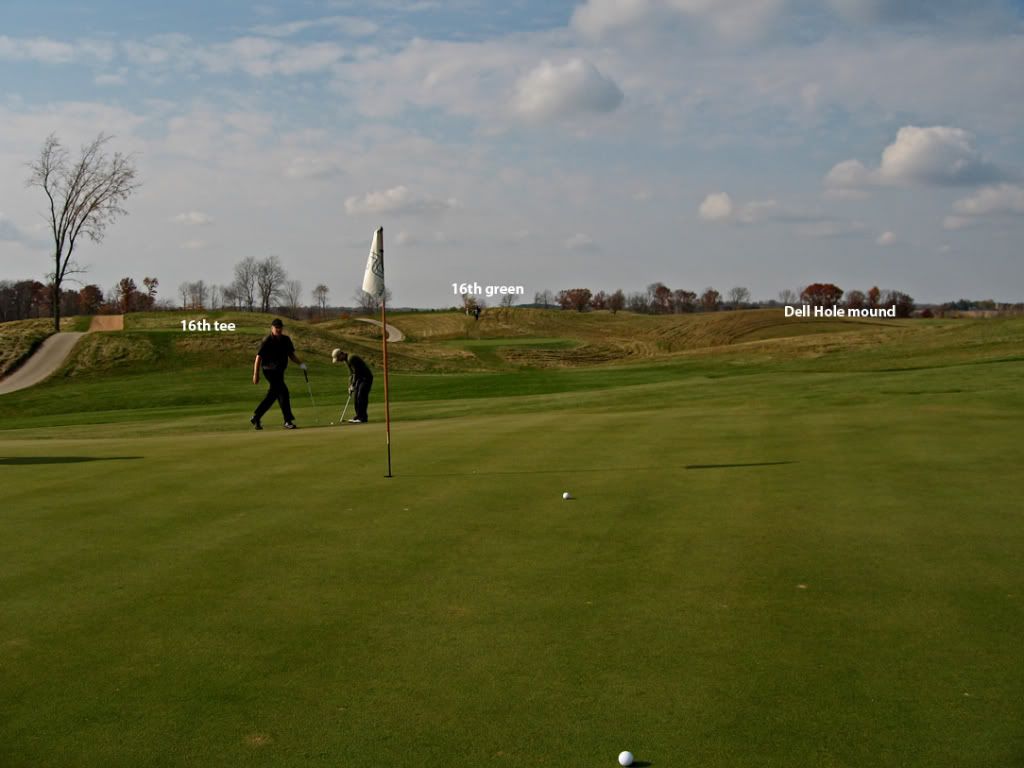
Hole 16 is a shorter par 3 from a hill top tee to a green located on another hilltop across the valley.  This moves in the opposite direction of Erin Hills 6th hole, a hole I really like from the 235 yard tee.  Tom's would have been much shorter.  I'm really not sure about the location of the green in the photo maybe between the palyers and the path, but it should be good enough to show the basic idea. 


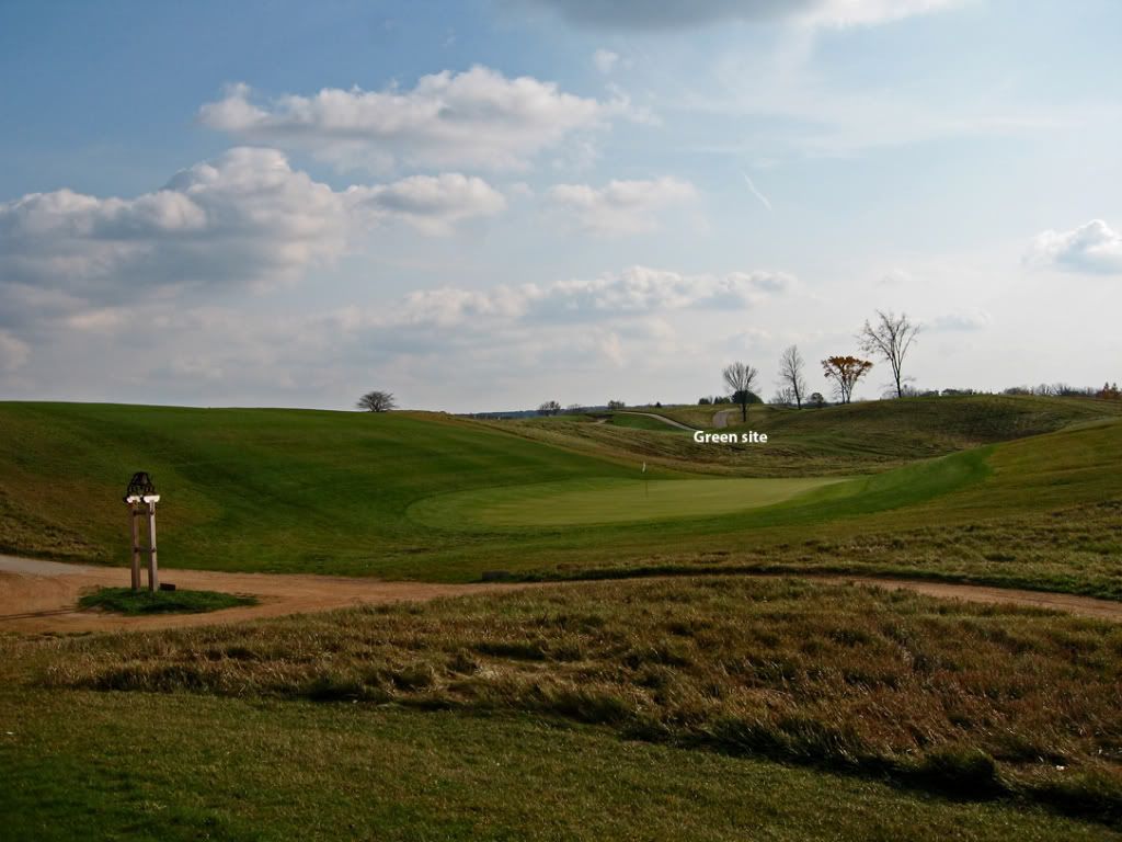
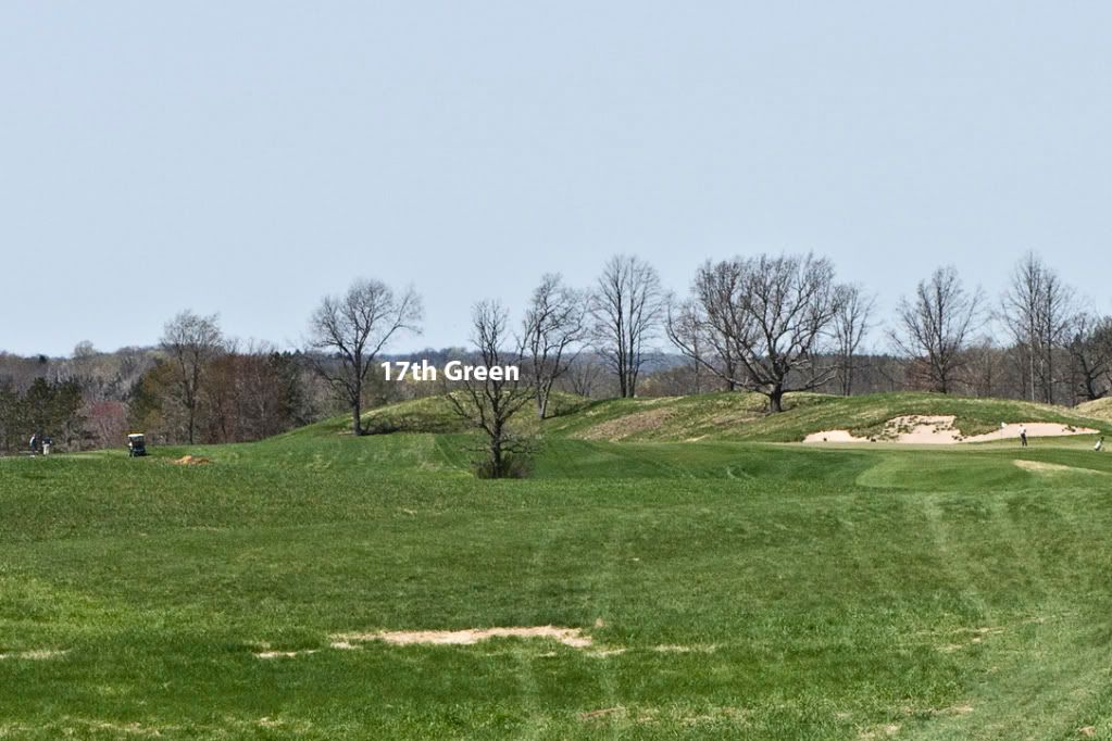
Hole 17 would have been a par 5 moving from the high ground behind the 5th green to a greensite located on the hillside to the left of the 8th green.  The hole uses some interesting ups and downs particularly as you get closer to the green.  I'm not sure the angles of these photos do the hole justice, but a close look at the topo map should help.   


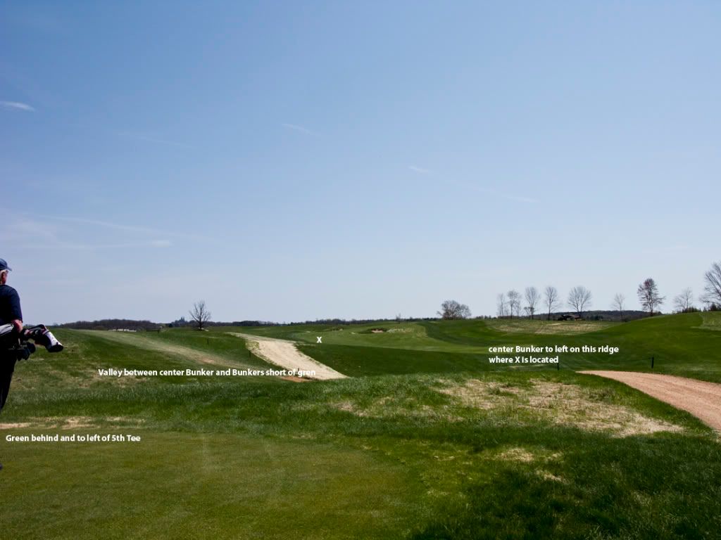
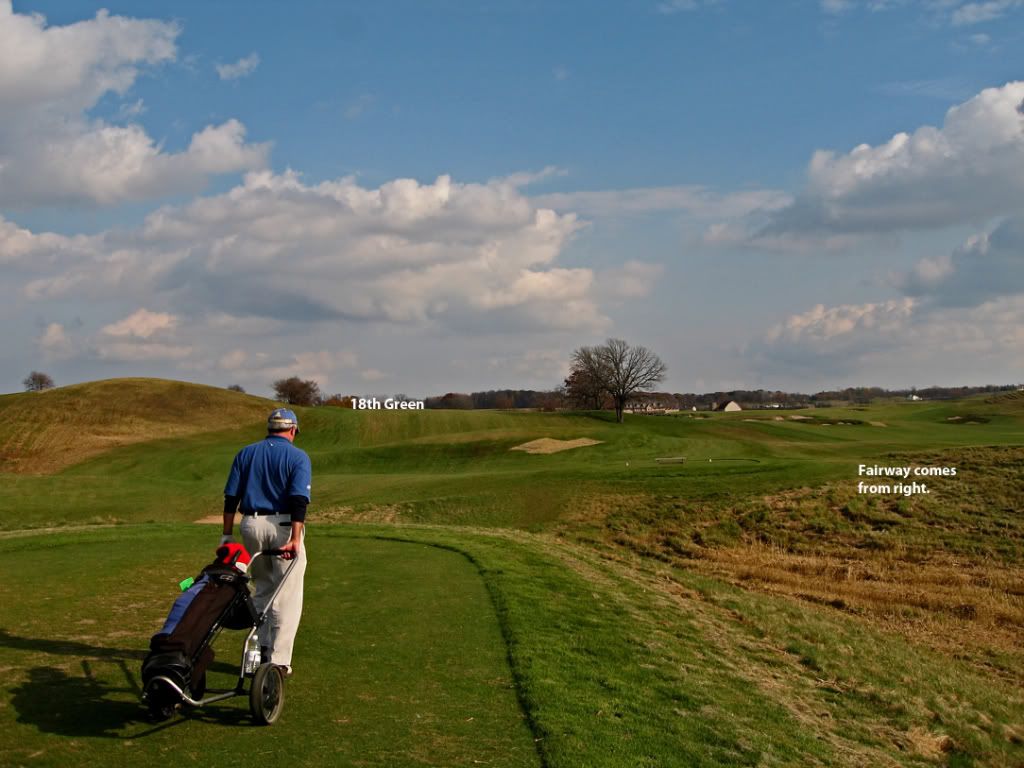
Note the cart is next to the tee shown in the photo above. 


Hole 18 is longer par 4 from a tee near the 8th green seen the last photo cutting on an angle across the 18th fairway to a green located on the rise of the 9th fairway.  The angle of the approach is on a diagonal to the slope the green is on and I suspect this green located on the hillside may have had some serious movement to it.   The 15th tee would have been located near the large tree probably a little left and frather backtree


"Is there any other game which produces in the human mind such enviable insanity."  Bernard Darwin

Charlie Goerges

  • Karma: +0/-0
Dan, I don't know if it's because of the nature of the ground, or if you had better photo coverage, but I had a much easier time following and imagining TDs holes on this last section of the course. Nice job.
Severally on the occasion of everything that thou doest, pause and ask thyself, if death is a dreadful thing because it deprives thee of this. - Marcus Aurelius

Dan Moore

  • Karma: +0/-0
Charlie, I actually thought the back nine was harder to put together.  Perhaps the front is harder to visualize because the tees on 6 and 7 are behind trees and hills and I didn't have a good shot of the 5th.  Having played the course several times I can visualize all of it pretty well.  Where I had problems was interpreting the topo map to find the correct feature where tees and greens were located.  Not having worked with topo maps before this took some effort, but I've learned something in the process. 

In any event I'm waiting for some comments on use of the Dell Hole Valley for the 15th hole. 

For Tom and the other architects, where would you normally start the routing process?  With the topo map or an on the ground survey? 
"Is there any other game which produces in the human mind such enviable insanity."  Bernard Darwin

Tom_Doak

  • Karma: +1/-1
Dan:

I always start working on the map first, if there's one available.  It's far easier to visualize how the holes are going to fit together, than by trying to walk your way around one shot at a time.  Generally I'll locate a few sites for possible cool holes, and then go to those spots the first time I'm on the property for a reality check.

You have to go back and forth between the map and the land, because there are features that don't show up on the map -- mostly views and trees, because even a lot of little movements show up on a two-foot topo if you know how to read it.

Tags:
Tags:

An Error Has Occurred!

Call to undefined function theme_linktree()
Back