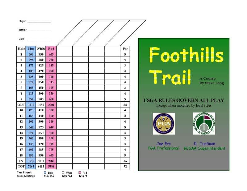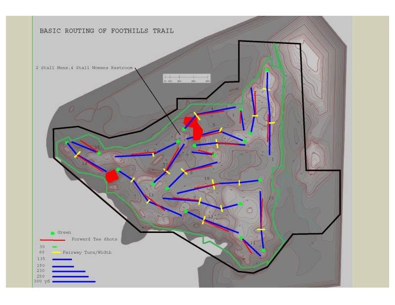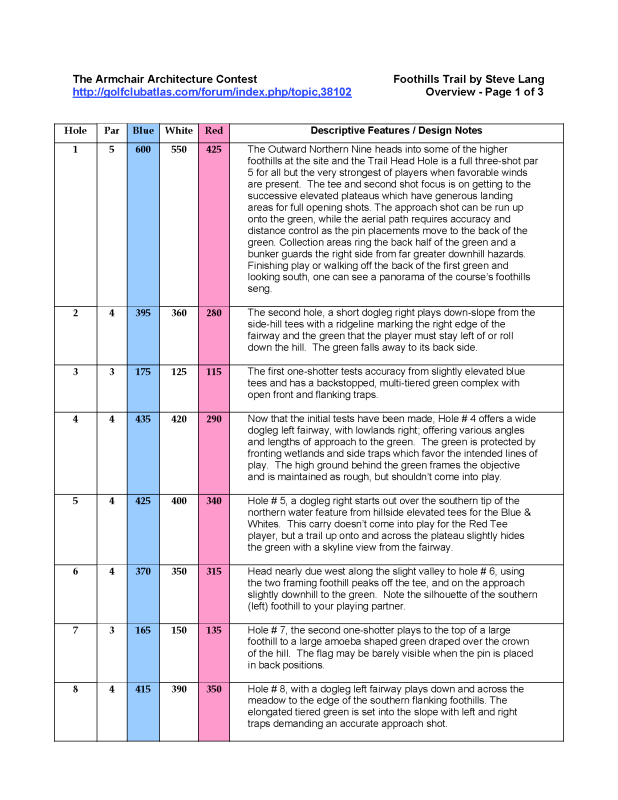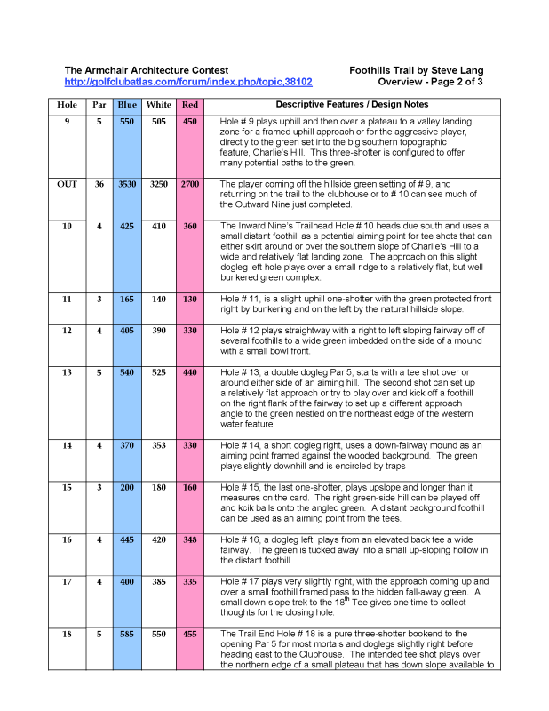
Thanks to Charlie for this challenge, great fun indeed!
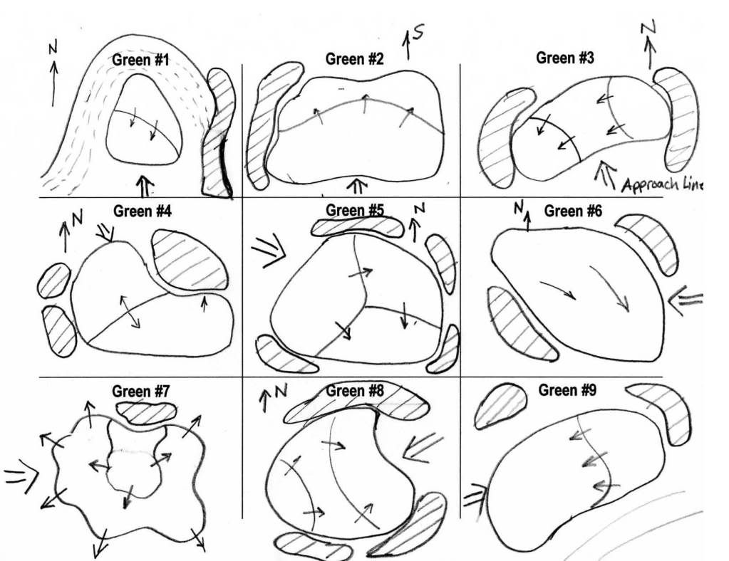
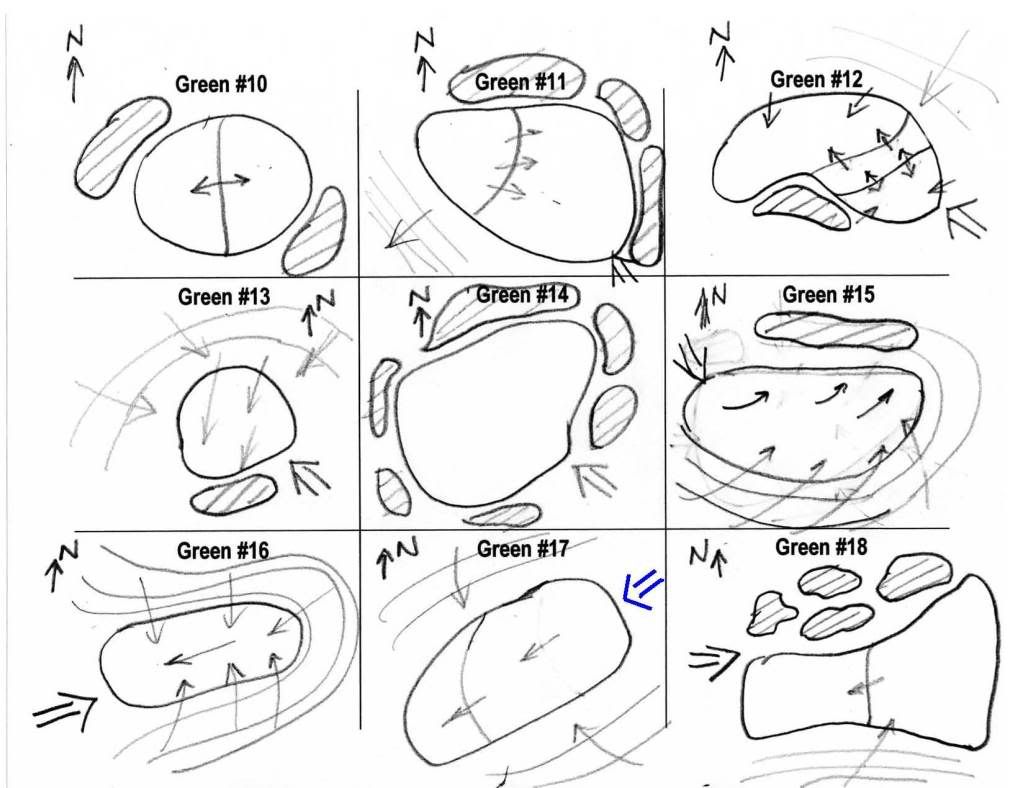
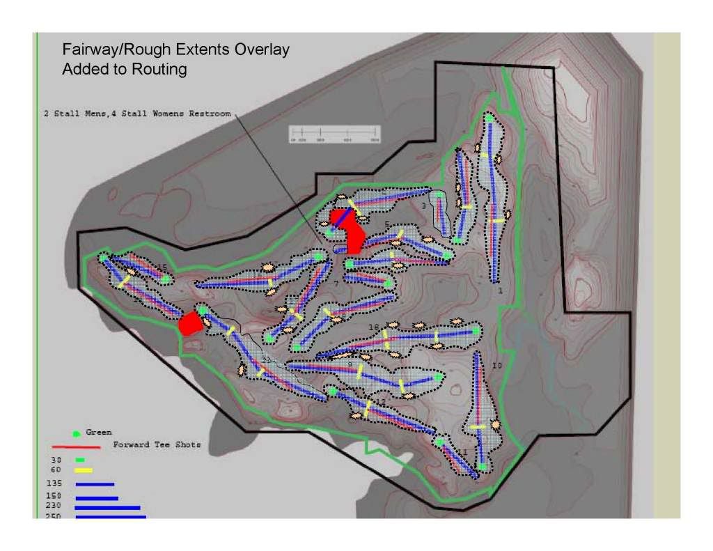
I took the paper and pencil approach from my favorite blue leather armchair, first using the topos (with liberal doses of JD on the rocks) and a ruler and compass to measure things out.. with full intent to transpose into Sketchup after some simple Powerpoint and Acrobat workups.. Unfortunately i didn't get Sketchup to work in my time available.. so one must imagine things draped over the topography..
So things are simple here.. not a lot of neet Sketchup views..
I really liked the hills/topography on the southern Flank and thus put much of the back nine down there.
Disclaimer: I am not related to Bob Lang of Erin HIlls, and had no inkling of it being the basis for this contest's layout, and I've never been there.
Several things I was sensitive to :
- Front tees having their own challenges/opportunities on a hole
- Play going in all directions
- a good trail goes up & over, around and through a site
- a good rest area and means to create different loops is priceless
